Hampi is an abandoned city in the jungle. Lost cities of India (11 photos) Lost cities in the jungle of India
enjoying amazing nature and the cultural richness of India, we should not forget about the lost cities. Despite the fact that these cities fell as a result of wars and natural disasters, their majesty has survived to this day, thanks to the surviving temples, museums and galleries in which the surviving art objects are presented. Let's enjoy time travel together.
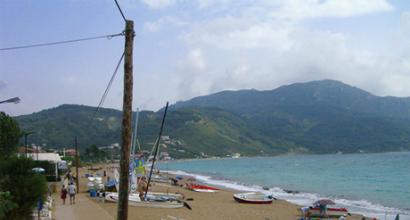
The dynasties of princes Harihara and Bukka Raya founded Vijayanagara in 1336. This mighty city was the capital of the empire. The golden years of this Indian region fell on the years 1509-1529. The city was surrounded by hills on three sides, and the Tungabhadra River flowed on the fourth. Like many other powerful empires, the empire eventually fell under the onslaught of the Deccan Sultan in 1565. Agricultural wealth brought great material benefits to the empire at the expense of international trade. The ruins of the city currently have the status world heritage, and surround present-day Hampi in the southern Indian state of Karnataka.


Tree in the courtyard of the Vitthala temple:

Puhar
The seven-storied building in the photo is now the Sillappathikara Art Gallery. Puhar is a city in the Nagapattinami district, in the southeastern state of Tamil Nadu. In ancient times, this city was called the prosperous capital of kings. Located at the mouth of the Kaveri River, the city served as a large shopping mall, in which goods brought from afar were unloaded. legendary city is mentioned in many songs, in poetry, in the heroic epic. The history of the city is well described in the epics Silapathikaram and Manimekalai. Scientists believe that the cause of the destruction of the city was the tsunami.


Muziris
Muziris is the Greco-Roman name of the ancient port city located off the coast of Malabar (South India). Excavations in 2004 proved that trade was carried out from this port with Western Asia, the Middle East and Europe. It is believed that the city was destroyed by an earthquake in the 13th century AD.

Lothal
The ancient city of Lothal, or rather its remains, can be found in the state of Gujatat. Known since 2400 BC, this lost city is one of the most important archaeological sites in India. It was discovered in 1954 and excavated between 1955 and 1960. The city was also a major trading port.

Kalibangan
Kalibangan is located on south coast Ghaggar district in the state of Rajasthan. Known as the site of the earliest system of plowing an agricultural field (c. 2800 BC). Scientists came to the conclusion that the city was destroyed by an earthquake in 2600 BC, but after that the 2nd stage of the settlement took place, which was not successful due to the gradual and irreversible drying up of the river.

Surcotada
Surkotada is located in Kutch district, Gujarat. The ancient burial mound is surrounded by sandy hills and red soil, giving the whole area a reddish-brown color. The Lost City was discovered in 1964. Among the attractions of India, these lost cities are far from the last place.

Pattadakal. Pattadakal Temple
Pattadakal is a city located on the banks of the Malaprabha River in the northern state of Karnataka. The group of ten monuments from the 8th century AD includes majestic temples, a monolithic stone pillar and a Jain sanctuary.
A sensational discovery was made by a group of archaeologists in Cambodia - a lost city with thousand years of history, the search for which was conducted for more than a dozen years. Modern technology came to the aid of scientists: the area was scanned from the air with a special device.
Archaeologists can't find the words! About the disappeared in the wilds rainforest the ancient city was previously known only from legends. Mahendraparvata, or "Mountain of the great god Indra", - this name has been conveyed to this day by an inscription on one of the religious buildings 40 kilometers from this place.
"This is definitely the ruins of the temple. Only the sacred buildings were made of stone. This is the pedestal on which the statue of the temple stood. All this was in the center of the city," says expedition leader Damian Evans.
After the first stone foundation, find follows find. Mysterious sanctuaries that stood for centuries, skillful stone carving, a developed network of roads, many canals, dams and ponds to supply water to residents and their crops.
"If you look at the vegetation around me, it will resemble a rice field. But if you look at the perspective, this is nothing but the territory of the temple. Nobody knew about its existence for hundreds of years. Everything that is inside has been there for a thousand years ago," says Damian Evans.
Scientists call the date of foundation of Mahendraparvata the 802nd year of your era. The year the Khmer Empire was founded. It was in these places, as the legend says, that its first ruler received a blessing for the kingdom. For a long time, the city of Angkorwat was considered the capital of his state; in its heyday, about a million people lived in it. Scientists are sure that now he will definitely share his fame with Mahendraparvata.
"Interestingly, the found city is exactly the same as Angkor. But we managed to establish that it was built much earlier than it, by about 350 years. And, apparently, we approached its outskirts. So far, we have been able to map the city approximately at 30 square kilometers, and that's not all," says archaeologist Jean-Baptiste Chevans.
The discovery of the international expedition of Damian Evans and Jean-Baptiste Chevans can be compared with the discovery of the legendary Troy. True, in this case, not without the help of modern technology. The search area was explored from the air for a whole week. 3d plan sacred mountain archaeologists made a laser scanner - lidar. He also discovered the ruins of 30 temples.
“Previously, it would have taken us more than one year to map all this. Now we need to describe everything we saw and continue working, since the city turned out to be much larger than we expected,” says Damina Evans.
Scientists have been going to Mahendraparvata for 13 long years, overcoming kilometers of tropical jungle, swamps and the legacy of a bygone era - minefields left over from a long civil war. The reasons for the decline and desolation of the city are allegedly called uncontrolled deforestation, because of which the canals began to dry up and the productivity of the fields fell.
Cities are considered abandoned when they are abandoned. locals and they don’t return there anymore, forever leaving him to “live out” his days alone. The reason for this may be wars, migrations, natural disasters, but in any case, these places remain forever in history, keep the secret of centuries and the spirit of the people who lived on the territory, and, of course, are waiting in the wings when archaeologists discover them one day and about the whole world knows them. Some of these cities remain forever unknown, some live only as a legend. Reality or myth, below are the most attractive and mysterious cities known to archaeologists, historians and tourists around the world.
Perhaps, of all the abandoned cities that have ever been found or studied, the distant Machu Picchu is rightfully considered the most mysterious and unexplored. The city, located alone near the Urubamba Valley in Peru, was never found or robbed until historian Giram Bingham visited it one day in 1911, and since then the whole world has learned about the abandoned city. It is now known that Machu Picchu was divided into districts, where more than 140 different stone-walled buildings were built. It is said that the ancient area first appeared in 1400 thanks to the Inca tribe. And 100 years later, the city was left forever, probably for the reason that a terrible smallpox epidemic brought from Europe hit Machu Picchu. There was also much controversy as to why the Incas built the city in such a strange place. Some researchers claimed that this place was sacred, while others said that Machu Picchu was used as a prison, but recent excavations have shown that the mysterious city was simply built by order of the Inca emperor named Pachacuti, and it was built specifically near the mountains, which corresponded to the ancient astrological mythology of the Inca tribe.
Everyone has ever heard of the legendary sunken island of Atlantis. Now the stories about Atlantis are recognized as just a myth created by the philosopher Plato in 360 BC. Plato described an island with an advanced civilization and powerful sea power. He claimed that Atlantis occupied a large territory of Europe, until, due to natural disasters, he went to the seabed forever. Plato's story is considered only a fiction, but nevertheless, his description of an ancient and strong civilization was so impressive that many travelers and writers went to distant lands in search of the mysterious Atlantis.

The Roman city of Pompeii was once destroyed in 79 AD. after the eruption of Mount Vesuvius. At that time, the population of the city exceeded 20,000 people. After the volcanic eruption, the ruins stood for about 1700 years, until finally, in 1748, they were discovered by a team of workers who were building a palace for the king of Naples. Since then, Pompeii has become the subject of attention of archaeologists and historians around the world. It's funny, but it was thanks to the volcano Vesuvius that the architecture of the city was preserved. Found on the territory of the ancient city of Pompeii, a huge number of frescoes and sculptures give a clear idea to modern scientists about the lifestyle of Ancient Rome.

One of the regions of Cambodia called Angkor was also the seat of the Khmer Empire from 800 AD. before 1400 AD The region was on the brink of destruction when the Thai army invaded in 1431. Thus, once a powerful city with a huge territory and thousands of Buddhist castles was abandoned and overgrown with jungle. The existence of an abandoned city was not known for a long time until one day in 1800 a group of French archaeologists tracked him down. He carefully studied it and skillfully restored it. As large as Los Angeles, Angkor and its environs have since become known as the largest pre-industrial city in the world, and its famous temple, Angkor Wat, is considered the largest religious building ever built.

Found in 3100 BC, Memphis was considered the capital ancient egypt. For hundreds of years it was the center of civilization, until the city fell into decay with the advent of Alexandria. During its heyday, Memphis had a population of over 30,000, making it the most big city antiquity. Over the years, the exact location of the abandoned city was also rubbed off, until one day it was discovered during the Napoleonic expedition in 1700. It was from that time that a detailed study of sphinxes, statues and tombs began for the first time. Some important parts of the city have remained unexplored by historians and archaeologists.

King Zipa used to decorate his body with golden sand, which he then washed off himself in the sacred lake of Guatavita. This old tradition of the Muisca - Ancient Civilization South America, became the basis of the legend of El Dorado.
One of the most famous of all legendary places, the empire of El Dorado was but a myth. It was assumed that she first appeared in the jungles of South America. Translated from Spanish, this word means "golden". It was said that the king ruled in this city, and he had an unmeasured amount of gold and diamonds. During the conquests, El Dorado became the subject of attention from the barbarians. In the thick of the jungle, where, according to the stories, this mysterious place was located, several expeditions were carried out, including the famous expedition led by Gonzalo Pizarro in 1541, but they never found traces of the distant El Dorado, as well as gold and diamonds.

Petra is probably the most beautiful city on our list. It is located in Jordan, in the region Dead Sea and is considered the center of trade of the Ancient Nabatian Kingdom. Most impressive is her refined stone architecture, carved from the rocks of the surrounding mountains. It is thanks to this ancient city was well fortified. It is still unknown what technologies were used at that time to create such a masterpiece. This city flourished for hundreds of years, but the conquests of the Romans, volcanic eruptions gradually destroyed Petra until it completely turned into a lost area and stood in the desert for years. In 1812, it was first discovered to the world by the Swiss explorer Johann Burkhard, and since then ancient Petra from year to year attracts crowds of tourists from all over the world.

The lost city of Z was supposed to be located in the deepest jungles of Brazil, and was even said to be quite advanced. There were bridges, and roads, and temples. Talk about the mysterious city began thanks to a document that was found by a Portuguese explorer who claimed to have seen the place in 1753, but nonetheless, no one else found traces of its existence. The lost area became even more famous due to the fact that the English traveler Percy Fawcett, who has since disappeared without a trace, took up the search for it.

A place made famous by Homer's epic poems. Troy was the first legendary city located on the territory of modern Turkey. It is here, according to legend, that the Trojan War took place. Troy was the most fortified and protected place, located on a hill near the river with the ancient name of Scamander. Due to the fact that Troy was located on the coast, it was protected from sea attacks, and the plains located near it contributed to the development of agriculture. At first, the existence of ancient Troy was also classified as a myth, until one day in 1870, the German archaeologist Heinrich Schiliman unearthed this city. Unfortunately, today this area has become unattractive, the reason for which was the constant excavation and robbery of tourists.

The city of the Caesars, also known as the "Wandering City" or the city of Pantagonia, is just a myth that it is mysterious place located on the very extreme point South America, in the region of modern Pantagonia. The abandoned city was never found and therefore it is considered nothing more than a legend. At first they said that the Spaniards, who had been shipwrecked, found it, they found there a huge amount of gold and diamonds. It was even said that this mysterious city lived 10-meter giants. They also said that ghosts lived on the territory of the city of the Caesars, who constantly appeared and disappeared.
While enjoying the amazing nature and cultural richness of India, one should not forget about the lost cities. Despite the fact that these cities fell as a result of wars and natural disasters, their majesty has survived to this day, thanks to the surviving temples, museums and galleries in which the surviving art objects are presented. Let's enjoy time travel together.
Virupaksha temple in Hampi.
The dynasties of princes Harihara and Bukka Raya founded Vijayanagara in 1336. This mighty city was the capital of the empire. The golden years of this Indian region fell on the years 1509-1529. The city was surrounded by hills on three sides, and the Tungabhadra River flowed on the fourth. Like many other powerful empires, the empire eventually fell under the onslaught of the Deccan Sultan in 1565. Agricultural wealth brought great material benefits to the empire through international trade. The ruins of the city now have World Heritage status and surround modern-day Hampi in the southern Indian state of Karnataka.


A tree in the courtyard of the Vitthala temple. 
The seven-storied building in the photo is now the Sillappathikara Art Gallery. Puhar is a city in the Nagapattinami district, in the southeastern state of Tamil Nadu. In ancient times, this city was called the prosperous capital of kings. Located at the mouth of the Kaveri River, the city served as a large trading center, where goods brought from afar were unloaded. The legendary city is mentioned in many songs, in poetry, in the heroic epic. The history of the city is well described in the epics Silapathikaram and Manimekalai. Scientists believe that the cause of the destruction of the city was the tsunami. 

Muziris is the Greco-Roman name of an ancient port city located off the coast of Malabar (South India). Excavations in 2004 proved that trade was carried out from this port with Western Asia, the Middle East and Europe. It is believed that the city was destroyed by an earthquake in the 13th century AD. 
The ancient city of Lothal, or rather its remains, can be found in the state of Gujatat. Known since 2400 BC, this lost city is one of the most important archaeological sites in India. It was discovered in 1954 and excavated between 1955 and 1960. The city was also a major trading port. 
Kalibangan.
Kalibangan is located on the south bank of the Ghaggar district in the state of Rajasthan. Known as the site of the earliest system of plowing an agricultural field (c. 2800 BC). Scientists came to the conclusion that the city was destroyed by an earthquake in 2600 BC, but after that the 2nd stage of the settlement took place, which was not successful due to the gradual and irreversible drying up of the river. 
Surcotada.
Surkotada is located in Kutch district, Gujarat. The ancient burial mound is surrounded by sandy hills and red soil, giving the whole area a reddish-brown color. The Lost City was discovered in 1964. Among the attractions of India, these lost cities are far from the last place. 
Pattadakal. Pattadakal temple.
Pattadakal is a city located on the banks of the Malaprabha River in the northern state of Karnataka. The group of ten monuments from the 8th century AD includes majestic temples, a monolithic stone pillar and a Jain sanctuary. 
There is a document in the National Library in Rio de Janeiro called Manuscript 512, which tells of a group of treasure hunters who discovered a lost city in the Brazilian jungle in 1753.
The text is a kind of diary in Portuguese and is in a rather poor condition. Nevertheless, its content inspires the search for more than one generation of researchers and amateurs - treasure hunters.
Manuscript 512 - perhaps the most famous document National Library Rio de Janeiro, and from the point of view of modern Brazilian historiography, is "the basis of the biggest myth of national archeology." In the XIX-XX centuries. the lost city described in Manuscript 512 has been the subject of heated debate, as well as relentless search by adventurers, scientists, and explorers.
The document is written in Portuguese and is entitled "Historical report on an unknown and large settlement, ancient, without inhabitants, which was discovered in the year 1753" ). The document has 10 pages and is written in the form of an expedition report; at the same time, taking into account the nature of the relationship between the author and the addressee, it can also be characterized as a personal letter.
Percival Harrison Fawcett was one of the most heroic personalities of the 20th century. An outstanding British archaeologist became famous for his expeditions in latin america. Perhaps not everyone is able to spend most of their almost sixty years of life in wanderings and in military service.
Fawcett went on an expedition in 1925 in search of this city (he called the lost city "Z"), which he believed was the capital ancient civilization created by people from Atlantis.
Others, such as Barry Fell, believed that the strange symbols seen in the city were the work of the Egyptians of Ptolemy's time. In addition, the city has a lot of evidence from the time of the Roman Empire: the Arch of Constantine, the statue of Augustine. Below are excerpts from this document.
The entire Fawcett expedition did not return, and its fate forever remained a mystery, which soon obscured the very mystery of the lost city.
The subtitle of the document says that a certain group of bandeirants ("Indian hunters") spent 10 years wandering through the interior unexplored regions of Brazil (sertans) in order to find the legendary "lost mines of Moribeca".
The document tells how the detachment saw mountains sparkling with numerous crystals, which caused amazement and admiration of people. However, at first they failed to find the mountain pass, and they camped at the foot of the mountain range. Then one Negro, a member of the detachment, chasing a white deer, accidentally discovered a paved road that passed through the mountains.
Having ascended to the top, the bandeirants saw from above a large settlement, which at first glance they took for one of the cities of the coast of Brazil. Descending into the valley, they sent out scouts to learn more about the settlement and its inhabitants, and waited for them for two days; a curious detail is that at this time they heard the crowing of roosters, and this made them think that the city was inhabited.
Meanwhile, the scouts returned, with the news that there were no people in the city. Since the rest were still not sure of this, one Indian volunteered to go on reconnaissance alone and returned with the same message, which, after the third reconnaissance, was confirmed by the entire reconnaissance detachment.
At sunset, they moved into the city, weapons at the ready. No one got caught by them or tried to block the way. It turned out that the road was the only way to get into the city. The entrance to the city was a huge arch, on the sides, which were smaller arches. At the top of the main arch was an inscription that was impossible to read due to the height of the arch.
Behind the archway was a street with large houses, the entrances of which were made of stone, on which there were many different images, darkened with time. Cautiously, they entered some houses in which there were no traces of furniture or other traces of a person.
In the center of the city there was a huge square in the middle of which stood a high column of black granite, on top of which stood a statue of a man pointing to the North with his hand.
At the corners of the square there were obelisks, similar to Roman ones, which had significant damage. On the right side of the square stood a majestic building, apparently the ruler's palace. On the left side were the ruins of a temple. On the surviving walls, frescoes were painted, decorated with gilding, reflecting the life of the gods. Behind the temple, most of the houses were destroyed.
In front of the ruins of the palace, a wide and deep river flowed, with a beautiful embankment, which in many places was littered with logs and trees brought by the flood. Canals and fields branched off from the river, overgrown with beautiful flowers and plants, including rice paddies, on which there were large flocks of geese.
Leaving the city, they went downstream for three days until they came to a huge waterfall, the sound of water of which was heard for many kilometers. Here they found a lot of ore containing silver and apparently brought from the mine.
To the east of the waterfall there were many large and small caves and pits, from which, apparently, ore was mined. In other places there were quarries with large cut stones, some had inscriptions similar to those on the ruins of a palace and a temple.
At a distance of a cannon shot in the middle of the field stood country house about 60 meters long with a large porch and a staircase made of beautiful colored stones leading to a large hall and 15 smaller rooms decorated with beautiful frescoes and a swimming pool inside.
After several days of travel, the expedition split into two groups. One of them, downstream, met two white men in a canoe. They had long hair and were dressed in European style. One of them, named Joao Antonio, showed them a gold coin found in the ruins of a farmhouse.
The coin was rather large and depicted a figure of a man on his knees, and on the other side a bow with an arrow and a crown. According to Antonio, he found the coin in the ruins of a house that was apparently destroyed by an earthquake that forced the inhabitants to leave the city and the surrounding area.
Part of the pages of the manuscript is completely unreadable, including a description of how to get to this city due to the poor condition of the sheets of Manuscript 512. The author of this diary declares with an oath that he will keep it secret and especially information about the location of abandoned silver and gold mines and gold-bearing veins on the river.


The text contains four inscriptions copied by bandeirants, made in unknown letters or hieroglyphs: 1) from the portico main street; 2) from the portico of the temple; 3) from a stone slab that closed the entrance to the cave near the waterfall; 4) from the colonnade in a country house.
At the very end of the document, there is also an image of nine signs on stone slabs (as you might guess, at the entrance to the caves; this part of the manuscript has also been damaged). As the researchers noted, the given signs most of all resemble the letters of the Greek or Phoenician alphabet (in some places also Arabic numerals).