Golan map. Where are the Golan Heights? Coordinates, map and photo
On March 25, 2019, during a meeting, the leaders of the two states, Donald Trump and Benjamin Netanyahu, signed a document according to which the United States recognized Israel's sovereignty over the Golan Heights. The American president then announced that Israel would improve its ability to defend itself. What is so remarkable about this mountain plateau, which has not disappeared from journalistic reports for decades, and the question of control over which causes serious controversy?
1. Geographically, the Golan Heights is a relatively small plateau of volcanic origin. It is located between Lake Kinneret and the valley of the river. Hula in the west and the Yarmouk Valley in the south and southeast. In the northern part, these heights deepen into the territory of Syria.
2. Most of the plateau's surface is elevated by 1000 or more meters above sea level. The highest point of the Golan is considered to be the peak with an indicator of 2814 m. It is located on the Syrian territory of this geological formation. If we consider the land controlled by Israel, then the highest point on it is Mount Hermon, towering 2236 m above the surface.

3. The total area of \u200b\u200bthe Golan Heights is 1,861 sq. km. Of these, about 2/3 (about 1,150 sq. Km) now belongs to Israel, and the rest (about 600 sq. Km) is controlled by Syria. Israel also controls 7% of the Hermon Range.
4. Due to the features of the relief, the climatic conditions in the Golan Heights are seriously different from the rest of Israel. It is not very hot here in summer and quite cool in winter. This made it possible to actively develop, for example, the tourism business. Mount Hermon, covered with snow for 4 months, made it possible to create a ski resort here. 2.1 million tourists come to the Golan during the year.

5. Thermal waters have been actively used in this region for a long time. The most ancient of them are the sources of Hamat-Gader, located in the south-west of the plateau, about which people have known since the time of Ancient Rome.
6. The Golan is covered with an extensive network of rivers and streams. Most of them flow into Lake Kinneret and the Jordan River. Basically, they take water from atmospheric precipitation, feeding themselves the main freshwater sources of Israel - the already named Lake Kinneret and the Jordan River. The country receives about 25% of its drinking water from the Golan Heights hydrographic network.

7. During the biblical period, the Golan Heights belonged to the Bashan region and was inhabited by the Rephaim. The name “Golan” dates back to the same time. It passed to the plateau from the biblical city of Golan, which once existed in Bashan.

8. Archaeological expeditions carried out on this territory have provided a huge amount of information about the ancient periods in the history of Israel. A significant number of rarities found here have expanded human knowledge about the biblical and Roman eras, as well as about the medieval one closer to us. Most of the ancient finds are exhibited in the museums of the cities of Caprin and Jerusalem. Among the most ancient artifacts is the "Wheel of Spirits" megalith, dating back to the late Cretaceous - early Bronze Ages.
9. Although archaeological research in the Golan began in the 19th century. However, they began to be systematically conducted only after the Six Day War, when most of this territory came under Israeli control. Jewish archaeologists have found confirmation that the Jews lived in the Golan Heights at least since the reign of Herod I. The ruins of synagogues and the remains of columns have preserved evidence of this in the form of Jewish symbols and inscriptions, including in Hebrew. It is important that the finds were made in many places, and not at one excavation site.
10. Beginning in 1880, Circassians from the Russian Empire arrived and settled in the Golan. The highlanders, who lost in the Great Caucasian War, were forced to leave their homes and move to the Ottoman Empire, then going to its southern borders. At first, 7 Circassian villages were formed in the Golan, in which there were up to 3000 inhabitants. A little later, a number of Circassians were transported to the El-Quneitra area, who organized several villages near the most important roads.

11. In 1920, in the Italian city of San Remo, a meeting of representatives of the Entente countries and other countries that joined them was held, which distributed the lands of the former Ottoman Empire in the Middle East region. Some of these territories were transferred to the mandate of Britain, and some to France. At first, the Golan Heights were included in the British part, which corresponded to the geographical boundaries of Eretz Israel.
12. British and French mandates for Turkish Middle Eastern lands were to begin in September 1923. However, six months earlier, these states agreed to exchange part of the territories. In accordance with a separate agreement, the Golan Heights fell under the French mandate for Lebanon and Syria. Britain has taken a different plot for itself.

13. After the end of the French mandate in 1943, Syria declared its independence. The Golan was incorporated into the province of Quneitra, and Jews were denied entry there. This situation persisted until 1967.
14. Syrian statistics say that in 1966, 147,500 people lived in the Golan Heights. 80% of them were Arabs, occupying 312 localities, including 2 cities: El Quneitra and Fik.

15. After the end of the First Arab-Israeli War, a whole network of artillery positions was set up in the Golan Heights, under the jurisdiction of Syria, from which Israeli territory was systematically shelled. For 19 years, 140 Israeli civilians were killed from shelling from this territory, many people were injured of varying severity.

16. The situation changed after the 1967 Six Day War. Then, during fierce battles, the Israelis recaptured 2/3 of the mountain plateau from the Syrians. The demarcation line, established after the end of the fighting, became the de facto border between the two states.
17. After the capture of the Golan Heights by Israel, most of the Arab population left there. There were about 7,000 people left who lived in the northern part of the region. However, Israel, fulfilling the provisions of the Treaty on the separation of forces from May 1974, was forced to liberate the largest settlement in the region.

18. An attempt by Syria to return the Golan by force was made during the 1973 Yom Kippur War. Fierce fighting ensued on the plateau, but the victory remained with Israel.
19. In an attempt to stabilize the region, Israel granted its citizenship to the Arab population of the Golan in the late 1970s. A couple of years later, the state completely declared the territory of the Golan Heights as its own, extending its jurisdiction to the controlled lands.

20. Due to the fact that in the Golan, both warring parties were intensively preparing for new battles, massive mining of neutral territories took place. As a result, areas were formed at the heights where people had not appeared for several decades, which helped to keep the unique natural landscape intact. And after the civil war broke out in Syria in 2011, the Israeli side renewed the old minefields and began to install new ones in order to protect its territory from the penetration of terrorists.

21. The retention of the Golan by Israel is beneficial to the state from a security point of view. From elevated positions in the hills, modern artillery can shell half of the country, which is absolutely unacceptable. It is this aspect that the Israeli leadership cites as the main argument when demanding the end of the sovereignty of the heights and the transfer of the plateau to the jurisdiction of Syria.

22. Another factor in maintaining control of the Golan Heights was the civil war in Syria. During the period of maximum intensity of fighting, almost the entire Syrian part of the heights began to be controlled by terrorists. Having a border that they could not cross saved Israel from extremely unpleasant consequences.

23. Now the Israeli part of the Golan Heights is poorly populated. The population permanently residing here does not exceed 20,000 people, the vast majority of whom are Druze. In order to somehow attract people to these places, since 1967, at the expense of budgetary funds, Israel has built 34 settlements, and a network of high-quality roads has been built. After the settlement of Jews in the Golan Heights, this region began to develop by leaps and bounds.

24. Now the Golan belongs to the most prosperous region of the country. There is almost no unemployment here, agriculture is developing well. It is estimated that this small plot of land produces up to 30% of certain types of vegetables and fruits, up to a quarter of all wines, of which 40% are exported. In addition, more than half of the consumed in the country is mined here. mineral water.

25. In addition to developing agriculture, Israel carefully protects the nature of this region. Hundreds of trees are planted here every year, millions of migratory birds are fed, and nature reserves are created and maintained.
The Golan Heights is a disputed territory in the Middle East. Until 1967 it was part of Syria. It was captured by Israel during the Six Day War. The war began on June 5, 1967. Egypt, Syria and Jordan pulled their troops to the borders of Israel, expelled UN peacekeepers and blocked the entrance of Israeli ships into the Red Sea and the Suez Canal. Israel launched a preemptive offensive. In the very first hours of the war, Israel managed to disable most of the aircraft of these states and seize the initiative.
In 6 days of war, Israel captured the Egyptian front Sinai peninsula, and on the Syrian front - the Golan Heights and the western province of Jordan. The war ended on June 12 with an agreement reached between the warring parties through the mediation of the United States and the USSR. As a result, Israel withdrew its troops from the areas west of the Suez Canal, but retained the occupied territories in the Sinai Peninsula and in Western Syria. This led to a further deepening of the military-political crisis in the Middle East.
As a result of the Arab-Israeli "Yom Kippur War" (October 1973), a Syrian-Israeli agreement on an armistice and disengagement of troops was concluded.
In December 1981, the Knesset (parliament) of Israel passed a law extending Israeli jurisdiction to the Golan Heights.
The UN General Assembly has repeatedly called this annexation illegal and called on Israel to return the Golan to the Syrians (one of the last such resolutions was adopted on December 1, 2006).
The Israeli authorities, in turn, stressed that the capture of the Golan Heights was carried out during a defensive war, these heights were used by the enemy as a springboard for an attack on the Jewish state - therefore the annexation should be recognized as legal.
Having established control over the Golan Heights, Israel in subsequent years considered the Golan as part of its territory, securing the corresponding interpretations in civil law.
The Golan is considered the breadbasket of Israel. Wheat, cotton, olives, tomatoes, almonds are grown here. On the western slopes of the Lower Golan, descending to Lake Kinneret, subtropical plants are grown: avocados, mangoes, bananas.
The largest settlement in the modern Golan is the Israeli city of Katzrin (the former "Syrian capital of the Golan", the city of Quneitra was destroyed during the 1967 war).
The return of the Golan Heights, occupied in 1967, is for Syria a non-negotiable condition for peace with Israel. In 2008, Turkey-mediated Syria and Israel held several rounds of indirect peace talks. They were interrupted after Israel launched a military operation in the Gaza Strip in December, which in the winter of 2008-2009. claimed the lives of over a thousand Palestinians and drew a flurry of criticism from the international community.
At the same time, Israel's relations with Turkey deteriorated. Declaring their readiness to return to the negotiating table with Syria at any time and without preconditions, the Israeli authorities have repeatedly talked about the advisability of looking for a new mediator, less "biased" than Turkey.
Israel prefers to see Paris as a mediator not Ankara.
The Syrian leadership has repeatedly declared its readiness to resume negotiations with Israel, provided that their goal will be the complete liberation of the Golan Heights occupied in 1967. Israel, for its part, insists on negotiations without preconditions, but says at the same time that if Syria wants peace, it must distance itself from Iran and stop supporting the Lebanese resistance movement Hezbollah.
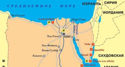
The Golan Heights (Golan) are located in the north of Israel, northeast of Lake Kinneret. The Golan Heights is a tiny, sparsely populated area still contested by Syria, which surrendered the Golan to Israel during the 1967 Six Day War. The strategic importance of the Golan Heights for Israel lies in the ability to control the southwest of Syria from them, including Damascus itself, which is visible from the heights in cold and clear weather. Today, there are several Israeli settlements in the Golan, the largest of which is the village of Katzrin with a population of about 7 thousand people.
Coordinates: 33
north latitude, 35.75
east longitude
Golan Heights on the mapwhich can be controlled (scaled and moved)
Share the link with your friends:
Interesting places:
Bethlehem
Bethlehem (Beit Lehem) is located in the Palestinian Authority, about five kilometers from the southern outskirts of Jerusalem ....
Armageddon
Armageddon (aka Ar-Megido) is located in Israel, near the ancient city of Megido. This hill, ...
The Golan Heights is a disputed territory in the Middle East, currently controlled by Israel. Until 1967, it was part of the Syrian province of Quneitra, captured by Israel during the Six Day War.
In 1981, the Knesset of Israel passed the "Golan Heights Law", which unilaterally proclaimed Israel's sovereignty over the territory. The annexation was invalidated by UN Security Council Resolution 497 of December 17, 1981.
Both Israel and Syria consider the Golan Heights to be part of their territory.
The Golan Heights is a mountain plateau of volcanic origin, stretching east from Lake Tiberias (Hebrew ים כנרת - Lake Kinneret) and the Hula Valley, and further into Syria. Most of it is located at an altitude of more than 1000 meters above sea level. The area occupied by Israel in the Golan Heights is about 1150 km² with a length of 60 km and an average width of 25 km.
In the west, the plateau drops abruptly towards Lake Tiberias, in the south and southeast it is limited by the deep and narrow gorge of the Yarmuk River. There are no clear natural boundaries in the east. Most of the Golan Plateau is located in Syria.
The highest point in the Israeli-controlled part of the Golan Heights is Mount Hermon, 2236 m high. The territory occupied by Israel accounts for 7% of the Hermon Range, and the highest point in Syrian territory reaches 2814 m.At least from November to March, the peak of Hermon is covered with snow. Israel has built a ski resort there.
Agriculture is well developed and includes numerous orchards (apples, cherries), berries (raspberries, strawberries). The cultivation of grapes and winemaking are very popular.
At the southwestern end of the plateau are the Hamat-Gader thermal springs, known since Roman times.
The Golan Heights is a fairly picturesque place. There are numerous nature reserves, streams and waterfalls. The Golan has a very moderate climate. Due to the altitude, it is not very hot in summer and rather cold in winter, relative to the rest of Israel.
Precipitation is comparatively abundant and flows into the Jordan and the nearby Lake of Tiberias, from which Israel draws most of its drinking water.
Settlement history
On June 9-10, 1967, during the Six Day War, Israeli forces launched an offensive and, after 24 hours of heavy fighting, occupied the Golan Heights. Thus, the Golan Heights, having come under the control of Syria in 1944 after the termination of the French mandate, were under Syrian control for 23 years.
During the Yom Kippur War in October 1973, the heights were the scene of fierce fighting. In the early days of the war, which began with a surprise attack by Egyptian and Syrian forces, Syria tried to regain control of the heights, but to no avail.
The Syrian administrative center of the Golan was the city of El Quneitra, but it was abandoned by the residents after the Israeli army occupied the Golan Heights during the Six Day War.
At the same time, according to the American historian Daniel Pipes, known for his criticism of the modern Islamic world, the Syrian authorities, in order to achieve a propaganda effect, did not allow the population to return to the city to their normal life and since then have shown the ruins of the city as a result of Israeli "unprecedented terrorism and cruelty ". The American organization "CAMERA" claims that the destruction of the city is the result of hostilities from Syria, which, in an attempt to shell Israeli positions in the Golan, for hours in 1970-1973 subjected Quneitra to powerful artillery shelling.
The buildings in Quneitra were also looted. Israeli officials say Quneitra was looted by the retreating Syrians. Niels-Goran Güssing, Special Representative of the Secretary General of the United Nations, considers such a version as unlikely given the extremely short time interval between the erroneous radio announcement of the fall and the actual fall of the city a few hours later. He concluded that "the responsibility for carrying out this extensive sacking of the city of Quneitra lay largely with the Israeli forces."
The US Committee on Refugees and Immigrants said that "before the withdrawal, the Israelis leveled the city with bulldozers and dynamite."
Since 1974, Quneitra has been in the neutral demilitarized zone between the Israeli and Syrian border, controlled by UN forces. The city remains practically uninhabited to this day.
The capital of the Israeli-controlled part of the Golan is Katzrin.
In the late 1970s, the government granted Israeli citizenship to Syrian citizens living in the heights, and in November 1981 Israel formally annexed the Golan Heights, extending its jurisdiction over them. The act has not received international recognition.
Today about 39 thousand people live in the Golan. Of the Syrian settlements, 4 villages remained: Majdal Shams, Masada, Bukata and Ein Kinie; most of their inhabitants are Druze.
A large number of old Syrian minefields remain in the Golan Heights. Most of them are fenced and marked with warning signs, but they have not been neutralized. As a result, natural nature has been preserved on a large territory and there are places where, since 1967, no human has actually set foot.
After the occupation of the Golan Heights, Israeli fortified posts were equipped here, equipped with electronic equipment for reconnaissance, the largest electronic reconnaissance stations are located on Mount Hermon (60 km from Damascus), as well as on the heights of Hermonit, Tel Fares, Avital and Buster.
Since the beginning of 2011, IDF units have begun laying new minefields in the Golan Heights. The decision on the new mining of the border was made after the Palestinians, who came from Syria, managed to break through the border fence and penetrate into Israeli territory, while the old mines did not work. In addition, by 2012 Israel had built a separation wall here. The IDF is reinforcing the wall along the ceasefire line and installing additional border surveillance to prevent possible infiltration attempts by Syrian refugees or militants, according to the Guardian newspaper.
In December 1981, Israeli jurisdiction was extended to the Golan region by a decision of the Knesset.
The annexation of the Golan Heights by Israel is not internationally recognized and UN Security Council Resolution 497 considers the area to be part of the Syrian occupied territories.
The Syrian population of the Golan before the Israeli occupation of the territory was about 116,000 people. During the Six Day War, most of this population fled (according to the Israeli version) or was expelled by the Israelis (according to the Syrian version). According to the Syrian version, Israel forbade these people to return after the war. After the Six Day War, only 6,400 Syrian citizens remained in the Golan, mostly Druze. In 1981, following the annexation of the Golan by Israel, they were offered Israeli citizenship.
Most of the Druze initially renounced Israeli citizenship, but eventually adopted it. At the moment they have dual citizenship. Today, according to Syrian data, 16,000 Syrians live in the Golan.
Since 1967, Israel has built 34 settlements in the Golan. The total number of their population in 2007 is about 20 thousand people. The population of Druze villages in the Golan is about 18 thousand people. In general, a significant part of the territory is sparsely populated.
In 1981, the Knesset of Israel passed the "Golan Heights Law", which unilaterally proclaimed Israel's sovereignty over the territory. The annexation was invalidated by the UN Security Council Resolution of December 17, 1981 and condemned by the UN General Assembly in 2008.
The issue of possible talks between Israel and Syria on the Golan Heights issue has a long history. As a rule, this is due to internal political events in Israel and / or Syria, or with the next international initiative.