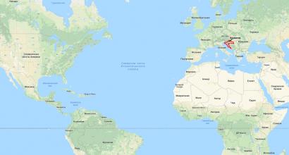
Map of Croatia. Picturesque Croatia on the world map Map of Croatia Austria
Croatia appeared on the world map after the collapse of Yugoslavia. Its clean beaches and low prices for holidays attract the attention of tourists from different parts of the world. The country includes 700 islands, of which only 50 are inhabited.
The coast of Croatia on a detailed map of the world and Europe in Russian

The map can be enlarged by clicking on it.
You need to look for Croatia on the world map next to the Adriatic Sea. In the north, the country borders, Hungary and Serbia are Croatia’s eastern neighbors, Bosnia and Herzegovina is located in the southeast of the country, and Montenegro is its southern neighbor.
Direct flights are operated by Aeroflot; the flight time is 2 hours 40 minutes.
In winter it travels from Moscow 4 flights per week to Zagreb. In summer, the number of flights increases significantly - planes fly every day to Slit, Dubrovnik, Pula and Zadar.
You can purchase a plane ticket using this search form. Specify cities of departure and arrival, date And number of passengers.
By train Croatia can be reached via. Train No. 15 departs from Kievsky Station, to which the Moscow-Budapest carriage is attached. From the capital of Hungary to Zagreb you can take a direct express train. The road route runs through Belarus, Poland, the Czech Republic, Austria and Slovenia.
Since Dubrovnik airport is located 35 km from the border with Montenegro, you can combine a holiday in these two countries. The nearest resort in Montenegro is 50 kilometers from Dubrovnik airport - this Herceg Novi. You can get from Croatia and back by car along the Jadran Motorway, as well as by plane, train and bus.
Read also in which country is better to vacation - Croatia or Montenegro.
Country information

Croatia gained its independence in 1991. The country has been a member of NATO since 2009, and in 2013 it joined the EU.
Story
On the territory of modern Croatia, the development of a Slavic settlement began in the 6th-7th centuries. For a long time the country was under the rule of the Franks. In the 9th century, two principalities arose in it - Dalmatian Croatia And Principality of Posava.
Already in XI, Croatia became one of the most powerful states in the Balkans. In 1918, it became part of a common state with the Serbs and Slovenes. From 1945 until its independence, Croatia was part of Yugoslavia.
General information
The country's territory covers an area of 56.6 thousand square meters. km. This parliamentary republic with a population of just over 4 million people. Tourists in the country are interested in ski resorts and beaches.
The largest city in the country is Zagreb. It is a compact settlement with perfectly preserved medieval buildings.
The most famous resorts in the country are located on Istrian peninsula. It is famous for its picturesque views of. The predominant religion in the country is Catholicism. Catholics in the country are about 76.5%. There are more than 11% of Orthodox Christians in the country. The official language of the country is Croatian. The time difference with Moscow is -2 hours.
Climate
The climate of Croatia is optimal suitable for summer holidays Russians. The air temperature in the hottest months of the year, July and , is about +30°C. During this period the sea warms up to +25-27°C. In winter, the air temperature stays within +6-10°C.
Tourism

Beaches Croatia has Blue Flags. They are covered with large pebbles or concrete platforms.
Cities and resorts
Each resort has its own characteristics. Romance lovers choose Rovinj, Pula or the island of Krk for their holiday. Young people strive to get to Medulin. Lovran is best suited for relaxation for older people, and Opatija for treatment.

Attractions and entertainment
The main entertainments of tourists in Croatia: diving, beaches, skiing and sightseeing, among which:
- Dubrovnik is an open-air museum city. The main attractions (Pile Gate, Stradun Square, Church of St. Savior, Sponza Palace, Minceta Tower) date back to the 17th century.
- Mljet Island where the National Park is located. Its attractions are 2 unique salt lakes.
The Republic of Croatia is a democratic state governed by the rule of law at the junction between Central Europe and the Mediterranean, with its capital Zagreb. Croatia is a centuries-old state that has been dependent on Yugoslavia for almost the entire part of its history. The name Stanas is correlated with the ethnonym of the local people - Croats. The country's area is 56,538 square kilometers.
The republic is divided into 102 districts.
Croatia is bordered in the north by Slovenia and Hungary, and in the east by the Danube River it borders with Serbia. In the east, Croatia's border meanders with Bosnia and Herzegovina and Serbia and stretches towards the Adriatic Sea. But throughout the entire border area there is a 20-kilometer stretch of access to the sea of Bosnia and Herzegovina. And the rest of the territory with the city of Dubrovnik does not have direct communication with Croatia, and is an isolated territory. In the west and south it borders with Italy across the Adriatic Sea, with Montenegro in the southwest, with Hungary in the north.
The western part of the country is a rocky desert region that is often subject to flooding. Forests cover only 20% of the territory, while 1/5 is occupied by agricultural land.
The coastal areas are rich in small islands, there are 1185 of them in total. Few of them are suitable for full life, but 66 are still inhabited. The most significant of them are Krk, Pag, Brac, Hvar, Cres, Mlejet, Vis.
See where Croatia is located on a map of Europe and the world.
Sorry, the card is temporarily unavailable
Detailed map of Croatia in Russian with resorts, cities, roads.

is a picturesque country that, despite its small scale, attracts with its hospitality and clean ecology.
Croatia is one of the youngest countries in Europe, which received its recognition only in the 20th century. But despite its youth, this country is conquering more and more tourist hearts.
Croatia is a country of contrasts and combinations, it is an amazing mixture of coniferous forests and clean air and incredible beauty of architecture.
The heart of Croatia is the Adriatic coast, which captivates the hearts of not only ordinary tourists, but also divers and windsurfers. Cities such as Brac, Pula, Split, Tucepi, Zagreb, Rovini, Porec, Dubrovnik, etc. are ready to delight with their beauties. Here everyone will find a vacation for themselves, from lovers of a fashionable holiday to extreme tourists. Anyone who comes to Croatia will not remain indifferent.
Croatia on the world map
Below is an interactive map of Croatia in Russian from Google. You can move the map left and right, up and down with the mouse, and also change the scale of the map using the “+” and “-” icons, which are located at the bottom on the right side of the map, or using the mouse wheel. In order to find out where Croatia is located on a world map or on a map of Europe, use the same method to reduce the map scale even further.
In addition to the map with the names of objects, you can look at Croatia from a satellite if you click on the “Show satellite map” switch in the lower left corner of the map.
Below is another map of Croatia. To see the map in full size, click on it and it will open in a new window. You can also print out the map and take it with you on the road.

You have been presented with the most basic and detailed maps of Croatia, which you can always use to find an object of interest to you or for any other purposes. Have a nice trip!
Croatia is a country in Central Europe, partly located on the Balkan Peninsula. On a detailed map of Croatia you can find the country's border with five states: Bosnia and Herzegovina, Montenegro in the south, Slovenia in the north, Hungary in the northeast, Serbia in the east.
Geographically, the territory of Croatia is divided into two regions - continental and coastal, stretched in a narrow strip along the coast of the Adriatic Sea.
Croatia is a country with developed agriculture, shipbuilding, automotive and oil refining industries.
Croatia on the world map: geography, nature and climate

Croatia on the world map is located in the southern part of Central Europe, partly on the Balkan Peninsula, washed by the waters of the Adriatic Sea from the southwest. The territory of Croatia also includes 1145 Dalmatian islands of the Adriatic Sea, the largest and most populated of them is the island of Krk.
The total length of Croatia's borders is 2,375 km, and the length of the Adriatic coast is 1,777 km.
Minerals
The country has large deposits of bauxite, marl, pyrite, copper and iron ores. There are minor reserves of oil and gas, hard and brown coal.
Relief
The terrain of Croatia is predominantly flat - more than 75% of the country's territory is occupied by lowlands and hills up to 500 meters above sea level.
The northern part of Croatia is occupied by the Central Danube Lowland with altitudes ranging from 100 to 200 meters.
In the center of Croatia lies the Dinaric Highlands, to which the country’s highest point, Mount Dinara (1831 m), belongs.
The Adriatic coast is located in the southwest of the country and has a highly indented coastline. Seismic activity in this region is at a high level: weak earthquakes often occur and destructive ones occur less frequently.
Hydrography
13 rivers with a length of more than 100 km and several hundred shorter rivers flow through Croatia. Most of them belong to the Black Sea basin, and a smaller part to the Adriatic Sea basin. The longest river is the Sava (562 km), the right tributary of the Danube. Other large rivers: Danube, Drava, Mura, Kupa.
The map of Croatia in Russian shows that numerous lakes are found in all regions of the country. The largest lake is Lake Vransko, with an area of 30.7 km², located in southwestern Croatia.
Flora and fauna
Forests occupy 47% of the country's area. They grow oaks, hornbeams, maples, and in the high mountain forests - spruce and fir. Steppe vegetation grows in flat areas; willows and poplars grow along the banks of rivers.
In the mountains and forests there are brown bears, martens, hares, deer, wolves, and roe deer. The steppe area is home to many snakes and lizards. Among the bird species that nest in the country are eagles, kites, falcons, wood grouse, partridges, storks, gulls and other birds. Pike, tuna, barracuda, pike perch, and carp are found in inland waters and in the waters of the Adriatic Sea.
Specially protected areas - 19 national and natural parks, 2 nature reserves and 400 game reserves - occupy 8% of Croatia's area. The oldest national park in the country is Plitvice Lakes. On its territory there are 16 large lakes, 140 waterfalls, 20 caves, beech and coniferous forests. This national park is located in the central part of the country.
Climate
Croatia's climate varies from humid temperate continental in the central part to subtropical Mediterranean on the Adriatic coast. In continental regions, winter is relatively cold, with possible precipitation in the form of snow; the average January temperature here is 0 °C; in coastal areas it is soft and humid, the average January temperature is +6 °C. Summer throughout Croatia is hot, sometimes humid, with average July temperatures ranging from 21 to 25 °C. Annual precipitation ranges from 800 mm in the interior to 1600 mm on the Adriatic coast. Croatia is a sunny country: the duration of sunshine is approximately 2000 hours per year.
Map of Croatia with cities. Administrative division of the country

The territory of Croatia is divided into 20 counties (districts), which consist of 122 cities and 424 communities. The capital of Croatia, Zagreb, has the status of a separate county.
Largest cities in Croatia
- Zagreb- the capital and largest city of the country, located in its central part, on both banks of the Sava River. Zagreb is an international trade and business center with developed pharmaceutical, textile and food industries. The city is famous for its many museums, parks and temples, and its hallmark is the Zagreb Cathedral in the neo-Gothic style, founded almost a thousand years ago. Zagreb has a population of 802 thousand people.
- Split is the second most important city in Croatia, located in the far south of the country, on the Adriatic coast. Split is a major tourist center and seaport of Croatia. The city's main attractions include the Croatian National Theatre, Diocletian's Palace and the ruins of the Roman city of Salona. The population of Split is 178 thousand people.
- Rijeka- a city and port on the Adriatic coast. On the map of Croatia with cities in Russian, Rijeka is located in the northwestern part of the country. The favorable climate, warm sea, ancient towers and castles make Rijeka a popular tourist destination in Croatia. The population of the city is 129 thousand inhabitants.
Detailed map of Croatia in Russian. Map of roads, cities and islands on the map of Croatia. Show Croatia on the map.
Where is Croatia located on the world map?
Croatia - “The Country of a Thousand Lakes and Islands”, “The Pearl of the Adriatic”, “Little Switzerland”, what epithets can you hear about this amazing country! The state, located in the southern part of Central Europe and partly in the western Balkan Peninsula, is becoming an increasingly popular destination in the tourism market every year, including among Russians.
Where is Croatia located on the map of Europe?
Croatia is located in the south of Europe next to Slovenia, Hungary, Serbia, Montenegro, Bosnia and Herzegovina, and is washed by the Adriatic Sea in the west.

Interactive map of Croatia with cities
Conventionally, the country can be divided into three tourist zones. The Istrian peninsula is popular due to the picturesque landscapes of the Adriatic coast, clear sea and proximity to Italy. The climate here is pleasant even in the midst of the heat, but the beaches are not the most comfortable - concrete platforms and large pebbles. In Central Dalmatia there are beaches with small pebbles and a comfortable gentle entry into the sea, and the entertainment infrastructure in Dalmatia is more developed; this region is excellent for families with children. Southern Dalmatia is known for its numerous islands and picturesque mountains. There are also several excellent ski resorts in Croatia, which are noticeably cheaper than their counterparts in Western Europe, the most famous of which are the resorts of Sljeme, Belolašica, and Platak.
Islands of Croatia on the map
Croatia owns 1,145 islands - from tiny to quite large. The largest are the islands of Krk and Cres, the Island of Hvar - one of the most picturesque places in Europe, and the most populated island of the country - Koločep, as well as the island of Mljet, famous for its forests and caves, and many others (Brac, Pag, Korcula, Dugi Otok, Rab, Vis, Losinj, Solta, Lastovo, Unije).

Geographical location of Croatia
The country is located at the crossroads of routes leading to the Mediterranean and Central Europe, so Croatia is classified as both the Mediterranean and the Central European-Danubian region. Croatia consists of a continental part, located in the Sava River basin, and an Adriatic part, which stretches out in a narrow strip along the Adriatic coast. Geographical coordinates of Croatia: 45°8′30″ N. and 16°13′45″ E.
Territory of Croatia
The state occupies an area of 56,594 square kilometers - 127th in the world according to this indicator. According to the relief, the country's territory can be divided into 3 main regions: the Adriatic coast, the Dinaric Highlands and the Central Danube Lowland.