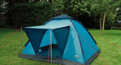
Climbing fisht. Climbing oshten (2804m) and fisht (2868m) Additional information about the event
At the end of October, a team of instructors from the Krasnodar “Big Adventure” made training ascents to the popular Fisht peak (2867 m) in the western spurs of the Main Caucasian ridge. The group included: Alexander Milkin (leader), Marina Martyshina, Andrey Satalkin, Vadim Ukraintsev, Kirill Kuznetsov, Pavel Plushenko, Ilya Popov. Alexander Milkin, deputy director of the camp for safety, talks about the ascent.
On October 21 at 13:00 the group climbed to the summit along the route 1B * of the complexity category. The route was an interesting combination of rocky and snow-ice areas, the ascent was complicated by deep snow cover and limited visibility due to fog. The rise required the participants to master new techniques. The next day, we passed the traverse of the second peak of Oshten, 2800 m.
Fisht, together with the peaks of Oshten and Pshekha-Su, forms a single mountain range. These are the first peaks of the Western Caucasus, which have all the classic features of real mountains: the peaks rise significantly above the border of the forest, there is a zone of alpine meadows, year-round snow and ice cover, large rocky walls.
In prehistoric times, the peaks of the Fisht-Oshten massif were coral islands of the ancient ocean. Tourists still find fossils and imprints of giant shells here. One of the sights of Fisht is a 200-meter waterfall that falls from the western wall of the massif. On the slopes of the mountain there is the source of another tourist attraction of the Caucasus - the Belaya River, which is popular with rafters.
On the first day, the Big Adventure team approached from the Yarovaya glade to the beginning of the ascent near the Fisht shelter, passing the uncategorized Guzeripl and Armenian passes. The assault on the summit took the whole next day. The traverse between the peaks passed along a simple ridge over the Lagonaki plateau. The participants were satisfied with the work done, in just the route they managed to "walk" almost 60 km.
The specifics of work in the "Big Adventure" does not require instructors to have solid mountaineering skills. Children do not go to high mountains. But the snowy peaks are very close, and one cannot fail to notice such an excellent training ground for sportsmanship. For many instructors, Fisht became the first categorical mountaineering peak.
- Most of all I remember the movement in bundles along the glacier and the key section of the ridge. Perhaps, for me, it was the most difficult section, since I had to go on crampons for the first time and insure myself with an ice ax, - said Pavel Plushenko.

- The ascent took place in good weather, - Marina Martyshina shared her impressions, - the passage of the glacier and technically difficult sections added extreme sensations. For me, this was the most memorable event of the season.
It is quite possible that a part of the route covered by the "Big Adventure" team will become the basis for the new summer program of our camp. Therefore, Krasnodar instructors prepare in advance. Do you want to conquer Fisht with us?


Mount Fisht (2868m), together with the peaks Oshten (2804m) and Pshekha-Su (2743m), forms the Fisht-Oshten massif. The peaks of the massif are the first in the Caucasus, if you move from west to east, alpine-type peaks, rising significantly above the upper border of the forest, having a wide belt of subalpine and alpine mountain meadows. The Pshekha River originates from the Fisht slopes, at the Fisht and Oshten peaks the source of the Belaya River is located, downstream of the receiving water of the Pshekha River, and flows into the Kuban River.
Many years ago, on the site of these stunningly beautiful mountains, there was the bottom of the ancient Tethys Ocean, and Fisht himself and his neighbors were coral islands. This is evidenced by the diverse fauna, carefully sealed by nature in rocks in the form of a huge number of fossils.
Mount Oshten has five peaks and is one of the safest and most accessible peaks in the Western Caucasus. We will climb the main peak of the mountain (2804m). There are no glaciers on Oshten, but snow can lie all year round. From different sides the mountain has a relief of different steepness and composition, which gives it incredible beauty and grandeur. The slopes of Oshten are located in the zone of alpine meadows, and the top is rocky. The mountain is made of limestone, which is why it is sometimes called Snow White. Climbing Oshten is a great start for beginners who dream of moving from easy routes to more serious ones.
Climbing Oshten is not particularly difficult, this is an ordinary trekking route that any person can do.
Mount Fisht is the westernmost peak of the Caucasus, with glaciers on its slopes. There is a relict Big Fishta glacier with a bluish surface, which is framed by scarlet limestone rocks. The peak of Fisht is crowned with steep cliffs, and on the slopes there is a unique rare vegetation, rivers and streams with waterfalls. Fisht in translation from the Adyghe means "white head". The mountain really looks like a wise old man, the keeper of many secrets and mysteries.
We will go to the top of Mount Fisht along the classic route of 1B difficulty category. Since there are simple rocky sections on the route, climbing this mountain requires some preparation (you can get it by participating in our training trips to Polushkino, Dyuki, Vorgol). The route passes among the rocks and along the glacier, so we will need: a helmet, crampons, a harness, a carbine and an ice ax.
Climbing Mount Fisht is not just enjoying the beauty of the surrounding nature, it is a chance to test yourself, test your fortitude and take the first significant step into the world of mountaineering.
Another vacation came, and I again go to the mountains. As usual, the hardest part is choosing where to go. I want it everywhere and at once, but it won't work that way. This time I decided to make a combined trip: first, I go alone to the Caucasian State Natural Biosphere Reserve to Mount Fisht, and then I go on a hike across North Ossetia with a group with "Mountain Roads". For a long time I wanted to go to Fisht, but there are no long routes, 4-5 days maximum, and somehow I didn't want to go just for the sake of such a short hike. At the same time, I did not want to go only on a campaign in North Ossetia. Although Ossetia itself is very interesting to me, but besides this I still wanted to get tired of the hike, and the route there is still pretty simple. And as a result, the idea was born to combine two such routes in one trip, which I have never regretted.
So, a mini-hike to Mount Fisht.
The main feature: the route passes through the territory of the reserve, and you need to follow the established rules, somehow stop for the night only in equipped parking lots, do not burn fires, do not walk in places that do not belong to permitted tourist routes. For myself, I chose route number 3 from the Lago-Naki checkpoint through the shelter at the foot of Mount Fisht to the village of Solokh-Aul. From the Fisht shelter, I also made a radial ascent to the top of Fisht, and also went to the Fisht-Oshtenovsky pass. For three and a half days I found 78 km, more than 3 km of climb and almost 5 km of drop.
Trekking track:
Trek: 19 km;
Cumulative climb / drop: 524 m / 714 m;
Yesterday I spent the whole day trying to get to the village of Kamennomostsky (aka Khadzhokh) in Adygea. The village is already in the mountains. I stayed at the Melnitsa hostel. A good home hostel, cheap, well fed, and even for the same money they settled in a single room instead of an armored bed in a dormitory room. I agreed with the owners to take me to the Lago-Naki cordon the next morning. Public transport, alas, does not go there. They asked for 1,500 rubles. In my opinion, a bit too much, but according to the information that I found on the Internet before the trip, taxi drivers took the same amount.
Drive about 30 km. On the way, we stopped at the Ministry of Emergencies, where I registered my trip. I have never done this before, and even now, generally speaking, I did not intend to, but, they say, the administration of the reserve does not like very much when single tourists do not register with the rescuers. So for their (well, my own, what really) peace of mind, I did it. The Ministry of Emergency Situations, however, made a note to me that they do not recommend this route (they write this to all singles), but they registered it. It works like this: at the end of the hike, I should call the specified phone number. If suddenly I don’t call me back, then on the key date they themselves will start calling me. If I do not answer any of the phone numbers (and they require two different ones), then a rescue squad will come out in search of me. The hike according to the plan ended on the 18th, the control date was set on the 20th.
At the checkpoint "Lago-Naki" I issued a pass to the reserve. I honestly told the employee the entire route, in particular, that I was going to climb Fisht. Before the hike, I still did not understand if the reserve allowed to go there, and decided to find out on the spot. But the guys didn't care, they didn't even reflect this moment in the pass. So, tomorrow I will try to climb to the top! The pleasure of walking around the reserve cost me 1,500 rubles, 300 rubles per day of stay. According to the plan of these days, I had 4, but I decided to pay for one as a spare.
I'm starting!
Left the cordon at 10:30. It was very easy to walk, the shallow elevator was not felt. By noon I reached the Abadzesh pass. On it, at the monument, I made a halt, rested for half an hour.
A thunderstorm began in the area of the Instructor's gap. It lasted an hour and a half or two with a powerful downpour, hail, hurricane wind and lightning directly overhead. The places were open, and there was nothing to do but walk forward, staring at the path in front of you. Many beautiful places remained unnoticed by me because of this thunderstorm. Stopped watering just before the Armenian Pass. Fisht was at the orphanage at half past four. Before I even had time to put up the tent, it started to rain again, things got a little wet. I had dinner already inside. Set the alarm at 5 am, I'll try to go to Fisht.
 On the Lago-Naki plateau. In the center is Mount Oshten.
 Mount Fisht from the Guzeripl Pass.
Trek: 12 km;
Total climb / drop of altitude: 1226 m / 1226 m;
Evening parking: 1581 m above sea level. m.
Woke up at five, as planned. But ... it was raining and thunder rumbled. I decided to lie down and wait until the weather cleared up. The rain stopped at about six, the sky seemed to dissipate, so I started making breakfast and getting ready. I left the camp at 7:30. He simply left the tent along with all his belongings, hoping that there were no criminals there.
 At the Fisht shelter. Pshekha-Su and Oshten mountains and Fisht-Oshten pass. On the left, on the slope, the so-called "Red Rocks", it is under them that the route of climbing Fisht passes.
The standard route of climbing Fisht has been studied by me for a long time, much before I started planning this trip. First, along the path to the Fisht-Oshten pass, approach under the "Red Rocks" (it is impossible to confuse that this is impossible, they are too prominent), then an ascent along them to the upper plateau, an approach to the Big Fishtinsky glacier, the glacier crossing, then a rather steep section - exit to the western ridge and finally a simple transition along the ridge to the top. The entire path is well marked, and on the ascent along the Red Rocks, in especially steep places, there are ropes. The only area where the markings are weak is between the glacier and the Red Rocks. In some places, the markings are not enough (you cannot see the next from one tour), and in some, on the contrary, there are many chaotically arranged tours, because of which it is not clear where the main path is. Apparently, due to insufficient marking, people began to wander there in different directions, and everyone considered it their duty to mark their way, and it only got worse.
Well, in order. The ascent along the Red Rocks is quite steep. There he overtook two tourists in motorcycle helmets instead of helmets. I met them yesterday too, overtook them before the Armenian Pass. I didn’t see them again, so, apparently, they didn’t reach the top, but turned somewhere earlier. And it was because of what! At first the weather was good, the sun was shining. But soon, somewhere after the Red Rocks, the sky began to frown, a dense cloud fell on the mountain, visibility deteriorated greatly, a thunderstorm thundered around. However, there was no rain at that moment, so I continued my ascent with the thought that the weather in the mountains often changes and that the sun will be shining soon.
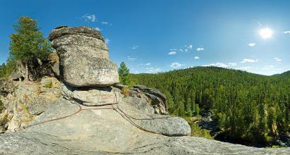
 Red rocks.

I got out onto the glacier. In the navigator, I had a trail drawn along it, but in reality it was not. Traces on the glacier almost do not hold, and after yesterday's thunderstorm, nothing remained at all. In the end, I went my own way, trying to keep the path drawn in the navigator. I have no cats, I walked in the same sneakers. However, the slope here is not very large, and at the bottom the glacier flattens out almost to the horizontal. There are no dangerous cracks either. The surface is rather loose, and it was quite normal to walk in sneakers. At least up. Down will probably be worse, we'll see later.
 Big Fishta glacier.
 On the Big Fishta Glacier, downward view.
Soon after I got to the glacier, the sky finally leaked out and from the cloud that sat on the mountain, heavy hail fell, mixed with rain. Well, in such weather it makes no sense to go to the top for sure. And it's not safe at the top in a thunderstorm. However, at that moment I was in the most interesting place, in the middle of the glacier, where it is not very easy to stand, and there is no place to hide at all. I decided to go further to the place of the ascent to the western ridge, and wait there and watch the changes in the weather. The trail goes across the entire glacier, taking it to the west, bypassing the bergschrundt in its upper part. At the end of the glacier, the precipitation ended as ordered, and although it was still cloudy, I decided to continue climbing. The path to the ridge is quite steep, but the markings are excellent. At the top of the ridge, I finally saw the top and the blue sky: finally clearing up! Now we have to go upstairs rather than cover it again. The ridge is rather narrow, with steep cliffs on both sides. However, it is safe to go, the main thing is not to approach the edge. Already at the top I caught up with two elderly tourists, at the top we are together. It took 4 hours to get up from the shelter.
 In the place of the ascent to the western ridge, a view of the glacier.
 On the western ridge. Summit Fisht finally without clouds, hurry there!
Unfortunately, there are almost no views, but we managed to take a few pictures. The height of the summit seems to be 2867, but the navigator did not measure more than 2790. I think because of the bad weather ... 20-30 minutes at the top and down. The mood after the top is upbeat. I met three guys on the ridge. They took a burner with them to have tea upstairs, but they forgot the lighter. Gave them mine. By the way, they later returned it to me, which was deserted and not working. And almost at the glacier I met another one of their company. He had been sitting on a stone for about 30 minutes and did not move. He said that he was tired, did not calculate and did not take a snack with him. He asked me for something to eat. I gave him half of the chocolate bar and the rest of the dried apricots. Later I found out that he did come to the top. Apparently it helped :) Descent without crampons turned out to be even easier than ascent. Well, it slips a lot, it is very difficult to deal with it, but it is not so necessary either: since the incline is not very large, I kept sliding on my feet to the very bottom. Fast and efficient.
 On the top!

 Big Fishtinsky glacier from the top of Mount Fisht.
I came back in a different way, from the glacier to the Red Rocks I followed an alternative path to the west. It is also marked, but bad. In the end, it all ended with the fact that I just walked in the right direction, choosing the path myself. In the same place, a thunderstorm began again and did not end until evening. I gave up all my plans to climb Pshekha-Su and just started descending. It was necessary to do it very carefully in such weather, especially along the Red Rocks. The ropes were really useful there. I went down to the shelter at 14:40, almost completely wet (only the membrane jacket works for a five). In total, 9 people were at the summit today. And when the weather is clear, there must be crowds.
Climbing track:
Trek: 28 km;
Total climb / drop of altitude: 1053 m / 2280 m;
Evening parking: 361 m above sea level. m.
The plan is to run to the Fisht-Oshten pass in the morning, and after returning to turn the camp and go to Babuk-Aul. I did not set the alarm, because there should have been enough time in any case. As a result, I was lying around for a long time, until it became terribly hot. The weather is fine today. At least for now. I left only at 9. The pass was not as close as it seemed, and the climb is rather big: it is necessary to gain 650 meters from the shelter. And horizontally 4.5 km somewhere. Climbed up in 1:40. At the pass I sat down to rest. The weather was excellent and I didn't want to go anywhere. As a result, I sat there for 50 minutes.
 The top of the Fisht mountain from the ascent to the Fisht-Oshten pass.
 View from the Fisht-Oshten pass to the Fisht shelter and the Belaya river valley.
Descended quickly. The heat at the shelter, 35 degrees, no less. It does not dispose to activity at all, so the fees were slow and sluggish. He left the shelter only at 13:15. Without rest I reached the Belorechensky Pass. And then the weather once again decided to play a trick on me and out of nowhere gave birth to another thunderstorm on me. As expected, with lightning all around and hail. The hailstones are a centimeter in diameter, they even pierce the hood, open hands also suffer. I had already been on the road for an hour, with an hour of continuous ascent, and felt an urgent need to rest a little. As a result, even despite the storm, almost reaching the saddle, he stopped. But I did not rest for long, a few minutes later I was almost washed away by the river flowing from the saddle of water and hailstones. My backpack and I were abruptly ankle-deep in cold liquid, so I had to move on. As I was later told, in the area of the Belorechensky Pass there are steep views, there is where to take a walk and what to take pictures. But skipping all the fun is already a tradition of this trip. Well, there will be additional motivation to return :) I slowly reached the Circassian Pass, where local shepherds sell milk-ayran. Soon after, the rain stopped, the sun shone again and it became hot. Oh, this weather!
 Pass Belorechensky. Bad weather again!
Before the "Merry Descent" I caught up with yesterday's acquaintances, with whom I was at the top of Fisht. We sat and rested for about ten minutes, and then said goodbye: they were not going to go to Babuk-Aul, but to get up for the night somewhere earlier. And I ran forward. The descent is really fun: in a short time you lose almost one and a half kilometers in altitude. On the way, I also made a halt at the Kholodny spring. I went to Babuk-Aul at about seven in the evening. A very civilized shelter, there are toilets, showers, awnings and gazebos. It took twenty minutes to light the burner. The lighter did not work after yesterday, and after today the matches got wet, despite the fact that they were in a tied bag. It was necessary to put them in a sealed bag, but I thought they would stay dry anyway. The second box of matches turned out to be quite messy. As a result, I disassembled the lighter and somehow managed to achieve a spark in the piezoelectric mechanism. There is still no telephone connection. And in general, she was nowhere on the route, although the Internet claimed the opposite. I think the weather is to blame, it should be on clear days.
 Cheerful descent.
Trek: 18 km;
Cumulative climb / drop: 473/649 m.
The alarm went off at 7, with the expectation to go out at 8:30. It was cloudy all night, sometimes it rained. The tent is wet in the morning. I was a little mistaken with the distance that had to be covered that day. The official description stated 7 km to the White Stream checkpoint. And he seems to be on the outskirts of Solokh-Aul. So I decided to get off at 8:30 in order to catch the bus at 10:35 with a margin. Most of the people who spent the night at the shelter ordered transport from the staff of the reserve so that they could take them, fortunately, there is a road. The road is rather boring, it went quickly. For the first time during this trip, tickets to the reserve were checked at the checkpoint. After the checkpoint, Solokh-Aul did not appear for a suspiciously long time, I decided to look into the navigator. And then there was a surprise: it turns out that there are two White Streams, one at the checkpoint, and the other in Solokh-Aul, and there is more than 10 km between them :) So, I didn't study this part of the route very carefully, and she immediately punished me for it. However, there was no problem as such. Well, I'll catch the next bus at 11:50, no big deal. Came just a few minutes before departure. At the bus stop, I met a whole crowd of tourists, who in the morning were taken from Babuk-Aul here in cars.
This was the end of this mini-trip to the Caucasian reserve. Then I went to Sochi, spent the night in a hostel, and the next day I went by train to Vladikavkaz, because there I have another trip around North Ossetia, only now with a group. There will be a separate story about him.
Well, I really liked this trip. Fisht-Oshten massif is a very cool place. Separately, I am pleased with the successful ascent of Fisht, the most vivid impression of the hike. The routes here are designed for beginners, it is impossible to get lost, and the transitions are quite simple and short. And in general, the place is very popular. At the Fisht shelter, at least a hundred people lived on both days. With the weather, of course, not very lucky. Every day some kind of storm swooped down, wet me to the skin, as a result, there were no dry things :) There is still very high humidity here, so everything did not have time to dry out in between the rains. In general, there is still where to walk here, you can safely return.
More photos from the hike
(2867 m) is located on the border of two subjects of the Russian Federation, Krasnodar Territory and the Republic of Adygea. Every year, Mount Fisht and its environs are visited by hundreds or even thousands of tourists from all over our country and neighboring countries. Because it is here, both from Soviet times and nowadays, that many tourist routes pass.
It is worth noting the fact that Mount Fisht is the highest point of the Lago-Naki highlands and has two glaciers on its slopes - Small and Big Fishtinsky. The first of which is one of the lowest in the Caucasus, the second is the westernmost glacier in the Caucasus Mountains. Actually, our route will pass through the Big Fishta Glacier.
- Description
- Information
- Photo / Video
- Reviews
DESCRIPTION BY DAY
Day 1.
Gathering of the participants of the hike at the bus station in the city of Maykop no later than 8.00. Then there will be a transfer to the Yavorovaya glade, which is 100 km from Maykop. Upon arrival, we check the backpacks, get food, and go. Today we have to go 10 km.
Ascent to the Guzeripl pass
In the first part of the way, we will overcome a rather long, but gentle ascent to the Guzeripl Pass (1965), from which a stunning view opens up. In the background, the Kamennoye More ridge rises majestically, the inaccessible walls of Mount Oshten to the right, and a little to the left opens the most mesmerizing view of the main Caucasian ridge and the highest point of the Fisht-Oshtenovsky mountain range, Mount Fisht.
 View of the main Caucasian ridge
 And the main thing from here opens a view of the Fisht shelter, which is located in a picturesque meadow at the foot of the mountain. From the Armenian pass to the shelter a little more than 30 minutes walk. Upon arrival at the shelter, we choose a convenient place for a tent and set up a camp.
 Massif of Mount Fisht, view from the Armenian Pass
 Day 2.
On this day, or rather the night, there will be a very early rise, at about 3 o'clock. For the most part, this is a forced measure, since closer to noon, clouds begin to form over the mountain, which subsequently form a thunderstorm front. Therefore, it is best to start climbing to the top before sunrise and by lunchtime descend back to the camp.
 We go in the direction of Fisht-Oshtenovsky pass
 At the Fisht shelter, we leave most of our things in the tent, we only take with us a small supply of food and the necessary equipment (ice ax, helmets, rope, crampons). Leaving the shelter, we will follow the trail in the direction of the Fisht-Oshtenovskiy pass, where after 1 km we will cross the Belaya river ford and begin a long long ascent. A few hundred meters after the ford, the main path will go to the right to the pass, while on the other hand we will go to the left towards the red rocks.
 On the approaches to the glacier
 Having approached the dense to the rocks, we will need to overcome several rather steep sections, after which we will come out onto a fairly flat surface and then move towards the Big Fishta Glacier.
 Glacier trek
  Exit to the ridge of the mountain
 The passage itself along the glacier is rather gentle, but upon its completion we will run into an almost 30-meter rocky ledge, overcoming which we will start moving directly to the ridge of the mountain.
 We come to the top
 The trek along the ridge to the top is less than 300 m and, in fact, just from here, in cloudless weather, gorgeous views of the nature of the Caucasian Reserve begin to open. A small photo session at the top of the mountain and descent back the same way.
 View from the top of the mountain
 The day trek will be about 13 km with an altitude difference of about 1300 m. The rest of the time we will devote to rest in the camp.
 On the way back, descending from the ridge
 Day 3.
On the final day of the hike, we return back to the Yavorovaya glade, from which our hike to the famous peak of the Western Caucasus, Mount Fisht, began.
 Fisht tourist shelter
 From the glade there will be a transfer back to the city of Maykop. At the request of the participants, before Maykop, it will be possible to stop by the thermal pool, thereby relieve yourself of the 3-day stress.
A short video about our ascent to Mount Fisht in August 2018.
For detailed information on the hike, the required equipment and payment methods, see the tab
ADDITIONAL INFORMATION ABOUT THE EVENT
Thread of the Route:
the city of Maykop - Yavorovaya glade - per. Guzeripl'skiy - lane. Armenian - Fisht shelter - top of Mount Fisht (radially) - lane. Armenian - per. Guzeripl - Yavorovaya glade - the city of Maykop.
Information about the hike:
This is a full-fledged mountain hike with an average degree of difficulty, suitable for people with good physical fitness and having an idea of the mountains in general. Participants in this hike need to be prepared for prolonged physical activity, early waking up and weather surprises.
Children from 14 years old accompanied by their parents are allowed. The total mileage of the hike is 34 km. Optionally, you can stay on vacation in guest house in the village of Guzeripl, and continue your journey through our region. Depending on the weather conditions and the condition of the group members, the guide / guide can make adjustments to the route.
This is a full-fledged mountain hike, we carry all equipment (personal and public) and food in our backpacks. As a rule, the total weight of this good for girls ranges from 2-5 kg, for guys from 4-7 kg, depending on the number of hiking days. If you do not have your own personal equipment, you can rent it from us. The rental prices can be found in the section Instructions - Rent.
WHAT YOU NEED TO TAKE WITH YOURSELF:
EQUIPMENT:
- Backpack - for girls 50-65l, for boys 65-80l
- Sleeping bag (comfort t 0 + 6 degrees)
- Foam mat (tourist)
- Tent
- Seat (hoba / podzhopnik)
- Trekking poles - optional
- Sunglasses
- Headlight
- Water container (plastic bottle)
- Sunscreen SPF 30-50
- KLMN (mug, spoon, bowl, knife)
- Matches, lighter
- Backpack cover (membrane)
- Polyethylene bag for 60-100l
- Personal hygiene products
- Individual first aid kit
- Document (passport)
CLOTHES:
- Two pairs of shoes (one for trekking - on a hard platform, the other light for parking - sneakers can be used)
- Two pairs of pants (preferably synthetic)
- Thermal underwear (if available)
- Minimum three pairs of socks
- Two fleece jackets
- Two synthetic T-shirts (one with a long sleeve, the other with a short one)
- membrane jacket (wind / waterproof)
- Hat, Panama (from the sun)
- Sleepwear (can be cotton)
- Rain cover (polyethylene)
- Gaiters / lanterns (if available)
- Fleece gloves
P.S All clothes, before putting them in a backpack, must be laid out in airtight bags, especially pay attention to things for sleeping.
Payment and Prepayment
Payment is made in two stages:
1. Prepayment 30% of the cost of the event. Necessarily.
2. The remaining amount must be paid no later than a week before the start of the event.
Pre-payment details are available upon request.
IMPORTANT!
Details for prepayment are sent only from the page of the tour organizer in VK -