Papua New Guinea. Papua New Guinea
Located in the Indian Ocean north of the Australian continent. It is usually referred to as Oceania. However, New Guinea is almost equally divided by the vertical border. The western part belongs to Indonesia, and the right one belongs to the state of Papua New Guinea. Therefore, its western part is often referred to as Asia. The closest neighbors to the north are the Moluccas, to the east is New Britain, and to the south is Australia. The island of New Guinea itself is simply huge. It is the second largest island in the world, only Greenland is larger than it. There are many small islands around New Guinea. Some of them are inhabited by aborigines, others are deserted.
The nature and climate of the island of New Guinea
On the island, the flat terrain is replaced by mountain ranges. In the western part there is a massif called Maoke. Its highest peak, Punchak Jaya, almost reaches an altitude of 4.9 km above sea level. The Bismarck Mountains in the east are only slightly inferior in scope and height. Mount Wilhelm is about 4.5 km above sea level.
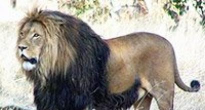
The proximity to the equator and remoteness from civilization have made this island a real wilderness. Researchers count here about 11 thousand species of plants, hundreds of species of animals and insects. There is a place on the island called the Garden of Eden. It was discovered only in 2005. The Garden of Eden is a site in the western part of New Guinea and covers an area of \u200b\u200b300 thousand hectares. Its location allowed the Garden of Eden to remain isolated until recently. Researchers have discovered many species of frogs, butterflies and plants that science knew nothing about. To their surprise, they found here the so-called "bird of paradise", which was considered extinct, and the rarest mammal - the tree kangaroo.

In the south and north of New Guinea, the climate is different. The northern part lies in the equatorial belt, the southern part lies in the subequatorial one. The hottest weather is usually on the coast and small islands. In the north of the island, the climate is uniform throughout the year. During the day, the air temperature is around + 30 ° C, at night it drops to about + 24 ° C. In southern New Guinea, seasons differ more. In summer, the weather is about the same as in the north. In winter, which lasts from May to September, the temperature during the day is around + 28 ° C, and at night - about 22 ° C. If you do not tolerate heat well, it is better to choose central or mountainous regions for recreation. There the air temperature is always 7-10 degrees lower. At high altitudes at night the air temperature can drop to + 6ºС. Therefore, you will have to take care of warm clothes.
The humidity on the island is different everywhere. Moreover, it is never possible to guess where it will rain more and where it will be less. The rainy season usually lasts from December to March. However, showers are not uncommon here in summer. They are especially common on small islands off the coast of New Guinea.
Attractions and population of New Guinea
When traveling to New Guinea, don't expect to see many cultural monuments... There are no majestic architectural structures here, no famous poets and painters were born here. But the island itself is amazing. It mesmerizes with its wild tropical nature. And a separate item is the local population. Scattered throughout New Guinea are traditional villages inhabited by Aboriginal people who have preserved their ancient culture.
An interesting attraction of Papua New Guinea - Giluwe volcano... It has two peaks at once, and alpine meadows stretch on its slopes. It is the tallest volcano in all of Oceania and Australia. Its height is about 4.4 km above sea level. For the first time, two Australians climbed Giluwe Peak - Mick and Dan Leahy. Nowadays, tourists are invited to repeat the expedition of the Leahy brothers and climb to the very mouth of the volcano. The view from the top is simply fantastic.

Another interesting place is the Cook settlement. It was named after the famous discoverer, sailor James Cook, who made many voyages and made a significant contribution to the study of the life of the population of Australia and Oceania. The Cook settlement is also called the Cook Marshes, which are located in the Waghi Valley, at an altitude of 1.5 km above sea level. Thanks to archaeological excavations, it became known that many thousands of years ago, local tribes were fluent in the art of agriculture. The findings of the researchers made it possible to compile a complete picture of the life of the aborigines - how they moved from gathering to agriculture and cattle breeding. As early as 4 thousand years ago, they had a developed drainage system that allows them to supply the soil with moisture.
The city of Port Moresby, the capital of Papua New Guinea, is also worth seeing. It is located on a peninsula protruding into the sea. At its end is the historic center of the city, which the locals call Town. Here is the high hill of Paga, from the top of which a wonderful view of the entire city opens. In Port Mosby, you can see buildings from the late 19th century. Of particular interest in terms of architecture is the united church of Ella and the Parliament building. The appearance of the city is very diverse. Here you can see old huts on stilts next to multi-storey office buildings made of concrete and glass. You can learn about the history and culture of the country at the National Museum, which is located in the city center. Ports Mosby is also home to the National Botanical Park. Here are collected plants from all over the country. It is worth paying attention to the exposition made in the form of a map of Papua New Guinea. Plants on it are planted so that they reflect the peculiarities of the flora of every corner of the country. Here you can also see a huge collection of orchids. You will travel between lianas and tropical thickets on wooden decks, enjoying the beauty and scent of these exotic flowers. In addition, the botanical park is home to many tropical birds and some animals. Couscous and tree kangaroos always delight and delight tourists. These are completely safe and very cute animals.
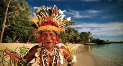
Compared with the beauty of the nature of New Guinea can only be its colorful population. To get acquainted with the life and culture of the brightest and most unusual tribes, you need to go to the eastern part of the island - Papua New Guinea. It is here that the Papuans live - aborigines who have lived outside of civilization for thousands of years. Of course, the tribes are gradually adapting to the modern world. If women and men wear traditional straw skirts or prefer nudity, then children can already see cloth shorts or jeans. It is impossible to say something definite about the tribes. The fact is that about 7 million people live here. At the same time, the researchers discovered about 850 different languages \u200b\u200band dialects and the same number of ethnic groups, each of which has its own unique culture, beliefs and traditions. The largest Dani tribe occupies an area in the central region of the island. Their settlements are open to tourists. Here you can learn about the traditions of the tribe, among which there is cannibalism and wars with neighboring villages. You will be shown local crafts, Papuan outfits and even ancient mummies. An extremely unusual sight.
If you want to get acquainted with all the tribes at once, it is worth visiting one of the festivals of Papua New Guinea, where aborigines represent their culture, dressing up in the craziest and most colorful outfits and performing traditional songs and ritual dances. The most ambitious holiday is the Independence Day of Papua New Guinea. On the eve of this day, the Goroka festival is held. It is here that you can see hundreds of representatives of various tribes. Their bodies are painted in the wildest colors, their necks are hung with massive necklaces of shells, and their heads are crowned with headdresses richly decorated with feathers of tropical birds, dry plants, bones and other natural materials. It is worth visiting the Goroka festival once, and there will be enough impressions for the rest of your life.
(Bougainville, Buca), the D'Antrkasto Islands and more than 200 other small islands. This article will tell you about what a vacation in New Guinea is, attractions, entertainment and prices in the country.
The total area of \u200b\u200bNew Guinea is 462.8 thousand square meters. km. Once the island was part of the mainland, then due to the rise in sea level it became an island separated from Australia by the Torres Strait. This fact explains that the same marsupials live in New Guinea as on the mainland.
The settlement of New Guinea occurred more than 45 thousand years ago by peoples from Asia. Europeans appeared here in the 16th century. During the colonization period, the island belonged to several European countries. New Guinea gained independence in 1975.
The relief of the island is mixed, there is both a flat part and territories covered with mountain ranges. The highest point rises 4.9 kilometers above sea level. The subequatorial climate in the south of the island is replaced by the equatorial one in the north. Winter here lasts from May to September, and from December to March - the season of heavy rains.

For domestic tourists, visiting this country seems to be a distant exotic. They are partly right. Here you can see what you will not see at the advertised famous resorts. In New Guinea, untouched by technogenic civilization, virgin nature has been miraculously preserved. White, sandy beaches stretch along the entire ocean coast, returning tourists hundreds of years ago, when, in the 16th century, a European first set foot on these lands.
New Guinea on the map:
And today the white man begins his acquaintance with these parts from the capital of the state of Port Moresby. The city is very interesting, picturesque, a rich excursion program is at guests' disposal. Although local hotels do not boast of the "Hilton" level of service, everything is provided for the guest.
The islands of New Guinea are of volcanic origin and are surrounded by countless picturesque lagoons, reefs, underwater plateaus, around which underwater life is in full swing in its amazing variety. Coastal ocean waters from the time when great geographical discoveries took place hide the skeletons of lost ships full of treasures. This is an amazing region with its own mysteries and mysteries.

Climate features
New Guinea has a humid, tropical climate, and most of the territory has a mountainous landscape. High ridges (Bismarck ridge, Central, Owen Stanley ridge) stretch across the country. Many volcanoes and mountain peaks rise 3,000 meters or more above sea level, and the height of the peak of Mount Wilhelm is 4509 meters. Between huge, significantly dissected rocks, there are intermontane basins, about 1500 meters above sea level.
The climatic features of this region can be considered the fact that here the year is divided into only two seasons: the rainy season and the dry season. When they change, no sharp temperature changes are observed. The thermometer fluctuates within + 25 ℃ (in the mountainous regions below), but it is really hot only near the coast. It is also surprising that each season comes to different areas of the country at different times. It mostly rains in most areas from December to March, and the dry season lasts from May to October.

sights
An interesting event happened in New Guinea in 2005. Scientists from the United States have discovered a place here where an untouched ecosystem has been preserved. This place was called the "Garden of Eden". The area of \u200b\u200bthe garden is 300,000 hectares, on its territory previously unknown animals, insects, several types of palm trees, many different plants are not familiar to science. Representatives of the local fauna are not at all afraid of humans, they even allow themselves to be taken in their arms. This proves that they also met people for the first time. "Gardens of Eden" - in fact, are a virgin rainforest, reliably sheltered from outside influences, forgotten by time, in which not a single path has yet been trodden by man. In this wonderful corner, everything remains the same as it was at the time of creation.
Giluwe Volcano is located in the Sutherne Highlands and is the highest volcano in all of Australia and Oceania. The slopes of the volcano are covered with green meadows. For the first time the Australians conquered the top of Giluwe. Many climbers now come to New Guinea to repeat this ascent.
The National Botanic Garden is located in the capital, Port Moresby. It has 3,000 orchid varieties, making it the largest collection of orchids in the southern hemisphere. And for birds, this is a real paradise, here you can enjoy the singing of local birds of paradise. Tourists from all over the world come here to admire the amazing, huge collection of orchids gathered here, walk along suspended paths and get acquainted with the "plant map" of Guinea.

The Bayer Sanctuary is another natural attraction that deserves attention. This river reserve, founded in 1968, has a huge area. Various species of parrots, possums, tree kangaroos and other animals live here. Here you can take an excursion along the river, stroll through extraordinarily beautiful places and admire the scenery.
Where to visit
As mentioned above, arriving here, tourists get an amazing opportunity to plunge into the world of virgin, wild nature, practically not affected by human activities. There are many nature reserves, National parks and gardens created here. First of all, it should be said about the "two-headed" (with two peaks) shield volcano Giluve. It is located in the Southern Highlands, and rises at 4368 meters, being the second highest peak in Guinea after Mount Wilhelm, and the highest in Oceania and Australia. On the surface of Giluv, one can see amazingly beautiful, green alpine meadows.
Another, no less famous and amazing paradise can be called the Bayer Reserve, mentioned above. Created by nature itself, it is located in the river basin, 55 km from Mount Hagen. And it is an amazing place where you can best get an idea of \u200b\u200bthe animal and plant diversity and wealth of this region.

Of course, Lake Qutbu should be included in the list of places worthy of attention. Located in the Southern Highlands, it is famous for its picturesque views and the fact that rare species of fish are found in its waters. The lake area is about 50 km². On its shores, Qutbu is covered by swampy forest lands, which are under the protection of the state.
It is impossible to ignore in this review and the first National Park of New Guinea - Variata. Located near the capital (only 42 km), it spreads over an area of \u200b\u200bmore than 1000 hectares. In former times, these lands were a favorite hunting ground for local tribes. There is even a cult structure in the park - a tree house, revered by the Koiaris tribe.
The so-called "Cook swamps" deserve special mention - in the past, these were settlements of farmers located 1,500 meters above sea level, in the Western Highlands and covering an area of \u200b\u200b116 hectares. Since the middle of the last century, archaeologists have been constantly excavating at the site of settlements.

The last on this list, but by no means the last in importance and value, is the National Museum of New Guinea. By visiting its exhibition halls, you can get acquainted in detail with the peculiarities of the national culture, the existing traditions and the rich history of the country. The museum complex is built in such a way that different, thematically broken, parts of its exposition are located in different parts of the city. On the one hand, it seems inconvenient, but on the other hand, residents and guests of the capital have the opportunity to address the spiritual heritage from different “angles”, including architectural ones.

Features of the national Guinean cuisine
The local menu looks not quite usual for Europeans. The local chefs abundantly add stewed vegetables and exotic fruits (for example, passion fruit, papaya, mango, pineapple, bananas, etc.) to our usual products, for example, fish or meat. Tuber crops are widely represented in the national cuisine: kaucau, taro, sago, yam and pig. And the most popular dish among the local population is "mumu". It includes ingredients such as rice, sweet potatoes, meat, herbs and spices.
However, the increased flows of foreign tourists contribute to the emergence of restaurants offering dishes from Chinese, European and Indonesian cuisine. From alcohol, locals prefer beer made according to recipes that came from Australia and the Philippines.
Where better to stay
Finding where to stay is not a problem. Moreover, it is possible to choose the right option for any budget. If you can't afford to stay in a hotel, you can easily take advantage of the hospitality of the locals, who will charge the tourist a nominal fee for breakfast. And those for whom it seems more preferable to stay in a hotel should pay attention to Kimbe Bay. The hotel is surrounded by beautiful tropical gardens and there are coral reefs nearby for diving. The apartments are air conditioned, have free internet access, and bars and restaurants.
Another excellent hotel to look out for is Kimbe Bay West New Britain. Its windows offer a wonderful view of the Pacific Ocean, and he himself is located in the port of Kimbe - the "coral capital" of the world. The hotel is adjacent to the New Britain Isle motorway. In the mornings, there is a buffet for guests, and at all other times the restaurant offers guests traditional Guinean dishes, as well as dishes from all over the world. The hotel has a currency exchange office and a secure car park. 
Shopping in local shops
There are many large shopping centers and shops in the country. Most of them work from 9:00 to 17:00, all days except weekends. But some outlets serve customers on Saturday (until 13:00) and even on Sunday. There are a lot of unusual goods produced in Guinea on the shelves. Large retail outlets serve international bank cards, but withdrawing cash from them is a very problematic activity.
There are few ATMs, and those that do exist are mainly located in large cities and in the capital and serve only those customers who have an account with a national bank. It is almost impossible to pay by card on the periphery. On the other hand, travelers' checks are accepted in all branches, but you should prepare for the queues.
It is completely unacceptable to bargain in the Guinean markets, and in the provinces, you can pay only in national currency, and, due to the shortage of banknotes with a small denomination, it is quite possible not to get your change.

Transport connection
New Guinea International Airport is located in its capital, Port Moresby. A ticket from New Guinea will cost at least 800 euros one way. There is coastal shipping between all the islands of the country.
There is a problem with other modes of transport in the country. This is due to the fact that the road infrastructure is poorly developed. Taxi services are also rare. Tourists usually rent a car, but for this you need to have a credit bank card, an international driver's license and driving experience. But when there are "wheels", there is an excellent opportunity to go everywhere and see everything.
Criminal environment
In New Guinea, the crime rate is not much different from that of any other country. The same crimes as everywhere else: scammers, thieves, hijackers, robbers, etc. Also, the Guinean police are not averse to making some extra money on newcomers. Basically, most of the offenses take place in cities and in the capital. There are various criminal youth groups. However, due to the efforts of the authorities, these crimes do not take the form of an epidemic.

Safety
Doctors strongly advise everyone who is going to visit this country to make a complex of vaccinations. In the tropics, diseases such as typhoid, cholera and malaria are much more common. Moreover, if for some reason it is not possible to stay in a hotel and eat only in a restaurant. And in relation to children, doctors are even more categorical and urge parents to vaccinate their children against a whole bunch of possible diseases, which include: diphtheria, tetanus, poliomyelitis, Japanese encephalitis and hepatitis B.
Knowing these intricacies and thoroughly preparing for the trip is the key to an interesting vacation in New Guinea in 2020.
You can feel the atmosphere of the country in the video:
Papua New Guinea in terms of tourism:
Papua New Guinea is perhaps one of the cleanest places on the planet, where the human hand has not yet had time to transform and modify the amazing nature of this island. This land is replete with the most exotic flora and fauna - we can say that these lands hold the record for the number of amazing species of animals and plants that are so attractive for both tourists and biologists. Papua New Guinea has everything that is included in the universal concept of "paradise on earth": sandy golden beaches, mysterious jungle, transparent blue sea, whole colonies of coral polyps, dazzling sun and serious cliffs, which contrast nicely with the bright colors of nature.
Address of the Russian Embassy in Papua New Guinea:
There are no foreign missions of the Russian Foreign Ministry in the country. The nearest diplomatic representation is located in.
Emergency telephone number in Papua New Guinea:
112 - Emergency operational service
112 - Police
111 - Ambulance
110 - Fire Department
Top main attractions of Papua New Guinea:
- Mount Wilhelm;
- Giluve volcano;
- Port Moresby;
- The ancient agricultural settlement of Cook;
- Fjords of Papua New Guinea (Northern District);
- Owen Stanley Ridge;
- Sepik River;
- Southern Highlands;
- Rabaul city;
- Lake Kutubu;
- Duke of York Island;
- Central District;
- Eastern Highlands;
- Western District.
Popular tourist cities of Papua New Guinea:
- Mount Hagen;
- Goroka;
- Port Moresby;
- Arava;
- Oro;
- Daru;
- Bensbach.
Average tourist budget in Papua New Guinea:
- Water, 0.33 liter bottle ₽75.47;
- Milk , common, 1 liter 119.18 ₽;
- A loaf of fresh white bread, 0.5 kg 125.34 ₽;
- White rice, 1 kg 126.69 ₽;
- Eggs, pack of 12 pieces 252.03 ₽;
- Local cheese, 1 kg 806.54 ₽;
- Chicken breasts, boneless and skinless, 1 kg 517.73 ₽;
- Beef tenderloin, red meat, 1 kg 567.02 ₽;
- Apples, 1 kg 378.72 ₽;
- Banana, 1 kg 129.77 ₽;
- Oranges, 1 kg 361.78 ₽;
- Tomato, 1 kg 339.44 ₽;
- Potatoes, 1 kg 211.41 ₽;
- Onions, 1 kg 196.58 ₽;
- Lettuce, 1 head 123.61 ₽;
- Water, 1.5 liter bottle RUB 131.70;
- A bottle of wine, average price RUB 883.94;
- Homemade beer, 0.5 liter bottle 167.89 ₽;
- A pack of cigarettes 392.97 ₽;
- Private preschool or kindergarten, monthly for 1 child 9,576.78 ₽;
- International primary school, annually for 1 child 491,114.97 ₽
Clothes and footwear
- A pair of jeans in branded clothing stores RUB 2,160.84;
- Summer dress in a branded clothing store 3,274.47 ₽;
- A pair of sneakers, average price RUB 4,387.34;
- A pair of leather shoes ₽6,090.33
Rental prices, per month
- Apartment, 1 bedroom, in the city center RUR 106,081.08;
- Apartment, 1 bedroom, Outside the city center $ 159.99;
- Apartment, 3 bedrooms, in the city center 409,394.04 ₽;
- Apartment, 3 Bedrooms, Outside of City Center $ 2,100.00
Prices for visiting cafes and restaurants
- Meals in an inexpensive restaurant 785.36 ₽;
- Meals for 2 people, Mid-level restaurant, three courses RUB 3,143.36;
- Mac menu at McDonalds or alternative fast food 567.02 ₽;
- Homemade beer, 0.5 liters 209.67 ₽;
- Imported beer, 0.33 liter bottle 295.16 ₽;
- Cappuccino 180.21 ₽;
- Coca- Cola 0.33-liter can 74.32 ₽;
- Imported beer, 0,33- liter bottle 235.09 ₽.
Sports and recreation
- Fitness club, Monthly fee for 1 adult 3,230.19 ₽;
- Tennis court rental, 1 hour on weekends RUR 1,026.22.
Transport
- One-way ticket, local transport 19.25 ₽;
- Monthly pass, Regular price 490.97 ₽;
- Taxi Start (Normal Tariff) Landing rate, average 98.58 ₽;
- Taxi, price for 1 km, normal tariff 588.97 ₽;
- Taxi, price for 1 hour of waiting, normal tariff 1,080.52 ₽;
- Gasoline, 1 liter 57.95 ₽.
The most famous dishes of Papua New Guinea, which you must try:
As a side dish, as a rule, stewed or fresh vegetables, root vegetables grown on the islands, rice or yams are served.
Do not be surprised if, instead of the usual bread or flat cakes, vacationers see breadfruit on the table of local residents. When traveling to the islands of Papua New Guinea, we recommend taking a time and trying Bally Beef (fried beef with rice), game stew or poultry.
Gourmets will be able to appreciate the fish "Kokoda", which gives a special taste to the sauce made from coconut milk. The fried crab meat "Hula" will not be ignored either.
Tropical fruit lemonades will appeal to little tourists. And beer, island spirits will not leave indifferent adult travelers.
Tropical fruits (bananas, papaya, passionfruit, mango and pineapple) will delight the sweet tooth with freshness. And delicate fruit desserts, including the delicious island delicacy "Talautu", will be remembered by vacationers for a long time.
The favorite dish of the inhabitants of Papua New Guinea has a funny name "Mumu". It is based on pork, which is cooked with herbs and herbs, rice, sweet potato tubers and numerous spices.
Delicacies made from sugarcane stalks, which are often offered to tourists on vacation on the coast of Papua New Guinea, will amaze guests of the country with an original taste.
What language is spoken in Papua New Guinea:
Papua New Guinea speaks English, Tok Pisin and Hiri Motu.
The most famous travel guides to Papua New Guinea:
- Daniil Olegovich Nasonov, Anton Krotov Papuans - without embellishment. A practical guide to the second island of the Earth Publisher: GEO-MT, TK "Skrinti", 2011
Visa for Papua New Guinea:
Citizens need a visa to visit Papua New Guinea. Due to the absence of representative offices of this state on the territory of Russia, visa applications are submitted directly through the website of the Immigration and Citizenship of Papua New Guinea (www.ICA.gov.pg). The visa fee is paid by credit card.
In case of a positive decision by the immigration authorities of this country, the applicant is issued an electronic visa, which must be presented in a printed form at the check-in counter of the airport of departure and when crossing the border of Papua New Guinea at checkpoints open for international traffic.
Souvenirs from Papua New Guinea:
- Carved masks and figurines made of wood;
- Figurines made from Angoram and Sepik;
- Beech wicker baskets;
- Decorative axes, arrows and bows made by local artisans;
- Crocodile leather products;
- Beads made of wild pigs tusks.
Features of the customs regime - what can and cannot be exported and imported into Papua New Guinea:
- It is possible to import any currency (foreign or national) into the territory of Papua New Guinea without any restrictions. Export of local currency is limited to 200 PGK, and foreign currencies - the equivalent of 10,000 PGK;
- Duty-free import applies to alcoholic, tobacco and perfumery products, as well as new goods, the cost of which will not exceed 200 PGK;
- For personal use, vacationers and their fellow travelers can take with them a radio receiver, television and other equipment in a single copy;
- It is forbidden to import into Papua New Guinea antiques, non-canned food (meat and fish), pork in any form. Representatives of flora or fauna can be imported only with a pre-issued permit. The import of cats, dogs and parrots is prohibited on the territory of Papua New Guinea.
After the end of the vacation, it is prohibited to export from the country:
- Antiques (artistic values \u200b\u200bthat are more than half a century old);
- Any items found on the ocean floor;
- Exotic representatives of flora and fauna.
Vaccination before traveling to Papua New Guinea:
- Measles, mumps, rubella (MMR);
For all travelers born after 1956, 2 doses of the vaccine are recommended if not previously vaccinated.
- Diphtheria-tetanus;
The vaccination is done every 10 years. Check your vaccination record before you travel.
- Hepatitis A;
- Typhoid fever;
- Hepatitis B;
This vaccination is recommended for all travelers.
- Rabies;
This vaccination is recommended for those travelers who plan to spend their holidays in rural areas, in places where animals congregate, which increases the risk of bites, as well as planning to visit places where there is a high risk of collision with bats.
- Japanese encephalitis.
For travelers who may spend a month or more in rural areas, as well as for short-term travelers who may spend a lot of time outside their homes in rural areas, especially at night. ties and jackets are extremely rare. In mountainous areas, warmer clothes will be required, and due to the high humidity of the local climate, various waterproof capes will be quite useful, especially during the monsoon season (December to March).
Port Moresby
The capital of Papua New Guinea and the main gateway to the country, Port Moresby (population about 145 thousand) is located on a peninsula in the excellent natural harbor of Fairfax, which lies on the southeastern coast of the island, in the wider Bay of Papua. The city itself is relatively small - its entire historical core fits on a small peninsula between Walter Bay and Port Moresby Bay, but the neighborhoods that have grown over the past twenty years surround the entire Harbor of Fairfax, forming a fairly spacious series of small suburbs and individual villages. The city was founded by Captain John Moresby in 1873 as a small colonial settlement, and the following year Christian missions that appeared in the nearby village of Hanuabada and Yule Island (10 km west of the peninsula) merged with the camp, and Port Moresby began its rapid development. as the administrative center of the region. This part of the country has a noticeably drier climate than the rest of New Guinea, so it is here that the main administrative and commercial institutions are gradually concentrated.
Port Moresby is a mixture of old colonial period buildings, modern offices and ramshackle houses on the outskirts. The city was badly damaged during the battles of World War II (it was the main transshipment base for the Allied troops), so there are few attractions here. Most of the government buildings are located in the northern part of the city (Waigani district). There is also the Parliament building (1984) in a colorful style that combines modern architecture and traditional motives of "houses of spirits" (haus tambaran) of the peoples of the island; a large sports complex built for the 1991 South Pacific Games in Port Moresby; The National Museum, where materials on the nature, ethnography, culture and history of Papua New Guinea are widely presented; An art gallery with a large exposition of the island's cultural works; a Catholic cathedral in an unusual style, as well as a restored pile complex of the village of Khanuabada, considered the symbol of the city.
The historical center of the city, which is simply called the Town here, is located slightly south of Vaigani and is bounded from the southwest by the Paga hill (98 meters high), from which a wonderful view of the city opens. There is a port along the northern coast of Town, the southern coast is occupied by Ela Beach Park, and in the center are the old quarters, in which buildings of the late 19th century have survived. The oldest building in Port Moresby is El United Church, built in 1890. The Boroko area is home to the most modern office buildings and the most expensive hotels, as well as the largest shopping center in the capital, which includes many restaurants, bars, banks and department stores. And a little to the east along the coast stretches the Gordons district, whose boring appearance is noticeably "diluted" by the bustling Gordons Market, which is one of the largest in the country.
The National Botanical Park (Port Moresby Botanical Gardens, open Monday to Friday, 9.00 to 15.00, on weekends by appointment) is the main attraction of the capital - in addition to a huge number of plants from all over the country, this garden is a real bird paradise. There is a corner here, made in the form of a map, and in each of the parts of this original map, plants from the corresponding region of the country are collected. In addition to the numerous representatives of the flora of the islands, more than three thousand varieties of orchids are naturally kept here (the largest collection of these plants in the southern hemisphere of the planet), and under the canopy of trees about 2 kilometers of hanging paths and boardwalks have been laid, allowing you to get acquainted with the local vegetation without causing any harm.
The hills surrounding the capital are extremely picturesque, and almost the entire throat of Fairfax Bay is blocked by powerful coral reefs, so there are many sports organizations. The city has all the conditions for scuba diving, windsurfing, sailing, sea fishing, water skiing, golf, tennis and squash, and some shortage of equipment and qualified instructors is more than compensated for by the unique environmental conditions. However, most of the interesting places are located outside the city limits, in the Central District.
Central District
The Central District covers a narrow strip along the southern coast of Papua Bay to the eastern tip of New Guinea Island, as well as the southern slopes of the central mountain range. Northeast of Port Moresby, the breathtaking Rowan Falls are rustling, and nearby is Varirata National Park, the country's first nature reserve. Covering an area of \u200b\u200babout 1000 hectares, the park was originally a hunting ground for the chiefs of the coastal tribes of the Koiari, but now you can see almost all the flora and fauna of the region, including birds of paradise, wallabies and deer. A dozen and a half hiking trails have been laid through the reserve, at the end of which a beautiful panorama of Port Moresby and the green coastline opens. North of Port Moresby, the Brown River is a pleasant spot for swimming, rafting and picnics.
The famous Kokoda Trail begins nearby, linking the northern and southern coasts of the island. This essentially ordinary mountain trail passes through the extremely picturesque places of the Owen Stanley Ridge, and is also the most popular historical excursion in the country - it was along this trail that the most fierce battles between Japanese and Allied forces during the Second World War broke out. The trail goes through rugged and beautiful mountainous areas, under the crowns of a dense tropical forest, past numerous clear rivers and waterfalls, visiting places of battles - bunkers, caponiers, artillery positions and defensive lines of both opposing sides.
Just 46 kilometers from Port Moresby, the picturesque Sougheri Plateau begins - the starting point for the Kokoda Trail. Here, at an altitude of about 800 meters above sea level, the air is fresh and cool, and numerous rubber tree plantations and ethnic villages only add to the charm. Here, in the town of Six Miles, near the airport, is the Village Arts - a state store with the best collection of arts and crafts in the country. And nearby are the historic Bomana War Cemetery with a beautiful park and the Moitaka Farm, which researches and breeds crocodiles and other living inhabitants of the region.
East of the capital begins the popular Idlers Beach, and in the waters of the bay lie the Sinasi Reef and Daugo Island, famous for their beautiful corals and white sandy shores. Farther east, just fifteen minutes drive from Port Moresby, is one of the best resorts on the island - Loloata Island Resort (www.loloata.com). Surrounded by one of the largest coral reefs on the planet, it offers excellent conditions for snorkeling, diving, fishing and other water activities (the Oceanarium Marine Park is nearby).
Northern District, or Oro
Few people expect to hear about fjords when they mention New Guinea. However, the coast of the Northern District around the town of Tufi really most of all resembles the rocks of Norway or Iceland, with the only difference that the water is always warm here, and these beautiful rocks are not formed by the influence of a glacier, but by the tectonic forces of the Earth. Cape Nelson, prominent in the Solomon Sea, was formed by the eruption of three volcanoes, whose rapidly hardening lava ran down to the water, creating numerous rocky tongues and gorges, so similar to classic fjords. The clear waters of the local fjords, reaching a depth of 90 meters, are teeming with a huge number of representatives of the tropical fish fauna, and the rocks themselves rise above the water to a height of more than 150 meters. The wide mouths of the bays are protected by reefs, and the shores are often covered with mangrove forests, over which vertical slopes overgrown with mosses and orchids hang, from which cascades of waterfalls break down. It is not surprising that in such a beautiful place, a tourist infrastructure is being intensively created, the fulcrum of which is the city of Tufi, from where diving tours and many different trips related to bird watching, deep-sea fishing, windsurfing, canoeing or just doing nothing on white sandy beaches are regularly organized. the shores that flank Cape Nelson from both the north and south.
Every October, the region hosts the Tapa Festival (a fabric made from plant fibers) followed by Martyrs Day and Korat Church Day. In the village of Kokoda, the northern branch of the Kokoda Trail ends, scattering along the coast to Buna and Gona with many local tourist roads. There were also fierce battles during the Second World War, so the surroundings are replete with traces of those battles, and on the Hiropa plantation, on Buna Road, there is a Japanese plaque in memory of the 15 thousand soldiers of the imperial army who died here. Thousands of birds nest on the slopes of the active Mount Lamington Volcano.
Southern highlands
The southern highlands lie not at all in the south, but in the very center of the country. This region is often called "Wonderland" because until 1935 this chaos of mountain ranges and valleys covered with evergreen forests was practically one big blank spot on all maps of the world. From here, the rivers Kikori, Erave and Strickland take a run, the second highest mountain of the island - Jiluve (2900 meters) is located here, caves of great depth were discovered and amazing peoples live, whose acquaintance with modern civilization is limited only by occasional meetings with the inhabitants of mountain towns. This is one of the few places on the planet where the traditional way of life is manifested in almost all aspects of local life. Ancient ceremonial rituals are ubiquitous, men and women still wear traditional dress, and the huts are still built from stones and bush. The fresh air of the mountains is ideal for numerous excursions, and under the canopy of a dense tropical forest you can see (and hear) dozens of bird species, the purest rivers with numerous waterfalls.
To the south of the capital of the district - Mendi, at an altitude of 800 meters above sea level, lies the beautiful lake Kutubu - the second largest lake in Papua New Guinea and one of the most unusual reservoirs in the region. Inscribed in 1998 in the list of natural monuments of planetary importance, it is famous for its unique ichthyofauna - 10 out of 14 fish species living here are not found anywhere else on Earth. Also, this calm and very beautiful lake provides shelter for almost a hundred species of birds, and its shores are teeming with reptiles and insects. Above the water's edge, local residents built a small boarding house using only local materials and traditional construction methods. From here, hiking tours to the most beautiful places in the vicinity of the lake start regularly.
The Mehndi Valley is also well known for its beautiful landscapes, limestone caves, and Uli Vig hunters who paint their faces in red and yellow paint and wear elaborate wigs made from human hair.
Eastern highlands
A land of gold mines and coffee plantations - The Eastern Highlands are more influenced by European influences than any of the country's other highlands. Highlanders still live in neat villages, which are clusters of circular huts surrounded by low walls and meadows of feather-grass kunai grass. Traditional rituals and dress are gradually being replaced by jeans and cowboy shirts, and English can be heard much more often than in other regions of the country.
The largest settlement in the region - Goroka (population about 25 thousand people) is its agricultural and commercial center. A small hill station at 1,600 meters above sea level, as Goroka was before the early 1950s, has now become an attractive and reasonably well-organized city with modern facilities and a relaxing atmosphere of endless spring. The climate here is really pleasant - the temperature rarely rises above + 30 ° С, and fresh winds from the mountains maintain a pleasant microclimate even in the rainy season. The main attractions of the city are the annual August festival, which brings together the best folk singers and dancers from all the surrounding hill tribes in one place, the McCartney Museum (the second largest in the country) with an extensive exhibition of handicrafts and crafts, war relics and photographs, and also known throughout the country, the Raun Raun theater troupe with its own theater (located near the market, just 5 minutes walk from the city center), whose entire repertoire is based on the use of traditional stories and legends.
The village of Bena Bena, 10 km from Gorok, is the largest community in the mountainous regions specializing in hand-weaving - rugs, bedspreads and mats made by local craftsmen are very popular throughout the country. Also nearby is the village of Asaro, inhabited by representatives of the ethnic group of the same name, widely known for its rituals, as well as for the unusual tradition of covering their bodies with gray mud (the legend says that in this way the Asaro warriors frightened their enemies, who took them for ghosts - theatrical illustrations of this particular legend are the centerpiece of the Goroka festival).
From Goroka Post Office, the trail leads to Mount Kiss, which offers a magnificent vista of the valley, while south of Goroka you can climb Mount Michael and visit a cave with prehistoric petroglyphs. Mount Gahavisuka Provincial Park is located 11 km from the city, occupying 80 hectares of beautiful mountainous area and turned into a small botanical park, where plants from all over the country are collected. And around there are endless coffee plantations, through which you can go to the Cotuni trout farm, or to the large cultural center of Cainantu (however, it is better to go here through the Kassim or Lae pass), where not only traditional local crafts are sold; but also teach local woodworking or weaving techniques.
Chimbu County
In the heart of the highlands lies Chimbu District, the smallest and most densely populated region in the country. The mountain slopes literally rears up here - the whole district is occupied by steep mountain ranges, dissected by deep and often inaccessible valleys. Here is the highest point of the country and the most popular place for climbers from all over the region - Mount Wilhelm (4509 meters). The main way of recreation here is active. Trekking trails of all categories of difficulty run throughout the district, passing by the traditional villages of the tribal group of Chimbu (Simbu), through dense rainforest, past the cleanest rivers with their trout farms, along the shores of the beautiful Pindounde lakes, where there is a small lodge. The landscapes here are breathtaking - on a clear day, you can see almost the entire island from the slopes of the mountains, from the northern coast to the southern one, and the climate is cool (even snow cover is not uncommon on the peaks).
The county capital, Kundiawa, sits in a picturesque setting near an old airfield that lies right on a mountainside (even the runway here is at an angle to the horizon). The town does not boast any sights, but it is a good starting point for mountain and river hikes in the region. Just a few kilometers from Kundiawa, almost by the main road, lie the Keu caves, where speleological tours are often arranged (there are many other caves in the vicinity, but most of them are burial places of warriors killed in battles, and therefore are closed to the public), and the local rivers Vagi and Purari are considered by many experts to be among the best in the world for rafting and kayaking.
Western highlands
Western Highlands District lies between Chimbu, Enga, and Southern Highlands. The mountainous land of the region is covered with dense equatorial lowland forests and green alpine meadows of mountain slopes that merge into mountain peaks forever shrouded in fog.
The regional capital, Mount Hagen, is a vibrant and bustling commercial hub, where rapid income from coffee and tea plantations quickly displaced traditional lifestyles, transforming the city into something of the "Frontier cities" of Wild West films. Growing rapidly over the last quarter of a century from a tiny village of cattle breeders and planters, the city has absorbed representatives of almost all ethnic groups in the country. Perhaps that is why it is considered one of the "most festive" cities in the country - a huge number of various cultural festivals, festive ceremonies and various traditional events are held here, from the usual bride ransom party in these parts to the colorful ceremony of opening a new road. The best time to visit Mount Hagen is August, when the city's annual festival is held. Representatives of hundreds of different hill tribes gather for this holiday, each wearing their own characteristic tribal dress, headdress (an important element in local symbolism, by the way) and body painting. This festival is a wonderful opportunity to get acquainted with the rich traditions and social structure of the peoples of the highlands.
Local handicrafts can be seen at the Mount Hagen Cultural Center. It is housed in a carefully restored traditional village hut and has a small museum with exhibitions of various crafts and ethnic elements. The traditional center of the city's social life is the Saturday market, where representatives of all ethnic groups of the region gather. It is a veritable kaleidoscope of fruits and vegetables, birds and animals, farmers in bright shirts or skirts, and hunters in traditional dress made of grass and feathers. Men here wear long beards, while women wear many shiny scarves and brightly colored bilum tote bags. Here you can buy almost the entire range of handicrafts for which this region is famous.
The Bayer River Reserve, 55 km north of Mount Hagen, is one of the best places in the country to see the famous birds of paradise, possums, tree kangaroos, parrots and cassowaries in their natural habitat. From here, hiking trails to the valleys of the Vagi and Ter rivers or trekking routes to the southwestern slopes of Mount Wilhelm begin.
Western District
On the southern coast of New Guinea, between the border with Irian Jaya and the western coast of Papua Bay, lies the Western District, the country's main agricultural region. The wide open fields and waterlogged river valleys of the region are literally teeming with life - here are found "rusa" deer, wallabies, wild pigs, crocodiles and lizards. And all this is literally a couple of steps from domestic herds and waterfowl - the inhabitants of the region manage to find a delicate balance between meeting their own needs for food and protecting the original inhabitants of this land.
The main town of the district - Daru is located on a small island of the same name near the southeast coast of the country, in the Torres Strait. Once a small center for pearl and sea cucumber fishing, today it has become a fast-growing commercial and fishing port, somewhat reminiscent of the ever-rustling Arab seaside towns. Its main export commodity is crocodile leather and products made from it, so the local market is constantly flooded with lovers of fashion accessories and tourists from Australia (it's only 180 km from Cape York - a trifle on the scale of the region).
The main tourist attraction of the Western District is Bensbach Wildlife Lodge, located on the river of the same name, whose mouth forms the border between Papua New Guinea and Irian Jaya. The vast plain of the Bensbach River is almost entirely flooded during the season, which provides unique living conditions for myriads of birds and fish (the lodge is considered one of the best places in the country for fishing), and in the dry season, herds of ungulates roam along this analogue of the Nile Valley.
In the upper reaches of the Fly River, which flows through the district, there is one of the largest gold and copper mines in the world - Oak Tedi. Opened in 1980, it produces about 80 thousand tons of ore every day, it is easy to guess that the Fly River is also gold-bearing - amateur gold mining on its banks has long turned into a kind of tourist attraction (the content of precious metal in local sediments is small, but the process itself is entertaining ).
Lake Murray (Murray), located in the very center of the county, is the largest floodplain lake in Papua New Guinea and increases its area fivefold during the rainy season, filling more than 400 square meters. km of meadows and valleys. Now a crocodile research station has been opened on the lake, offering tourists and other environmental services.
Sepik County
The Sepik River, whose valley forms the northwestern district of the country of the same name, is one of the largest river systems in the region (the river itself is about 1126 km long). This vast region north of the Bismarck Ridge is almost entirely occupied by a huge river basin, swampy lowlands and tropical forests, turning into mountain slopes, whose peaks are often crowned with snow caps (at the equator that!). This secluded corner of the planet with its oily brown rivers, dozens of tribes, many of which are at a level barely exceeding the Stone Age, their myths, magic and rituals, is an ideal place for fans of extreme tourism. Colorful local villages line the banks of the rivers with their pile houses, long canoes with crocodile-like heads, lakes overgrown with exotic flowers, and local foggy sunrises and striking sunsets are said to be unparalleled on the planet.
Good beaches for recreation and diving are located in the area of \u200b\u200bCape Moem, in the Mapik area you can get acquainted with the amazing culture of the Abalem tribes, around Madang - the capital of the region of the same name - with the art of local potters, in the village of Timbunke - with local construction methods. Near the capital of East Sepik - the city of Vevak - you can visit Cape Wom (Uom) - the place of surrender of the last Japanese garrison on the island (here on September 13, 1945, Lieutenant General Adachi signed the act of surrender and handed his sword to General Robertson) with its war memorial and old an airfield, around which silent evidence of that war is scattered in abundance (there is also a Japanese military cemetery and a Peace Park in Vewake itself).
Chaumbri Lakes, a vast, shallow area located in East Sepik, are renowned for their lively bird community, crocodiles and many villages with renowned arts and crafts. The village of Aibom is famous for its potters, who use ancient technologies not only to make ordinary kitchen utensils, but also to make fireplaces and tiles. The village of Kanganaman is famous for its recently renovated "house of spirits" (the local haus tambaran is considered a monument of national importance), and Korhogo is famous for its "mei" masks (local tribes have used totemic symbols from the insect world since ancient times), there is also a wonderful "house of spirits" in Vaskusk , in Yigei they make traditional tamtams "garamut" (when rafting down the river, their sound can be heard everywhere), and in the village of Svagap (Suagap) simple and graceful pottery in the folk style is molded.
The superb shores west of Vanimo (Sepik West, 30 km from the Indonesian border) form a small peninsula that literally abuts the limestone cliffs on which a Japanese landing barge rusts (the waters here are excellent for diving). From September to January, the 260 km coastline near Wootung attracts hundreds of surfers, and strong northwest winds from December to March create excellent conditions for windsurfing. Several small islands lie at a short distance from the town of Aitape (founded by the Germans in 1905). There were also bloody battles in this area, so in the waters around the islands and the old Tajji airfield, you can find several dozen wrecked aircraft and warships (there is a war memorial near Taji).
Morobe County
In the very northeast of the island of New Guinea, on the Huon Peninsula around the bay of the same name, Morobe County is located. In these places, the densely forested Saruwaged Mountains, the northern spur of the Owen Stanley Range, face the coast, forming a chain of small volcanic islands in the sea, and the southwestern part of the county lies within the fertile Markham Valley, sandwiched between high ridges. Such a varied relief has led to the richest natural world of the region - the interior regions and the coast of Morobe abound in unique representatives of flora and fauna and are cut by numerous excursion paths, especially frequent in the Wau-Bulolo area.
Lae
The second largest city in Papua New Guinea, Lae was a tiny mission station until the 1920s, booming with the discovery of gold veins in the Wau region. Over the next twenty years, it grew into the main port and industrial center of the north-east of the country. During World War II, Lae became the main stronghold of Japanese troops in New Guinea, and Mount Lunaman, located in the center of the city, was used as an observation post (and now it offers a magnificent view of Huon Bay and Markham Valley). The battles that flared up in the Lae region (primarily air battles) cost the opposing sides tens of thousands of lives, therefore the historical center of this attractive tropical city is still the Lae Military Cemetery, located within the Botanical Gardens.
Now Lae is a fairly modern city with numerous banks, international hotels, department stores, colorful local markets and street workshops, where local decorative crafts are produced and sold right in front of guests. A good collection of local handicrafts, including "paintings" of colored sand (practically the trademark of the local artisans), can be found at the Melanesian Arts Center and the Morobe Arts and Crafts Center. Lae University of Technology has an interesting collection of rare and especially valuable handicrafts, including ritual carved pillars of the Sepik peoples, as well as a small coffee shop in the traditional house tambaran style.
But the main decoration of Lae is its famous Botanical Gardens, which are considered one of the best in the country. A huge exhibition of gardens (area of \u200b\u200babout 3000 square meters) contains more than 15 thousand representatives of local plants, 21 species of birds, including the magnificent bird of paradise Raggiana, several species of reptiles, as well as about 70 species of butterflies, 6 species of turtles and several dozen species of frogs and fish (there are several lakes and many ecological zones typical for different regions of the island).
Not far from Lae lies the town of Wau, which was previously a large gold mining center, and now houses the Wau Institute of Ecology with a small museum and a zoo on its territory. Near the city are the McAdam National Park and Mount Kaindi, the pretty coastal town of Finschhafen (founded by German colonists in 1885, today it is the center of the island's Lutheran community), the Watut River (Ouatut) with its beautiful raft sites, and the Tami Islands. whose population is widely known for its carved wooden balls, considered to be real works of art.
To the south of Lae lie: the attractive coastline of Sialum with coral terraces, the excellent Salamaua beach with good conditions for swimming, diving, windsurfing and hiking in the battlefields of the Second World War, the picturesque Labu Lakes in the Markham Valley (there is an interesting population of lake crocodiles), the Siassi Islands with beautiful coral reefs, as well as the long ocean shores of Maus Buang and Labu Tali - nesting sites for the leatherback turtle, some of which weigh up to 500 kg and reach a length of up to two meters.
Milne Bye County
The easternmost part of Papua New Guinea, together with the Trobriand, Murua (Woodlark), Lachlan, D "Antrkasto, Louisiada, Conflict and Samarai islands groups, is part of Milne Bai County. During the Second World War, one huge naval base The district is literally full of various traces of those events.It also includes 160 small islands and 500 reefs, scattered over an area of \u200b\u200bmore than 250 thousand square kilometers, which makes it a real Mecca for divers and fans of water activities.
The county capital, Alotau, spectacularly situated on the edge of Milne Bay, is an excellent place to start exploring this extraordinary region. From here, numerous ships leave for Fergusson Island with its hot volcanic springs, mud fumaroles, geysers and volcanoes, to the picturesque Mishima Island with its reefs and gold mines, Murua Island (Woodlark) with its woodcarving masters, Trobriand Islands with their unique social system (local chiefs have tremendous power and influence, but inheritance is carried out along the female line) and the colorful Milamal harvest festival, to the island of Kirivina with its freshwater caves (an amazing phenomenon for the small islands of the region) and ritual caves near the village of Matava, on the island of Gudenau, in the center of which rises a large stone with mysterious inscriptions, as well as to numerous shallow reefs, the waters around which contain the ruins of hundreds of sunken ships and warplanes from the Second World War.
New britain
The island of New Britain (area 37.8 thousand square kilometers), which lies 30 km north-east of the coast of New Guinea, forms two administrative regions - Western and Eastern. It is the largest island in the Bismarck archipelago - it stretches for almost 475 km from east to west, and from 35 to 85 km from north to south. Its northern shores are washed by the Bismarck Sea, and the southern by the Solomon Sea. Despite its age (about 10 million years), the island is mountainous and active - along its entire length, a low mountain range runs, teeming with volcanic peaks, fumaroles and green valleys. There are especially many volcanoes in the northern part of the island - here the high peaks of active volcanoes Langila (Cape Gloucester, 1330 meters), Bamus (2248 meters), Ulavun (the highest volcano of the Bismarck archipelago, 2334 meters) stretch here almost in continuous succession, and many of them have extensive caldera. The southern slopes of the mountains are composed of limestone, and therefore abound in caves, grottoes and picturesque outlier rocks.
Rabaul
Rabaul is the official capital of the island and one of its most tragic monuments. Once the richest and most beautiful city in the country, which became the scene of fierce battles during the Second World War, the city of flowering gardens and a rich port in September 1994 was almost completely destroyed by the eruption of the Tavurvur volcano, and its inhabitants were evacuated to other parts of the island. From its former appearance, only the quarters half-buried with black volcanic ash around the Simpson Bay harbor, some port buildings (the port is still working!) And numerous underground structures of the huge (total length of almost 576 km) tunnel system dug by the Japanese during the war years, remained.
Moving from the airport, which is now located in Tokua (about 50 km from Rabaul), you can visit the picturesque Gazelle Peninsula peninsula, bordering from the sea a beautiful bay with a towering Tavurvura cone above it, drive through coconut groves and lush forests of the foothills and enter the lunar zone. landscape at the foot of the volcano. After driving through the black streets of the city, most of all similar to the scenery of some apocalyptic movie, you can go through the relatively unharmed Mango Avenue to a real oasis of miraculously survived (and carefully restored) tourist hotels. If you have a certain courage, you can dive in the harbor of Rabaul, which stores in its depths dozens and hundreds of warplanes and ships of the Second World War. Continue east to the town of Kokopo with its Museum of Military History and the remains of the Gunantambu Mansion, built in the 1880s by the legendary "Queen Emma".
Duke of York Island is a 45-minute boat ride from Cocopo, renowned for its excellent diving and snorkelling facilities, while the surrounding lagoons offer everything you need for canoeing, windsurfing, water skiing and yachting. Or head north to Cabacada, home to the extremely popular Kulau Lodge, built right on the beach in a traditional local style.
The western part of New Britain is virtually untouched by tourism. The only exception is the Valindi plantation area, where one of the best dive resorts in the Pacific is located. The resort is located on a private palm plantation that stretches along the coast of Kimbe Bay, and is surrounded by a wall of volcanic peaks. Volcanic caves, thick coral and clear blue waters of the bay are home to a huge number of marine life. It is also home to the most popular diving site known as the Cathedral, a vast horseshoe coral reef with a large cave at one end. The inner side is formed by a long strip of white sand, and the outer side is formed by the richest coral "gardens".
Muruk Cave in the Nakanai region is believed to be the deepest underground system in the southern hemisphere (French cavers have recently passed part of the tunnels to a depth of 1200 meters below the entrance level, but did not reach the end of the tunnels). The small town of Talasea is located on the shores of the Williams Peninsula, adjacent to which the bay is widely known for a whole "necklace" of small islands, the ruins of American bombers from the Second World War and active volcanism.
Talasea is a center for the production of traditional local "money" from cowrie shells, and obsidian (volcanic glass) mined in this area has been found in excavations in many parts of Oceania, and many of these samples date back to the third millennium BC. And on Pangula Island, the Wabua Valley (Valley of Hot Water) with several dozen geysers and fumaroles deserves attention.
The best surfing spots - www.surfingpapuanewguinea.org.pg - are located along the Vanimo coast (West Sepik, 30 km from the Indonesian border), on sandy shores in the Kavienga region (New Ireland Island).
Today we present you an article on the topic: "sights of new guinea" with a full description of where to go and what to see. We also offer interesting comments from travelers.
The main attractions of Papua New Guinea: overview and photos
The island of Papua New Guinea was first noted in the 16th century thanks to the explorer from Portugal who discovered it. Throughout its history, in the "clutches" of civilization, the island has been repeatedly colonized, conquered, given to other countries for management and mercilessly used its natural resources. Today Papua New Guinea is a state with sovereignty and self-government.
Papua New Guinea is perhaps one of the cleanest places on the planet, where the human hand has not yet had time to transform and modify the amazing nature of this island. This land is replete with the most exotic flora and fauna - we can say that these lands hold the record for the number of amazing species of animals and plants that are so attractive for both tourists and biologists. Papua New Guinea has everything that is included in the universal concept of "paradise on earth": sandy golden beaches, mysterious jungle, transparent blue sea, whole colonies of coral polyps, dazzling sun and serious cliffs, which contrast nicely with the bright colors of nature.
Papua New Guinea annually attracts a decent number of tourists for its beauty and sights. You will learn about the main and most famous attractions of this island below.
Despite the fact that mountain peaks are mostly associated with Sweden and Austria, Papua New Guinea can also surprise with its mountain ranges, cliffs and gorges. Of course, ski enthusiasts will be disappointed - after all, there is very little snow on the top of Mount Wilhelma in New Guinea, which, however, does not diminish the interest of tourists in it.
This mountain is a real landmark of Papua New Guinea, which is associated with many significant events in world history and which is more than 4 thousand meters in height. There are two routes for climbing it, differing in the level of difficulty. Mount Wilhelma is notable for its scenic beauty - its trails lead tourists past the exotic jungle, which islets of lush vegetation frame its slopes.
Giluwe Volcano is a real giant of the Australian continent that appeared long before the start of the Ice Age. The volcano is slightly inferior in height to Mount Wilhelm and has a vertical length slightly less than 4.4 thousand meters.
Port Moresby is the capital of Papua New Guinea and perhaps its most amazing city. The entrance to Port Moresby begins at the sea harbor called Fairfax. This capital is strikingly different from large and rich European cities - not because the number of high-rise buildings in the city is minimized, but because of its stunning natural design.
Port Moresby is, like all the cities of Papua New Guinea, a part of civilization with the harmonious inclusion of islets of nature - gardens, alleys, parks - in the city bustle. On all sides, the capital of Papua New Guinea is surrounded by forests and hills - they seem to carefully "hold" the city in their paws, bringing the necessary harmony and exoticism.
Undoubtedly, one of the most amazing places in Papua New Guinea is the village of Cook - an ancient town, currently half-hidden by the jungle. The settlement is an archaeological site with an area of \u200b\u200b116 hectares. It is known that the age of this settlement exceeds 5 thousand years, which makes this swampy and uneven area especially attractive for archaeologists and scientists.
Despite the fact that the tribes living several thousand years ago in this area were far from the sciences of Ancient Greece, they created their own system for watering "gardens", which looked like a branched grid. The ancient agricultural settlement of Cook has recently been included in the UNESCO World Heritage List.
The word "fjord" alone is associated with the harsh nature of Norway and we often have to be surprised when we come across this word, for example, in Papua New Guinea. Oddly enough, the island of Guinea does have fjords with the same magnetism and beauty as in the land of the Vikings.
Amazing bays with steep cliffs, azure transparent water and low skies - every year they attract a huge number of tourists who want not only to admire the natural landmark, but also to touch the warm (unlike the fjords of the northern countries) water, and, if possible, even swim.
Owen Stanley is one of the most famous and well known landmarks. This ridge in a long chain, which has a horizontal length of about 3 hundred kilometers and a vertical length of about 3 thousand meters, runs along the island of New Guinea, originating in its southern part. Owen Stanley was opened at the end of the 19th century and since then has become one of the visiting cards of the Guinean island.
Throughout Papua New Guinea, it is quite problematic to find a place free from habitats of plants and animals, and this mountain range is no exception. Many species of plants grow on its rocks, holding onto the rocky soil by the roots, while Owen Stanley itself is surrounded by tropical forests that stretch at its foot.
Sepik is a river of the Guinean island, which is the longest and most picturesque river in New Guinea. The Guineans are extremely proud of this natural landmark because it mostly supports and supports life on the island.
Sepik runs through almost the entire island, meandering and making interesting turns, having a length of more than 1.1 thousand km. For tourists, the river is interesting because its waters, although not crystal clear, are nevertheless very fertile, and the banks are picturesque. Sepik, like virtually all of New Guinea's nature, escaped the intervention of civilization. That is why the journey along it seems even more exciting, because in some places on its shores - whether it be a swampy area or a difficult jungle - a person has never even set foot.
The Southern Highlands are a whole system of mountain ranges, jungles, rainforests, rocks, waterfalls and rivers. It is absolutely impossible to capture all its beauty during one excursion. It will take more than one day to enjoy the amazing views that look more like glossy heavenly covers than reality. The southern highlands are home to many peoples living according to the traditional way of life, formed several hundred years (and maybe even millennia) ago.
During excursions, you can get acquainted with some of them and even more closely feel the harmony with natural forces and life itself that permeates the entire island. Practically unfamiliar with civilization, the peoples of New Guinea are extremely amazing who can teach a modern person much more than he thinks. Excursions to the Southern Highlands include crystal waterfalls and breathtaking cliff views, lush rainforests and deep lakes.
Rabaul is a city that has survived many tragic events in world history, witnessed the Second World War, saw the battles of local residents with the conquerors and died, almost completely disappearing under the ashes of a volcano that woke up near the city.
Previously the most prosperous, most famous city of Papua New Guinea, at the moment Rabaul is only a dim echo of its former beauty, however, despite this, crowds of tourists annually begin their excursion routes with a visit to this city.
The world famous lake Kutubu is one of the most amazing pearls of Papua New Guinea. Qutubu is the second largest lake on the Guinean island, however, despite this, perhaps, the most "alive".
Its depths are home to the rarest fish species on the planet, whose habitat is limited only by the border of Lake Kutubu. The shores of the natural reservoir are decorated with colorful vegetation, in which many species of birds, amphibians, reptiles and insects have found shelter.
Local residents are very proud of the lake and do everything to preserve its purity, flora and fauna. Tourists wishing to see this attraction are waiting for several excursion routes that pass through the most attractive and amazing places in Qutubu.
Perhaps nowhere else in Papua New Guinea is there such a suitable and perfectly designed conditions for active recreation. Numerous turbulent rivers passing between rocks, waterfalls, coral lagoons fully justify a visit to Duke of York.
On this island, interested tourists can try all kinds of water disputes: canoeing, diving, windsurfing, surfing and much more. This island, it seems, was created specifically for entertainment and will not let tourists who like active rest get bored.
The Central District is one of the favorite places to visit for tourists because it can be called the "heart" of the wildlife of Papua New Guinea. It is here that the main and largest nature reserve of the island called "Varirata" is located. Also, the Central District is famous for its landscapes, green lush forests of which are crossed by chains of mountain gorges, waterfalls and rivers.
The Varirata Nature Reserve is visited by a large number of tourists every year, who are invariably delighted with the many species of animals and exotic birds. In the Central District, there are many places where anyone can find a vacation according to their interests: a tour of the Kokoda Trail, a walk along the numerous beaches, resorts and much more.