Mount Roman Kosh in Crimea where it is located. One-day hike to Roman-kosh and the gazebo of the winds
The peak of Roman-Kosh is called by the locals "Crimean Everest" - it has a height of 1547 meters and is the highest point of the peninsula. The natural object does not belong to the promoted walking routes and is rarely found in tourist guides. But everyone who has been here once knows: this is the best option for people looking for an adventure with vivid memorable moments.
Location
Roman-Kosh is located on the plateau-like massif of Babugan-yayla, not far from Gurzuf. Despite the fact that from the top you can contemplate half of the peninsula, the mountain itself is "hidden" from sight and is not visible from the main roads. In appearance, it resembles a huge flat hill towering over the gentle slopes of the massif. Its name is translated from Turkic as “mountain in the middle of the forest”, but there is also another version of the translation - “forest pasture”.

Walking excursion to the Roman-Kosh mountain
Roman-Kosh is part of the territory of the Yalta mountain-forest reserve. Even untrained tourists can make a gentle ascent upward, but it is fraught with difficulties.

Travelers who are going to conquer this height for the first time should go on a hike as part of an excursion group. There are several reasons for this:
To visit the mountain, you need to obtain an official permit, which is usually the case for a guide;
It's easy to get lost in the dense forest that Roman-Kosh covers, but with an experienced guide, you have nothing to fear;
If you walk at a leisurely pace, the ascent takes 6 - 7 hours. Therefore, it is better if there are people nearby who will provide moral support and can help in case of an unforeseen situation.
Climbing the trail, you will not get tired of being surprised by the richness of flora and fauna of the Roman-Kosh mountain in Crimea. Outlandish flowers grow on the lawns, roe deer, wild boars and mouflons live in forest areas. And on the northern slope, there are relict birches that have remained from the time of glaciation.
On the way, there are beautiful views of the Bear Mountain, the Gazebo of the Winds, the Red Stone, picturesque meadows and meadows.

If you take pictures of everything that comes along the way, then there is a risk of falling behind the excursion group. But the most interesting thing starts higher when the clouds get closer and you have to walk in complete fog for several minutes. After all, being among the clouds is an indescribable feeling. At the very top there is a stone pedestal, as well as a wooden cross in memory of the partisans who died here during the Great Patriotic War.

But the main thing is the views unsurpassed in beauty, the calm strength of this area and a sense of pride, because you managed to conquer the highest peak of the peninsula. Having visited Roman-Kosh, you will discover the unexplored Crimea and understand that the unique beauty of the local nature can win the heart of even an experienced traveler.
We offer you to watch an interesting video about the hike to the top of Roman-Kosh:
Today Roman-Kosh is located on the territory of the Crimean nature reserve. Officially, the entrance to the reserve is prohibited. In the summer months, it is very likely that you will meet on the Gurzuf saddle with representatives of the reserve's protection, who in most cases simply do not allow them to enter the plateau.
You can climb Roman-Kosh in several ways:
From the village of Krasnokamenka (Kyzyltash), go up the street that goes to the western outskirts of the village (there are vineyards on the right side of the road), then go through the motor depot, an abandoned quarry, then go up the path through the forest marked with red markings (in summer 2008, the path from the quarry to the top badly read, stamps worn out, the steepness of the rise is quite serious.
From Yalta, or from Mount Ai-Petri, moving along the mountain path along Yaila to the northeast (Mount Kemal-Egerek will remain on the left, further - on the right - the Gazebo of the Winds).
From the Angarsk pass (for the hardy) - climb the Konyok ridge to Babugan-Yaila, move to the south-west. On the left, there will remain the Zeytin-Kosh peak (1537
If you notice an inaccuracy or the data is out of date - make corrections, we will be grateful. Let's create the best encyclopedia about Crimea together!
Today Roman-Kosh is located on the territory of the Crimean nature reserve. Officially, the entrance to the reserve is prohibited. In the summer months, it is very likely that you will meet on the Gurzuf saddle with representatives of the reserve's protection, who in most cases simply do not allow them to enter the plateau. You can climb Roman-Kosh in several ways: From the village of Krasnokamenka (Kyzyltash), go up the street that goes to the western outskirts of the village (there are vineyards on the right side of the road), then go through the motor depot, an abandoned quarry, then go up the path through the forest marked with red marking (in the summer of 2008, the path from the quarry upward was poorly read, the marks were worn out, the steepness of the ascent is quite serious. From Yalta, or from Mount Ai-Petri, moving along the mountain path along Yaila to the northeast (Mount Kemal-Egerek will remain on the left, further on the right - Gazebo of the Winds) .From the Angarsk pass (for the hardy) - climb the Konyok ridge to Babugan-Yaylu, move to the southwest. The Zeytin-Kosh peak will remain on the left (1537 Save changesGoing to Crimea? Then be sure to visit the highest point of the peninsula, Mount Roman Kosh. Geographically, the mountain is located near the village of Partenit, data for the navigator: 44.613889 N, 34.234338 E and is included in a nature reserve.
Travelers will have a hard climb, steep paths, but all this is literally forgotten, it is worth climbing Mount Roman Kosh! From a height of 1547 meters, not just a breathtaking view opens up, it is a flight of the soul, thoughts, fantasies and dreams. The surroundings are so magnificent, so mesmerizing, that one wants to literally step into this space, filled with the sun, sweet wind and unknown.
Many interesting things are connected with the Roman Kosh mountain. For example, the height of Roman Kosh is indicated in almost all sources of 1545 meters, but in fact it is 1547 meters. A small mistake, especially for a mountain of such height, but this is a completely different nature, endemics of flora and fauna.
The origin of the name is no less interesting. There are two legends: one is very beautiful, the second is rather practical.
According to the first legend, the name of the Roman Kosh mountain in the Crimea has Indo-Aryan roots and is translated as peace, the pinnacle of bliss, achievement. But on the second, everything is simple: this is the upper pasture of the shepherds. Difficulties in climbing to the top set their own rules - in excursion routes, the Roman Kosh mountain, the height of which is quite high, is rare. But if you set your goal and still rise, the reward will be truly royal. The Crimean Everest must first submit, and then it conquers itself, and this is what attracts all connoisseurs of merging with nature, detachment and finding harmony to the mountain.
Where is the Roman kosh mountain?
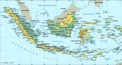
It is not difficult to find the Roman Kosh mountain on the map, it is located in the Babugan massif, in the same place as the Ayu-Dag mountain - a very famous peak of the peninsula. Both points belong to the territory of the Crimean Natural Reserve, which is of considerable value for both historians and scientists, so do not be surprised if you meet foresters on the way - these people are doing their best to preserve the pristine purity and beauty of the land.
View from Roman Kosh
For travelers who dared to climb the mountain, today there are several routes of varying difficulty and content. For example, along the path through Krasny Kamen - a favorite place for climbers, past a tiny mountain lake, which is said to be blessed for women and good for men, and can also heal children from fright and other minor ailments. And when, having admired the water surface, you raise your eyes, you will be greeted by a huge array of forest! Green, full of life, smells, aromas and colors, this is a real living organism. And, do not be surprised, you will want to shut up to hear the whisper of the forest….
Mountain Roman Kosh knows how to surprise!
On the way, you will meet sweet-sounding springs, the water of which is sweet as nectar, persistent Crimean pines will give their aroma, meadows with grass and flowers will fill the soul with joy. There will be plenty of interesting things while climbing the mountain to remember this journey forever.
And everything will start very mundane: drive to the Partenit village on your own or buy a tour at an agency, in half an hour get to the Gurzufskoe saddle pass, which Lermontov has repeatedly sung, and hit the road, constantly climbing up the mountain to the highest point. You will not be able to forget that you are on Mount Roman Kosh, here and there there are reminders: the inscription "Top of Crimea", carved on a stone pedestal, flowers of incredible beauty that are found only in the mountains and, of course, views from great heights.
Your gaze will open the entire Partizanskoye reservoir, Chufut-Kale in Bakhchisarai, Kyz-Kermen and Tepe-Kermen - mountains where people lived long ago, conquering nature, which you are now struggling with. Yes, yes, the wind will not let you stand calmly and enjoy the views, this is not a light sea breeze, but a real wind, the conqueror and master of the mountains, and Roman Kosh is no exception.
But even a stormy mountain wind-blown little scares those who want to climb Roman Kosh and see with their own eyes the natural beauty, flora and fauna of local lands. Tourists would like to advise to stock up on strong and durable shoes, not to overeat before the hike, and be sure to have a small tourist kit in stock: chocolate, water, matches, a first aid kit, light windbreakers and, possibly, mountain sticks for climbing to a height. Even climbing a flat hillock requires preparation, and if it is a hike to the Roman Kosh mountain, do not neglect the advice, the mountains do not like disrespect and severely punish careless tourists.
You will have to give up the hike if you often have pressure drops, a headache from altitude, or a chronic illness has worsened. In this case, postpone the hike to the Roman Kosh mountain, but not for long. Having conquered the Crimean Everest, you will receive a huge amount of emotions unknown until now, and you will definitely want to climb Mount Roman Kosh more than once, bring your friends and all your acquaintances here.
The visit to which is officially prohibited.
The origin of the name of the mountain, according to some sources, has Crimean Tatar roots and means a forest pasture of shepherds. And from the Turkic it is translated as "mountain in the forest". In 1966, a bust of V. I. Lenin was installed on the mountain - in honor of the opening of the 15th Congress of the Komsomol, 1200 pioneers of the Artek camp climbed the mountain.
Climbing Roman-Kosh is a fascinating journey through the coniferous forest in the mountains with wild nature, suitable for lovers of mountain walks.
The height of the Roman-Kosh mountain
The absolute height of the mountain is 1547 meters away... Roman-Kosh is the highest among the Crimean peaks. Having reached the highest point of Crimea, tourists will see the mountains surrounding them. Some believe that this is no match for the breathtaking views from Ai-Petri. However, the climb itself will also reveal amazingly beautiful landscapes: Bear Mountain, Gazebo of the Winds, Red Stone. A walk through a dense mountain forest with the cleanest air will also bring pleasure.
How to get to the mountain
The ban on visiting the reserve has a simple explanation: in summer it is too hot in Crimea, the forest floor becomes dry, and the level of fire danger increases. That is why, when visiting the wooded ravine of the Gurzufskoe Saddle, it is easy to meet a local forester or huntsman. The reserve keepers, as a rule, do not allow random tourists to enter the plateau. To enter the reserve, you need to get a pass: this can be done in Alushta ( st. Partizanskaya, 42)... The guide can receive a group pass. On the territory of the reserve, you can get a pass from a huntsman by buying it for a conditional price, however, as some travelers write, such a pass has no legal basis.
What do you know about Roman-Kosh? Personally, before the hike, I only knew that it was the highest peak of the Crimea, 1545 meters high. And since this is the highest peak of Crimea, how can I not conquer it? I will not describe in detail the Roman-Kosh peak itself. In this article, I just want to describe my ascent to the roof of the Crimea.
Before the hike, I read articles on the Internet by other lucky people who managed to conquer Roman-Kosh and realized that the easiest way to get to the top is from Krasnokamenka, through the Gurzufskoye saddle pass. In one of the articles I saw such a phrase that only very brave and desperate people who are sick in the head go on a solo trip to Roman-Kosh, since it is quite easy to get lost in the reserved forest even in clear weather. I was convinced of this from my own experience, and twice in one trip.
Officially, to get to Roman-Kosh, you need to take a permit to visit the reserve, but in practice everyone walks at their own peril and risk, “buying” a permit on the spot from the foresters, if they get caught. As one grandfather, who I met at the Gurzufskoe saddle pass, told me, the reserve used to be swarming with foresters and gamekeepers who caught illegal tourists, and it was impossible to go unnoticed to the gazebo of the winds. And only excursion tours were allowed there.
I'm lucky. I went on a hike at the beginning of October 2014, and most likely, due to the change of power during my hike, I did not meet a single forester, and the passage to the gazebo of winds was not guarded at all.
Brief description of landmarks
- Stop Krasnokamenka on the Yalta-Simferopol highway.
- Climbing the stairs, go around the grocery store on the right along the asphalt road.
- Asphalt intersection: the lake is on the left, and we are on the right.
- Yalta mountain-forest nature reserve.
- Career
- The spring, which is surrounded by a fence, turn right about 100 meters from the spring.
- Forest intersection, turn right on it.
- A glade with a monument to partisans and a spring.
- Pass Gurzufskoe saddle.
- Roman-Kosh.
- Gazebo of winds
Hike
The beginning of my route began in the village of Krasnokamenka. You can get to it by any transport, the route of which runs along the Yalta-Simferopol highway. I traveled from Yalta by trolleybus # 52, the travel time was 25 minutes, the fare was 10 rubles. Trolleybuses run every 20 minutes, and their route can be
Leaving the trolleybus, you need to cross the track and climb the stairs, it is impossible not to notice it. Climbing the stairs, you will see a grocery store, which you need to bypass along the asphalt road on the right. For rough orientation: the Gurzufskoe saddle pass is located almost directly on the course.
Then my path ran along an asphalt road, which twisted, gained height and brought me to an asphalt intersection. At the intersection, go right. If you turn left, you will see a private lake with fishing piers and a sign that informs you that: “Entry and travel prohibited. Private property". Not knowing the way, I wasted 20 minutes. We need to go to the right.

The asphalt road further gains height, and on one of the bends it opens our gaze to the Red Stone, another good landmark. He will be to your right, and behind you you will see a bear-mountain. The road passes through a construction site, the lucky ones are actively building here, therefore, most likely, when you follow this route, you will see views of brand new cottages.

The asphalt ends, and to the right of the road you will see a barrier and a sign. We go there. Then the reserve begins, where it is illegal to stay without a special pass, but this does not stop anyone. I walk past the barrier with thoughts, maybe it will carry me by, and walk along the forest road.

My next landmark is the quarry.

You need to be at the top of the quarry, and for this you need to turn right at a fork in the forest. Along this road, you will go up the quarry and your gaze will have an excellent view of the bear mountain.
Here is a video from the quarry with a description of the further road:
I can't say for sure, but at the top of the quarry the approximate height is 500-600 meters above sea level, I made this conclusion, because the bear mountain is approximately at the same height with us, and its height is 577 meters above sea level. From this point, it remains to dial, only, a kilometer. Further, the path leads to the spring, which is fenced off, from the spring the path is already marked, and is called Artekovskaya.

There is a spring behind the blue fence. From it you need to walk about 100 meters along the road and turn right onto the path.
At the bottom of the quarry, I did not turn right, but went straight. This was my first deviation from the route, I don’t know how, but after climbing through the forest, after about 20 minutes I still went out onto the correct path to the spring, surrounded by a blue fence.
Upon reaching the spring, red marks appear on the trees. After passing 100 meters from the spring, you need to turn right, this will no longer be a forest road, but a well-trodden path in a pine forest. I liked this part of the route. Coniferous forest, excellent trail, sunny weather and I still have enough strength and energy to enjoy the beauty of nature.
The trail has a good climb and I sweated well as I took a high pace trying to make up for the time I wasted not knowing the road. On this path, I came to a forest intersection, and I had three options for continuing the path: left, straight and right. The most logical for me turned out to be - straight ahead, but in fact here, you need to turn right. From my own experience, I can give advice: at any fork, after walking 10 minutes on the way and not meeting a single mark, go back. It takes 1.5 hours to walk from the intersection to the glade, the trail is marked and the marks are often found, so you need to carefully monitor the marks.

At this intersection, turn right.
And here is a video from the same intersection:
I went straight, I don’t even know why, but I didn’t pay attention to the absence of marks, my head was occupied with thoughts of not meeting the foresters and making up for the time spent. As they say further, there is more firewood in the forest. The road was getting worse and worse and thoughts began to visit me that I had gone the wrong way, the situation was complicated by the fact that it was not possible to stop and look around, because as soon as I stopped, I was attacked by strange flies. And I had to keep a high pace of walking and fend off insects on the go. At the same time, I wrote down landmarks and time, so as not to get lost.
It is very easy to get lost in the forest. I describe the situation: I walk along the path, it seems to be there, it is crushed by leaves and branches, but it still exists, and then it quietly melts and disappears altogether. And all of her is gone. I turn around, there is no path, the trees are all the same landmarks, and the thought immediately arises: “what am I doing here and why didn’t I sit at home?”. And this is in clear weather, but what if there is fog? And fog in the mountains is not uncommon. But I was lucky that day, and I found my path. And he continued on his way.
I didn’t want to go back to the intersection, as it would be a great loss of height and time, and I was afraid that I would not have time to get to Roman-Kosh. I went further on the principle of only upward. I also knew that there was a forest fire road from Gurzuf to the Gurzufskoe saddle pass, and I expected to get out on it sooner or later.
I continued my ascent to the top of the Crimea, fighting off annoying insects. The forest had long since become deciduous, and I often saw traces of wild boars, and I involuntarily began to recall the accidents of meeting tourists with wild boars in the forest, but I tried not to think about it. As you guessed, I already had no time for the beauty of the reserved forest. I thought when this forest would be over, and I would be able to make a halt and orient myself on the terrain.

Glade with a spring and a monument to partisans.
Video from the meadow:
After 2 hours of wandering through the forest, I went out into the clearing and was able to take a breath. I made a halt, at last these small insects lagged behind me. Looking around in the clearing, I noticed a monument to the partisans, bowed my head in front of them and continued on my way.

A forest road leads into the clearing, along which you can go to the Gurzufskoe saddle pass. There is also a spring in the meadow. It is precisely on the spring that the Artekovskaya trail leads.
I was sure that going out into an open place, I would see the gazebo of the winds, but I was wrong, I did not see anything of this and did not even have an approximate idea of where the Gurzufskoe saddle pass was. From the glade, you need to follow the road, and it leads to the pass. Coming out to the pass, you will immediately understand that this is it. It takes 20 minutes to walk from the spring to the pass. Coming out to the pass, you can recall a proverb from a Russian fairy tale about heroes: "You will go to the right - you will come to Roman-Kosh, you will go to the left - you will get to the gazebo of the winds"

Spring video:
If you are near the spring, then the pass is to the left, but I thought that the pass is directly above. And for the third time I took the wrong route. I went straight up, from the spring there is a path, well trampled at first, and then it disappears. This again did not stop me, I continued climbing the goat paths in the truest sense of the word. The ascent became very steep, 45 degrees, I had to help myself with my hands. Looking back, I saw a bear mountain. For 3.5 hours of travel, I saw her for the first time, from this height she seemed to be a small mound. Climbing even higher, I was able to make out the rocks of Adalara. A very beautiful picture, which you can admire for hours, but I had little time, and I had to hit the road again.

Climbing up, I turned out to be to the right of the pass, but I didn’t know this yet, because I didn’t see any road or other landmarks, but I saw pure untouched nature.

Gazebo of the winds. View from the Roman-Kosh side.
Climbing one of the hills, I finally saw the gazebo of the winds, and this made me happy. I still did not see Roman-Kosh, but I knew that it would be an inconspicuous nondescript mound with a cross and a round of stones. Out on the road, I went to the highest point of the Crimea. The road ran across the steppe, the weather was clear, calm, there was not a single sound except my steps, it felt like I was the only person on the planet.

This is Roman-Kosh. And you can't tell right away.
Soon, I noticed Roman-Kosh. Indeed, there was nothing attractive about it, a small mound, a cross and a round, everything as I read. Coming to the top, I was seized with excitement, I thought that now I would go to the hill, and behind it there would be a steep cliff, and a strong wind would hit my face. But none of this turned out to be. No wind, no cliff. I was even upset.
Here is what opens to the eye from the top of Roman-Kosh:
Roman-Kosh is a failed volcano, the ascent and descent to this volcano is gentle, you will not find steep cliffs here like on Ai-Petri, and this has its own zest. They say that strong winds always blow on Roman-Kosh, but that was my day, the weather was clear, warm and calm.

I cannot say that I was amazed by the views from Roman-Kosh. The sea is not visible, wherever you look only mountains. I was wondering what Eklizi-Burun, the highest point of Chatyr-Dag, looks like from Roman-Kosh, but it seemed to me that even from Alushta it looks more interesting. Frankly, there is not much to look at, but psychologically I was very glad that I had conquered Roman-Kosh, and looked at this "nondescript view" with my own eyes.
After all this, I had the honor to dine on the highest peak of the Crimea, and after dinner I was tired. Why shouldn't she find it if I had been on the road for five hours already, and the pace of the campaign was high. So at dinner I was thinking about going to the gazebo of the winds or not. I decided to go to the Gurzuf saddle, and there it would be visible.

I reached the pass in 30 minutes. I even met roe deer, but they were far away, and I could not really see them.
Video on Bear Mountain and the Gazebo of the Winds from one of the passes:
At the pass, I nevertheless decided to go to the gazebo of the winds, climbing the hill, I met the first person for the whole day, he told me that the foresters and gamekeepers were nowhere to be found. But he assured me that I would not have time to go to the gazebo of the winds and come back, it gets dark early in the mountains.
I take mountains seriously and understand all the risks that awaited me if I hadn't made it before dark, but still decided to go. I walked very quickly to the gazebo in 45 minutes. The picture that opened up to my gaze cannot be described: the blue sea, viewed in the distance for 150 km, and this is, after all, half the distance to Turkey. A small mound below is the famous bear mountain, two small pebbles are the Adalara rocks, 35 and 40 meters high. This is not Roman-Kosh for you, I thought to myself, but on the other hand, Roman-Kosh is the highest point of Crimea.

Bear Mountain and Cliffs of Adalara. View from the Gazebo of the Winds.
And this video from the Gazebo of the Winds:
Enjoying the panoramic view, and thinking what is better to visit Roman-Kosh or the gazebo of the winds, I came to the conclusion that I need to visit both there and there, these two places are wonderful and beautiful in their own way, and I could not give preference to one of them. I was very happy that I was able to visit these two places in one day.
The thought returned me to reality, that I had only three hours left before dark. I made a march to the pass, and was there 15 minutes later. On the way, I met roe deer again. They stood 20 meters away from me and looked at me in surprise, however, as I did at them. Having looked at each other, we parted, I was still waiting for a serious descent.

Here's a video:
Going out into the clearing, he drank some spring water and washed himself. It refreshed and betrayed the strength that was already running out. I decided to descend along the Artekovskaya trail, from which I repeatedly strayed during the ascent.

Reserved forest. The beginning of the descent from the meadow.
The trail starts from the spring, and it is well trampled. You just need to carefully monitor the marks at the forks. Having gone down a little, the trail led me to a forest blockage, where a strong wind knocked down many trees and the trail became almost invisible. In this place I had to get nervous, but peering into the trees, I managed to find marks, and soon I came out of the blockage.
It is impossible to get lost further, go down for yourself, watch the marks and that's it. The trail is well trodden, much better than the trails I took upward. Soon I came out to the intersection at which I chose the wrong road, I already knew the further road. Again the spring behind the fence and at the end I went to the quarry. The descent time was 1.5 hours, from the quarry to the stop at a leisurely pace for another forty minutes.

View of Ayu-Dag from the top of the quarry.
To say that I am tired is to say nothing. I was VERY TIRED, besides, I loaded my legs so that by the end of the way one leg was almost out of order 🙂 pulled a muscle, but with grief I got home in half, drank water and fell asleep. Then he recovered for another week. I was sure that I would not go to Roman-Kosh again, but now only two weeks have passed, I am writing a report on the trip and looking through the photos, I understand that I want to visit Babugan Yaila again. This is an amazing place!
By the way, not far from Roman-Kosh, on the same Babugan Yaila, there are three more highest peaks of Crimea, in the next trip I will conquer one of them. Their height is a few meters less than the height of Roman-Kosh. Let me remind you that the fifth place of the highest mountain peaks of Crimea is occupied by Eklizi-Burun (Chatyr-Dag) with a height of 1527 meters, which is only 18 meters less than the height of Roman-Kosh.
Time of passing the main landmarks
9:00 stop Krasnokamenka
9:40 came to a career (lost 20 minutes at a fork near a private lake)
10:30 went to the forest crossroads (knowing the road, you can get there faster)
12:20 I went out to a clearing with a spring (I lost a lot of time, since I was getting through the forest along old paths that no one had walked for a long time.)
14:00 got to Roman-Kosh (45 minutes break)
14:45 went from Roman Kosh to the pass
15:15 pass Gurzufskoe saddle
15:55 gazebo of winds (walked at a brisk pace)
16:15 began to return to Krasnokamenka from the gazebo of winds through the pass
16:30 Gurzufskoe saddle pass (march)
16:45 glade by the spring (15 minute break)
17:00 began the descent along the Artekovskaya trail from the spring
18:00 came to a career
18:40 came to a stop (slowed the pace because of the leg).
I wish you good luck in conquering the mountain peaks, but treat such hikes very seriously and responsibly. The mountains can punish very harshly for negligence.