Eruption in Santorini: a new theory reveals the secrets of the cataclysm at the end of the Bronze Age (7 photos). Santorini volcano
Santorini is the number one destination in Greece according to Tripadvisor. And indeed it is. The Acropolis of Athens pales against the backdrop of this extraordinary island.
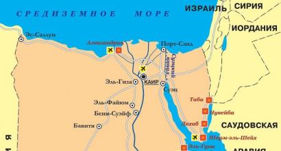
In fact, Santorini is a group of islands in the Aegean Sea. The group includes the islands of Thira, Thirassia, Palea Kameni, Nea Kameni and Aspro. The population of Thirassia is very small, Palea Kameni, Nea Kameni and Aspro are generally uninhabited, which is why the main island of Thira is called simply by the name of the archipelago.
Santorini volcano
The main attraction of the island is the Santorini volcano. Arriving in Santorini, it is simply impossible not to visit the volcano - the island is the volcano. The exception is the peak of Santorini, but more on that later. The volcano is active. The island shakes regularly. The last serious earthquake occurred here in 1956.
Until 1500 BC, the island had a round shape and was called Strongila. The volcano Santorini, which was located in the center of the island, had a height of 1.5 km. About one and a half thousand years BC, an event occurred that drastically changed both the history of the ancient world and the shape of the island - an eruption with a force of up to 7 on the scale of eruptions. As a result of the eruption, the crater of the volcano collapsed and a huge caldera (funnel) was formed, which was immediately filled with the sea. The area of \u200b\u200bthe sea surface of the caldera reaches about 32 sq. miles, and a depth of 300-400 m. From the ancient Strongila, only the currently visible crescent with a sheer cliff of more than 300 m in the western part and gentle beaches of the eastern part remained.

This is how Santorini looks today. In the very center there is a crater island (Palea Kameni), around it a flooded caldera and separate islands. Source: Wikipedia.
After filling the mouth of the volcano with water, it evaporated and a huge explosion (the effect of a steam boiler) occurred, which caused a huge tsunami, presumably from 100 to 200 m high, which struck the northern coast of Crete. The tsunami resulted in the decline of the Minoan civilization. The catastrophe was completed by strong earthquakes and volcanic ash thrown out at a considerable distance. A tsunami several tens of meters high destroyed everything that was on the islands of the Aegean Sea, in Crete, in coastal Greek settlements, in northern Egypt, everyone who lived on the shores of the Mediterranean Sea, and suspended the development of civilizations for a thousand years. There is a version that it was this tsunami that destroyed Atlantis.
If you look closely at the satellite image, the mountain is clearly visible on the right. This is the peak of Santorini. It has nothing to do with the volcano and was here before it. It has exactly the same structure and origin as all the other islands of the Cyclades archipelago.

From the side of the island, the caldera is framed by steep slopes. It is on these slopes that the top attractions are located - the cities of Fira and Oia.

Sheer cliffs around the Santorini volcano caldera. The dark island in the center is a crater.
Santorini is conditionally a Greek island. This is evident in the architecture, culture, names and Catholics. The name of the island itself has a Latin origin - Santa Irini (in Greek it would be Agios Irini). Obviously Latin names are found among settlements - Emporio, Perissa, Messario, etc.


Santorini volcano carter. Oia is visible in the background and the island of Ios even further.
I am very skeptical about the crowds of tourists, but this island was building one. We spent five days on the island and did not have time to see everything.
Transport in Santorini
Santorini volcano
Ruins of a Minoan city at Cape Akrotiri
Akrotiri is the name of the excavations at the site of a Bronze Age settlement, attributed to the Minoan civilization. The site is named after a modern village located on a nearby hill. The original name of the ancient settlement is unknown. It was buried under a layer of ash after a volcanic eruption around 1500 BC, as a result of which it is remarkably well preserved. According to experts, before the city was covered with volcanic ash, there was a strong earthquake, in connection with which residents had time to leave their homes.
Akrotiri Museum is one of the most civilized places in Santorini. It's clean, neat and well thought out. The infrastructure is very similar to the pyramid of Guimar in Tenerife. I didn’t like the only paid parking (3 euros). We have never seen more paid parking lots in Santorini.

The Akrotiri Excavation Museum is a branch of Tenerife in Santorini.
Shortly before the completion of the excavations in 2005, the roof collapsed, covering the entire excavation area, as a result of which one of the visitors died. The excavations were not damaged, but after that the object was closed for free visits. In June 2008, it was announced that Akrotiri would be closed to tourists until at least 2010. I don't know when it was opened, but the museum is open.

Red beach
Red Beach is in close proximity to Akrotiri. The beach is like a beach, only red. For such a popular and organized beach, surprisingly poor parking and approach. Poor aunts hardly make their way over stones and other gullies. The parking lot by the beach resembles an average Novgorod courtyard.


Black Beach
Santorini's black beach is everywhere. A volcano is a volcano. There are beaches with very small pebbles - they are called sandy. They are located in the beach villages of Perissa and Kamari.


Surprisingly, beach holidays are developed in Santorini. Beach villages and beaches are so-so here, if you want a beach - go to another place (better not to Greece at all).
Santorini peak
Santorini Peak is the highest point on the island. NATO radar is at its peak and the summit itself is closed to the public. However, almost at the very top, there are observation decks. The entire archipelago is clearly visible from the peak.
On the island of Santorini in the Aegean Sea, there is the eponymous volcano Santorini. Now there is a small footprint from it, an ancient caldera, and earlier there was a huge volcano cone:
Santorini is an active thyroid volcano on the island of Thira in the Aegean Sea, the eruption of which led to the death of Aegean cities and settlements on the islands of Crete, Thira and the Mediterranean coast. The eruption dates from 1645-1600 BC. e. (according to various estimates).

The collapse of the caldera is associated with intense seismic activity, bulk pyroclastic flows and tsunami that washed away all coastal settlements. During the eruption, the Santorini volcano completely emptied its interior, after which its cone, unable to bear its own weight, collapsed into an empty magma reservoir, where sea waters rushed after it. The resulting giant wave with a height of about 18 meters (according to wikipedia data, that up to 100m) swept through the Cyclades archipelago and reached the northern coast of Crete. The tsunami destroyed all settlements on the islands of the Aegean Sea, and also affected the shores of Egypt and other countries of the Mediterranean Sea, halting the development of mankind for a long thousand years.
After the eruption of Santorini, many other events took place in the center of the formed caldera. Some of them affected the archipelago in the 19th and 20th centuries. In particular, the last major eruption occurred in 1950. Today Santorini shows constant seismic activity, and fumaroles and hydrothermal springs still operate on some of its islands.
The largest Minoan eruption in ancient history on the island of Thira, or Fira, occurred in 1628 BC. e. (dendrochronological date). The next - the most powerful - happened in 1380 BC. e. (date is approximate). The latter happened in 1950.
As far as I've heard, dendrochronology can only match the dates of events a few hundred years ago. There are simply no thousand-year-old trees in the right quantity in the right place.
Geologists have found out how the explosion of the supervolcano caused the "great flood" in Crete
Before the eruption of the supervolcano, the modern Santorini archipelago was a single island. Scientists found that the eruption occurred almost instantly in geological terms - in just 100 years, the magma chamber under the island was filled with "fresh" molten rocks, which heated up local magma reserves, forced it to expand and literally tear the island apart.
An unusual "channel" in the northwestern part of the archipelago, which scientists discovered under water, told them about what happened to the island and the surrounding ocean during the eruption and in the first days after the disaster.

For example, the unusually deep walls of this channel and its structure indicated that the walls of the supervolcano on Santorini Island collapsed even before sea water burst into its exploding vent. This means that the tsunami, which was supposedly caused by the destruction of the island and the fall of its "debris" into the Aegean Sea, was born in a completely different way.
Scientists have no doubts that this tsunami really existed - traces of sea water and sand in the Minoan palaces of Crete clearly testify to its occurrence, where it could only get if the wave height at the coast exceeded ten meters.
Scientists found traces of this event in the center of the former volcano, and a few hundred meters from the shores of the archipelago.
As the analysis of rocks in the central part of the former island showed, at the first stages of the eruption part of Santorini exploded due to the fact that in the central part of the island there was a lagoon with seawater, which was the first "victim" of hot magma rising from the bowels of the Earth. This explosion led to the fact that the southern part of the former island was literally instantly flooded with powerful outpourings of magma, whose volume exceeded 16 cubic kilometers.
They eventually "slipped" into the Aegean Sea, covering the bottom off the southern shores of Santorini with a 60-meter layer of new rocks, and caused a powerful tsunami, the wave height of which at the former island exceeded 35 meters, decreasing to about ten meters already when they reached coast of Crete.
Almost immediately after this, the walls of the volcano collapsed, after which the sea broke through a "dam" of volcanic ash that had formed at the northeastern channel at the bottom of the modern sea. Its waters began to fill the formed basin, filling it completely with water in just 40 minutes, if the depth of the channel was the same as today. Such a rapid course of such geological disasters, as scientists note, suggests that supervolcanoes, especially their island varieties, should be given special attention.
As you can see, scientists and historians assigned the death of the Minoan civilization to this (in the past) volcano. They say that it was destroyed by a flood, a tsunami from the eruption.
An irregularly shaped failure of a volcano cone.


It looks like a flooded quarry


Lime hills side by side with tuff hills


Central island

Santorini is part of the Cyclades group
List of minerals that are available on the islands:

But there are no sample analyzes for metals.
I propose to see the excavations and the remains of the structure of the Kroto-Minoan culture, which was destroyed by this volcano:

According to the first signs, the territory is quite far from the sea, respectively, higher than 10m above it

The fact that it was destroyed by a flood or mudflow is beyond doubt among archaeologists. But could a 10m high wave reach these buildings? If the volume of water was large, then its inertia could drag the mudflow here too.
Excavation of this complex from above


In the process of excavation
After. Already glued and reconstituted jugs
It is possible that the entire Mediterranean coast suffered from this cataclysm. And traces of destruction and flood along its entire coastline are the consequences of this event.
Santorini Volcano is a legendary volcano on the island of Santorini (Thira) in the Aegean Sea. The eruption of the Santorini volcano, which took place three and a half thousand years ago, is considered the largest volcanic phenomenon on Earth in history.
As a result of a monstrous eruption, the crater of the volcano collapsed, and a huge caldera was formed, which was instantly filled with the waters of the Aegean Sea. The explosion of the Santorini volcano led to the death of the Aegean civilization, settlements on the islands of Crete and the Mediterranean coast. According to some scientists, the state that died as a result of the explosion is the legendary Atlantis.
Santorini is a group of several islands that make up the Cyclades archipelago. Among them are the island of Tira, Palea Kameni, Thirassia, Nea Kameni and Aspro. They are built in the form of a ring, in the interior of which there is a deep (up to 400 meters) volcanic caldera. The inner coast of the largest island - Thira - is a steep slope, the height of which reaches three hundred meters. While the outer edge is gentle, comfortable beaches with black lava sand washed by the waves of the Aegean Sea.
Tourists love Santorini for its interesting history and the wonderful vacation that is possible in a picturesque romantic town on the island. Many hotels provide visitors with comfortable rooms and houses for accommodation. The excellent service and infrastructure of modern Thira is in stark contrast to its ancient predecessor. The archaeological reserve, where excavations are still ongoing, is one of the most popular places in Santorini.
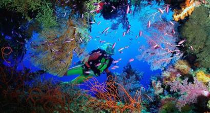
In addition, everyone can take a yacht excursion to the islands of Palea Kameni and Nea Kameni, located in the center of the caldera. These islands are nothing more than the result of the activity of the legendary Santorini volcano. Before our eyes - alien landscapes, under our feet - a fairly hot earth, and through its thickness streams of hydrogen sulfide break through in places. The volcano is asleep, but not extinguished. Its last activity was observed in 1950. And at any moment Santorini can wake up again.
Santorini volcano - PHOTOS


Santorini volcano (crater diameter - 1680 m; height was 1.5 km) is an active thyroid volcano on the Greek island of Santorini (Thira).
The history of the eruptions of the Santorini volcano
For the ancient Cretans, Thira served as a metropolitan island: the slopes of Mount Santorini were occupied by the capital and other settlements, and at its foot was a harbor.
The eruption, which dates back to 1645-1600 BC, killed the settlements on the island and on the Mediterranean coast. So, because of the tsunami (height - 18 m), the Minoan civilization of Crete was destroyed (the ash cloud spread over 1000 km). In addition, this process led to the collapse of the volcanic cone, and sea waters rushed into the formed abyss.
It is worth noting that the island of Tira “shook” more than once: the largest (Minoan) earthquake was dated 1628 BC, the next (most powerful) - 1380 BC, and the last - 1950 (now the volcano sleeps ”, but did not go out). The reason lies in the fact that Tira is located at the junction of the Eurasian and African plates, which is why this area is cut by volcanic relief and volcanic activity manifests itself here.
What's interesting: Plato, the author of the dialogues "Critias" and "Timaeus", described Atlantis as an island-state that disappeared from the face of the earth under mysterious circumstances. The existing versions say that: the island of Tira is Atlantis; Atlantis was destroyed by the explosion of the Santorini volcano.
Santorini for tourists
The crater of the Santorini volcano is located on the island of Nea Kameni (there are active mini-craters - sulfur compounds emerge from them) - everyone is taken there on small boats and on larger tourist boats.
If you are going to climb the crater of a volcano, you will climb a rocky lava path to a height of 130 meters; if you wish, you can go around the crater, from here you will see a wonderful panorama of Santorini and the Aegean Sea. Do not forget to provide yourself with water (there are no fresh water sources on Nea Kameni) and comfortable shoes. In addition, you should take a bathing suit with you, since a trip to the volcano is combined with a visit to the healing thermal springs in Palea Kameni (another attraction of the island is the Church of St. Nicholas), in which you can and should swim (give preference to a dark colored swimsuit - from for the high content of various minerals, it can be colored).
The boat tour includes several stops:
- The first stop is the volcano (charitable contribution - 2.5 euros): an English-speaking guide will tell you about legends and interesting facts, after which tourists will have free time to enjoy unforgettable views and take unique photos.
- The second stop is the Palea-Kameni springs (30 minutes - 1 hour will be allocated for swimming).
- The third stop is Thirassia: there for two hours you can admire the local beauty, relax on the beach, visit one of 21 churches, as well as a Greek tavern, where visitors are treated to local delicacies.
- The final stop is Oia, where you can visit souvenir shops, as well as admire the famous sunsets. The western part of the resort overlooks the Amoudi Bay. The eastern part of the resort also deserves attention - it offers a view of the Gulf of Armenia.
And after a busy day of sightseeing, tourists are returned back to the old port of Fira (the approximate cost of the tour is 42 euros).
Landmarks of Santorini
On Santorini, a volcanic island, tourists will be invited to visit the Archaeological Reserve (visit will cost 5 euros; open from 8 am to 8 pm in June-October; non-working day - Monday), located in Akrotiri. In its vicinity, excavations were carried out and the ruins of the city of the Minoan civilization were discovered, namely - 2-3-storey buildings well preserved under the ashes of a volcano, the facades of which are faced with stone slabs; wall paintings that adorned interiors; Houseware; anthropomorphic marble sculptures; figurines of animals; various vessels; the only gold item in the form of a statuette of a golden ibex.
In addition, the Archaeological Museum deserves the attention of tourists (it is a repository of finds found during the excavations of Ancient Fira and Akrotiri - funerary artifacts, red and black-figure vases, vessels with geometric patterns and other things; entrance costs 3 euros) and the Museum of Prehistoric Fira (the exhibition allows you to admire ceramics from the Neolithic period, a jug from Megalochori, a Minoan vase from Akrotiri and other interesting objects; a visit will cost 3 euros) in the city of Fira.
Travelers are also happy to relax on the amazing local beaches, covered with both red and black sand. Pay attention to Perivolos Beach, where you can rent a thatched parasol and sun lounger, go diving or windsurfing, and host your wedding ceremony.
in love with books. Mutually
My Mediterranean love) The island is a fairy tale, simple, dried, but insanely beautiful and cozy.
The visiting card of Greece, Mecca for lovers and romantics, the land of enchanting sunsets and at the same time a dormant mortal danger. 
Santorini now
The Santorini archipelago is a group of five islands:
The main island is Thira 75.8 sq. km, coastline - 70 km, population about 8000 inhabitants.
Terasia (Thirassia) 9.3 sq. km, about 250 inhabitants (excursions are made here by boat with a visit to the volcano and thermal springs)
Aspronisi 0.1 sq. km, not populated
Old Kameni (Palea Kameni) 0.5 sq. km, 1 inhabitant
New Kameni 3.4 sq. km, not inhabited. 
Yes, again there are a lot of letters, but this is the last time) probably)) the history of the island is very interesting and its attractive power is amazing. Santorini-Fira is connected with one of the most catastrophic volcanic eruptions in the history of mankind, as well as one of the most mysterious and alluring myths, the legend about Atlantis.
I will try to briefly retell) the epic nature of what happened in antiquity on the island leads me to some kind of almost sacred awe)
Great cataclysm
The Mediterranean is located - African and Eurasian, and therefore
« Most of the islands in the Aegean Sea have emerged from volcanic activity. One of these islands, part of the Cyclades archipelago, is Thira (Fira). Thira, together with the islands of Thirassia, Palea Kameni, Nea Kameni and Aspro, is part of the ring-shaped group of islands called Santorini.»
“The history of Santorini began 80 thousand years ago, when a new volcano was born in the southern part of the Aegean Sea. He "notified" the Mediterranean about his birth with a powerful eruption and ashfall, traces of which are found today all over from Italy to Cyprus. Over time, the volcano grew, rose above the water, joined three rocks protruding from the sea and turned into an island fifteen kilometers across. Then its activity dropped, the volcano "fell asleep", overgrown with grass and forest and became similar to other habitable islands of the Aegean Sea. "
In the most common version, Tyr is represented as a volcanic cone, although there are theories that the island was a complex group of volcanic cones that have grown together with each other, located mainly along its periphery , and the interior was partly occupied by a lagoon or plain.
Lying at ease in the middle of the sea, warmed by the sun, it attracted people with fertile soils. It is believed that the first name of the island was "Strongili", Round.
“It is difficult to say when the first people appeared on the island - it is only known for certain that long before the onset of our era life on its shores was already in full swing: cities stood, gardens bloomed, ships with goods from Egypt, from Crete, from other islands of the Cyclades archipelago ... "
“The inhabitants of the island of Santorini knew the system of measures and calculations, they mined lime and built complex vaulted structures, painted the walls with fantastic frescoes. They successfully developed agriculture, weaving, pottery. "
The village of Akrotiri in the south of the island was a colony of Crete and one of the centers of the Cretan-Minoan civilization. During excavations near it from 1967 to 1974 (just some forty years ago) expedition Spyridon Marinatos discovered
a whole residential area, consisting of spacious two- and three-storey houses with facades faced with stone slabs. Many houses probably collapsed into the sea at the time of the explosion of the volcano, which split the edges of its crater, on the slopes of which the settlement discovered by Greek archaeologists was located. But even according to the surviving remains, one can imagine a populous and prosperous seaside town that once stood here.
and also found
“Wall painting of amazing beauty and thoroughness of execution, which adorned the interior of almost all houses in the surviving part of the settlement discovered during excavations. In terms of their artistic merit, these paintings are in no way inferior to the frescoes, long before that opened in the palaces of Knossos, Pylos, Tiryns and Mycenae. Among them there are also works that are completely unique in their artistic and historical value. In all Aegean art, there is hardly anything comparable to the amazing pictorial frieze depicting an entire squadron of ships cruising along the coasts and islands of the Aegean or perhaps the Mediterranean Sea. "
And it is at this wrong time (approximately between 1500 and 1640 BC, the data is updated as the dating methods improve) the volcano woke up from a thousand-year "hibernation". There is no historical evidence of this event, but the picture can be restored from volcanology data and observations of other eruptions, such as the explosion of Krakatoa in Indonesia, etc.
The catastrophe was monstrous, the eruption began with an explosion. “A giant black“ Sultan ”soared over the island. A few minutes later, the shock wave, having overcome 130 km, reached Crete: the mountains shuddered, the walls of the royal palaces cracked. Stunned and frightened, the Cretans ran out of their homes: in the north, where the sea was always serenely blue, a black cloud swirled, all in crimson reflections. Devouring space, she was rapidly approaching.
An impenetrable, suffocating darkness covered not only Crete, but also Palestine - this is evidenced by the biblical legends and the Egyptian chronicles. The ashfall probably lasted for several days, after which the force of the explosions subsided, but Santorini was shaken by a new, no less terrible cataclysm.
The eruption devastated the magma chamber below the volcano, and the entire middle of the island - more than 80 cubic kilometers of rock - fell into an underground void with a crash that should have been heard at such a distance as Norway. Norway, can you imagine? Sea water rushed into the formed abyss, it fell directly on the hot lava. Huge volumes of water instantly turned into steam, the pressure of which grew at a tremendous rate.
Santorini Island exploded like a steam boiler. This explosion caused vibrations of the earth's surface and its local subsidence. But the most terrible was the formation of a new tsunami wave, which surpassed the first in its size and power.
A huge wave, the height of which supposedly reached from 100 to 200 m, hit the northern coast of Crete. This wave finally destroyed the entire Minoan fleet, and buildings on the island, and part of the population of Crete and the Cyclades. The Cretan-Minoan civilization suffered such damage that it could not recover from it in the future.
The Strongy no longer existed. From the round island there are only broken edges with dizzying cliffs going to the inner bay 380 meters deep - the so-called caldera. Black, red, yellow rocks - that was the “flesh” of the old volcano ripped apart by the explosion and collapses. "
“The entire island was covered with a thick layer of pumice, the thickness of which in some areas reaches over 30 meters... Basalt boulders erupted from the volcanic vent with such force that they damaged many houses in Akrotiri. "
"At a speed of 150 km per hour and at temperatures over 600 degrees, lava burns everything in its path."
The explosion at Strongili is considered one of the strongest in the history of our planet. Add to this the earthquake, tsunami and fires and you have a picture of a real apocalypse for the Mediterranean region.
“The volcano of Santorini has changed almost the entire Middle Sea beyond recognition, and the sound wave from the explosion has circled the entire planet several times. The ash that rose into the atmosphere changed the climate for several years for many thousands of kilometers from the epicenter. "
According to various estimates, the spread of the crater contents reaches 500-700 km, affecting Africa, mainland Greece, and the Middle East
“The volcano threw out a huge amount of pumice. And pumice is lighter than water. As a result, the entire eastern Mediterranean Sea was covered with pumice for many years. Navigation has become impossible. "
« The eruption of Tyra sent European civilization down a different path.
Perhaps Tyra wiped out an entire continent. For example, the legendary Atlantis.
Under the caldera, at a depth of three hundred meters, under water and a layer of ash, there may be a lost city.
800 kilometers from Tira, the eruption was observed in Egypt. It is even mentioned in the Bible. The eruption of the volcano and the tsunami are associated with such a biblical event as the exodus of the Jews from Egypt, and in particular, the famous crossing of Moses across the sea, when the sea receded (low tide before the tsunami) and the Jews passed, and the army of the pharaoh was destroyed by a huge wave that had run over. »
Living on a volcano
When Marinathos started excavations, archaeologists expected to find a second Pompeii, but something warned the inhabitants of the danger and they left the settlement in advance.
“In Akrotiri, no valuables, no decorations, no seals or other signs of power have been found, and no human or animal remains have been found, except for one pig skeleton. The time period that lasted between the earthquake and the awakening of the volcano is unknown. Most likely one year has passed since the seeds that had been in the ruins of houses since the earthquake began to germinate when the first volcanic ash covered them.
But for some reason people like to live on a volcano) And even after such a disaster, the former Strongili did not fall into desolation. Centuries passed, history turned into legend, and the inhabitants returned to the island. Only already others.
At different times, Phoenician, Dorian and Roman ships moored its shores. The Dorians liked the island so much that in the 2nd century BC they decided to found a city on the main island called Fera in honor of King Feras (the modern name is Fira). In the Hellenistic period, Fera served as a naval base for the Ptolemaic dynasty, later passed to the Romans, in the IV century the first Christian church on the island appeared.
Santorini received its current name in 1204 from the Franks - in honor of Saint Irene. The Franks preferred to move the capital to the eastern steep coast, building a fortress on the Skaros rock. Later, nearby, right on the ridge of the caldera, the modern capital of Santorini, Fira, arose.
A series of bloody quarrels between the dukes who owned the Cyclades islands, attempts by Byzantium to conquer Santorini, the raids of the Turks - a relatively calm life for Santorini came only in 1579, when the island was finally annexed to the Ottoman Empire. For some reason, the Turks granted Santorini autonomy, allowing the inhabitants to elect their own elders. Either the Turks were fascinated by the Santorini windmills (in Turkish the island was called "Deimertsik" - "Little Mill"), or they were confused by the renewed activity of the volcano.
The new inhabitants of Santorini have had a hard time. The former greatness of the island remained forever buried under a layer of volcanic ash, along with its fertile soil, clean springs, and convenient harbors. The dry ground continued to retain traces of fire and looked more like a pumice stone. The vine had to be twisted in a ring so that it would not be broken by the wind. And the fishermen had to take a whole journey to get down to the boats.
Permanent eruptions
But the volcano itself did not allow people to relax.
Scientists know about another powerful cataclysm associated with the Santorini volcano, which occurred about 25 thousand years ago, and about many smaller ones.
1) Santorini troubled the Greeks in 197 BC BC, then the island of Palea Kameni arose.
2) The eruption of 236 BC separated Thirassia from the northwestern edge of Tyra.
3) In 726, the island of Palea Caymeni grew significantly
4) A terrible volcanic eruption sunk half of the Palea Kameni in 1452.
5) The southern coast of Santorini sank in 1570. Three years later, Malaya Kammeni appeared.
6) In 1650, the Columbus stranded
7) An underwater eruption with poisonous gases, which occurred around 1700 in the northeast of Oia, resulted in the death of thousands of people and animals.
8) During 1707-12. The new Kammeni appeared above the water. 5 years!
In 1707, sailors saw something black in the middle of the Santorini bay. They decided that it was the remains of a sunken ship, and rushed there, but ... ran into the rocks! These rocks moved, and the sea around them changed its color from green to red, from red to yellow. Heavy smoke and flames burst from the depths - the population of the island was seized by panic: people decided that the fire was about to spread to the island itself. The lava island grew before our eyes, gradually turning into a giant black "spider", resting in the center of the bay. Meanwhile, the sea boiled and burned like butter in a frying pan, and the waves threw dead fish onto the shore. Every night over the bay flames flared up, which rose high into the sky and scattered over the stunned people "star rain". And so it went on for almost a month ...
9) In 1866, a series of eruptions lasting two years led to the appearance of the Afotesse island, which then disappeared again.
On 01/26/1866, stones fell from the ancient cone of Nea-Kaymeni, on the 30th the number of stones increased. The inhabitants of the island noticed that in many parts of the bay the water became noticeably warmer than before. Clouds of steam rose from the water, spreading the smell of sulfur. The next day, steam began to rush out of the water with a noise, a slight underground rumble was heard, cracks appeared on land, and many houses in the villages scattered across the archipelago also cracked. Then the frightened inhabitants, in search of salvation, moved to the largest of the islands. On February 1, volcanic activity intensified, and at about noon in the middle of the bay, a black jagged rock appeared from the water, enveloped in white steam, giving rise to the island of Georgios, which on February 5 joined Nea Kaymeni. On February 13, after a strong underwater roar, another island appeared on the surface of the water, named Afroessa. Finally, on February 20, the underwater eruption reached its maximum. There was a terrible explosion on Georgios. A huge column of ash and steam rose to a height of several hundred meters, and hot pieces of lava flying out of the sea rose up at least 500 meters. Soon a third island arose, which then became one with Afroessa. Eruptions continued throughout the year, with periods of increased volcanic activity alternating with periods of relative calm.
10) In 1920, the formation of New Kammeni again, there were no casualties.
11) In 1925-26. connected Malaya and Novaya Kammeni, did not entail major destruction. And it looked like this:
12) The volcano last woke up in 1956, causing a strong earthquake and tidal waves 17 meters high. 50 people died on the island. This earthquake destroyed most of Santorini's houses and many residents were forced to leave the islands, only about 400 people remained on the island.
Not everyone could withstand such "performances". People left the "devil's island", but many soon returned back. To survive on a volcano, where there is not a single normal tree, there is really no clay, no sand, no stone, the Santorini people began to dig horizontal caves in the pliable volcanic tuff - "scaffolds".
The "cave" life on Santorini continued until 1956, when the island suffered a catastrophic earthquake. A new misfortune drove the inhabitants out of their nor-skaft forever. The horror of the prospect of being flattened in the thickness of the rock cannot be experienced twice - people did not want to return to their homes, although it was the skaffts that survived: the viscous tuff withstood the vibrations of the firmament, while all the above-ground structures collapsed.