What plants are found in the Sea of Japan. Geographical position
It is separated from it by the Japanese Islands and Sakhalin Island. It washes the shores of Russia, Korea, Japan, and the DPRK. A branch of the warm Kuroshio Current enters in the south.
Area - 1.062 million sq. km.
The greatest depth is 3742 m.
The northern part of the sea freezes in winter.
Fishing; production of crabs, sea cucumbers, algae.
map of the sea of japan
map of the sea of japan
Main ports: Vladivostok, Nakhodka, Vostochny, Sovetskaya Gavan, Vanino, Aleksandrovsk-Sakhalinsky, Kholmsk, Niigata, Tsuruga, Maizuru, Wonsan, Hungnam, Chongjin, Busan.
Climate of the Sea of Japan
moderate, monsoon. The northern and western parts of the sea are much colder than the southern and eastern parts. In the coldest months (January-February), the average air temperature in the northern part of the sea is about?20°C, and in the south about +5°C. The summer monsoon brings warm and humid air.
The average air temperature of the warmest month (August) in the northern part is approximately +15°C, in the southern regions about +25°C. In autumn, the number of typhoons caused by hurricane winds increases. The largest waves have a height of 8-10 m, and during typhoons, the maximum waves reach a height of 12 m.
In summer, the surface water temperature rises from 18-20°C in the north to 25-27°C in the south of the sea.
Salinity of water Sea of Japan 33.7-34.3%, which is slightly lower than the salinity of the waters of the World Ocean.
Tides in Sea of Japan clearly expressed, to a greater or lesser extent in different areas. The greatest level fluctuations are observed in the extreme northern and extreme southern regions. Seasonal fluctuations in sea level occur simultaneously over the entire surface of the sea; the maximum rise in level is observed in summer.
Flora and fauna
The underwater world of the northern and southern regions Sea of Japan very different. In the cold northern and northwestern regions, the flora and fauna of temperate latitudes has formed, and in the southern part of the sea, south of Vladivostok, a warm-water faunal complex predominates. Off the coast of the Far East, a mixture of warm-water and temperate fauna occurs. Here you can find octopuses and squids - typical representatives of warm seas. At the same time, vertical walls overgrown with sea anemones, gardens of brown algae - kelp - all this is reminiscent of the landscapes of the White and Barents Seas.
IN Sea of Japan a huge abundance of starfish and sea urchins, of various colors and sizes, brittle stars, shrimps, small crabs are found (Kamchatka crabs are found here only in May, and then they go further into the sea). Bright red ascidians live on rocks and stones. The most common shellfish is scallops. Among the fish, blennies and sea ruffes are often found.
In the Sea of Japan, the ice cover reaches its maximum development in mid-February. On average, ice covers 52% of the area of the Tatar Strait and 56% of the Peter the Great Bay.
Ice melting begins in the first half of March. In mid-March, the open waters of Peter the Great Bay and the entire coastal coast up to Cape Zolotoy are cleared of ice. The ice boundary in the Tatar Strait retreats to the northwest, and in the eastern part of the strait clearing of ice occurs at this time. Early clearing of the sea from ice occurs in the second ten days of April, later - at the end of May - beginning of June.
Bottom relief. Soils. By the nature of the underwater relief, the Sea of Japan is a deep depression. This basin begins from the parallel of the La Perouse Strait and ends at the southern limits of the sea. In the northern part of the basin, the bottom is relatively flat with prevailing depths of 3300-3600 m. In the south, the basin is divided by an underwater ridge into two parts: western and eastern. This ridge is oriented along the meridian of the Oka Islands and extends into the sea to its middle. At the northern end of the ridge there are two underwater hills: Shunpu with a minimum depth of 417 m and Yamato - 287 m. These two hills are separated by an underwater saddle. By their nature, the Shunpu and Yamato hills are of volcanic origin; on their slopes you can find pumice and volcanic (melted) glass.
The coasts of Primorye, North Korea and the southern part of Hokkaido are deep. Depths of 2000 m are located 60 miles from the coast of Primorye, in some places 15, and sometimes 4-7 miles. Thus, in North Korea, between Capes Kazakov and Boltin, the 2,000-meter isobath is 7-10 miles from the coast, and at the southwestern tip of Hokkaido, at Cape Motsuta (Kutuzov), even 4 miles.
Unlike other seas washing the Soviet Union, no large rivers flow into the Sea of Japan. Of the few rivers, mainly of a mountainous nature, the largest river. Tuminjiang (Tumyn-Ula).
On the western coast of Sakhalin there are only streams, often with waterfalls. The rivers flowing from the central mountain ranges of Hokkaido and Honshu into the Sea of Japan are very short. Even the most important rivers Ishikari, Teshiogawa on Hokkaido, Shinanogawa and Magamigawa on Honshu are no more than 350 km long and are accessible only to small vessels.
The river basin of the Sea of Japan is several times smaller than the area of the sea itself. For other seas, for the most part, the opposite relationship is observed: for example, the basin of rivers flowing into the Caspian Sea is more than 8 times the area of the sea itself.
This circumstance affects the nature of the soils that make up the bottom of the Sea of Japan. They are formed under conditions of limited supply of solid particles from the mainland.
The soils of the seabed are extremely diverse. This is explained by the peculiarities of the geological processes occurring in the sea, the complexity of the bottom topography, the richness and heterogeneity of the organic world. Solid remains of living beings, falling in continuous rain onto the seabed, are one of the main sources of sedimentation in the Sea of Japan. Silt deposits are the most common. They are found at depths of more than 3000 m.
As the depth decreases, the admixture of sand in the silt increases. Sandy silt (silt with a small admixture of sand) occupies vast areas in the central part of the sea at depths of 2000-3000 m. It is also characteristic of the continental slope (a relatively narrow area where the bottom abruptly transitions from the coastal continental shallows to the greater depths of the sea). At higher elevations, silty sand is common, confined mainly to the continental shallows. It is found on the banks and in the bays of Peter the Great, Olga, and Vladimir. The coastal parts of the continental shallows are dominated by sand, which borders the shores of most of the sea with a strip of 5-10 miles.
Pebbles and gravel lie close to the shore. However, pebble-gravel soils are often found far from the coast. The “seaside pebble belt”, first described by N.I. Tarasov, is characteristic. This belt stretches in a relatively narrow strip 10-15 miles from the shores of Primorye and represents one of the ancient submerged coastlines of the Sea of Japan.
In some places in the Sea of Japan there are outcrops of rocky soil. Most often they are found along rocky shores, on the banks of the Yamato Seamount and on the Musashi Bank, northwest of the island. Hokkaido. Sometimes these outcrops of bedrock can be traced at great depths (about 1000 m). In such cases, they are confined to the steepest sections of the continental slope with a bottom inclination angle of up to 7-10° or more, for example, near the southwestern tip of Hokkaido and south of Peter the Great Bay.
Current system. In the Sea of Japan, as in the vast majority of the seas of the northern hemisphere, there is a counterclockwise circulation of water.
Through the Korea Strait, a branch of the warm current, the Kuro-Shivo-Tsushima Current, enters the Sea of Japan (Kuro-Shivo is a continuation of the northern trade wind current, which arises under the influence of the northeastern trade wind of the Pacific Ocean, blowing throughout the year. The trade wind current crosses the ocean from east to west between 10 and 20° N. Reaching the Philippine Islands, it divides into several branches, the main one of which heads north, approaches Taiwan Island and from here follows further to the north under the name Kuro-Siwo (translated as the blue current, it is so named for its exceptionally pure blue color). When approaching the southern shores of Kyushu, the current divides into several branches - the Tsushima Current penetrates into the Sea of Japan.). Cold Primorskoe is moving towards it, adhering to the mainland coast, from north to south. These currents play a huge role in the life of the sea.
The Tsushima Current enters the Sea of Japan through both passages of the Korea Strait. The bulk of the water flows through the Kruzenshtern passage, the smaller part through the Broughton passage.
Leaving the Korea Strait behind, the Tsushima Current approaches the Japanese shores. A significantly smaller part of its waters, in a separate branch, rushes to the north, towards the island. Ulleungdo, from which it goes further under the name of the East Korean Current, gradually deviating to the east, crosses the sea and from the western side flows into the Sangar Strait, connecting with the main branch of the Tsushima Current.
The main flow of the Tsushima Current, directed along the Japanese Islands, has a low speed. On the site about. Tsushima - Noto Peninsula speed is only 1/2-1/3 knots (Knot is a unit of speed equal to 1.85 km/h). Encountering numerous obstacles on its way in the form of banks and capes protruding far into the sea, the current forms many local eddies.
About three-quarters of the waters of the Tsushima Current enter the Pacific Ocean through the Sangar Strait, where the current is always directed from the Sea of Japan to the Pacific Ocean. At high tide its speed is highest - more
7 knots, and drops sharply at low tide. On the northern shores of the strait, with fresh easterly winds, as well as during strong low tides, even a current from the Pacific Ocean to the Sea of Japan occurs.
The rest of the Tsushima Current follows north along the western shores of Hokkaido and, having reached the La Perouse Strait, exits mainly into the Sea of Okhotsk. Off the southwestern coast of Sakhalin, the current is greatly weakened. Nevertheless, the slow movement of water along the western shores of Sakhalin can be traced to the northern borders of the sea (On the approaches to the Sangarsky Strait, the speed of the Tsushima Current is 1-1.5 knots. In the Tatar Strait, the current speeds are very low and do not exceed 1/4-1/2 knot ).
As they move from south to north, the waters of the Tsushima Current cool, giving up their heat to the air, and they arrive to the north largely modified.
This happens in the summer. In winter the picture changes dramatically.
In the Korea Strait, the bulk of the Tsushima waters are directed through the Broughton passage; in the Kruzenshtern passage, the current is insignificant, and in the middle of winter it stops altogether. Off the western coast of Kyushu and the southwestern coast of Honshu, there is even a reverse current from the Sea of Japan to the East China Sea. The East Korean Current also weakens due to the winter monsoon and does not penetrate far to the north. This is explained by the strong northern and northwestern winds of the winter monsoon, which have a braking effect on the Tsushima Current. Only when the north wind gives way to a south wind (this happens when cyclones pass through the Sea of Japan) does the Tsushima Current resume again, but it is possible that in the deep layers there is still always a constant, albeit weak, flow of water to the north.
Regarding the Primorsky Current, it was believed that it begins in the Sea of Okhotsk, in the Amur estuary, which is why it was called “estuary”. Later, Russian researchers proved that waters from the Sea of Okhotsk do not flow through the Nevelskoy Strait. In summer they cannot penetrate into the Sea of Japan, since its level is higher than in the Sea of Okhotsk. The southern winds of the summer monsoon constantly back up the waters in the Tatar Strait, thereby preventing the penetration of the waters of the Sea of Okhotsk and the fresh water of the Amur. Only in winter, when northwestern winds push water into the Sakhalin Bay of the Sea of Okhotsk, are conditions created for a certain amount of sea water and fresh Amur water to flow into the Sea of Japan. However, in winter, the flow of water through the Nevelskoy Strait is so small that it cannot create any significant current.
The Primorsky Current, so named by the major explorer of Russian seas K. M. Deryugin, originates in the area between Sovetskaya Gavan and De-Kastri Bay. Then it goes from north to south along the coasts of Soviet Primorye and North Korea. Even in the old sailing directions, it was noted that during the accident of one ship south of De-Kastri Bay, discarded barrels of kerosene were discovered two months later south of Peter the Great Bay. The Primorye Current brought them here. Along the southeastern coast of Korea, this current is not clearly visible in the surface layers, but it is possible that here it passes at some depth.
The speed of the Coastal Current ranges from 1/4 to 1/2 knot, but can be higher at times. In summer, the current approaches the shore, forming local eddies in its bends. In winter, the nature of the current changes: numerous branches extend from it into the open sea.
Content of salts and gases. Transparency and color of water. Sea water differs from the water of rivers, lakes and other bodies of water on land in a number of features. Its bitter salty taste makes it unsuitable for drinking; it does not dissolve ordinary soap and cannot be used in steam boilers, as it forms a lot of scale. This is explained by the fact that sea water is a weak solution of various salts.
The amount of dissolved salts, expressed in grams per kilogram of seawater, is called its salinity. Typically, in the open ocean, far from the mouths of large rivers, the water contains 35 grams of salts per 1 kg of water, or 35 thousandths of a kilogram. Thousands of parts of a whole are usually called ppm and denoted “°/oo”. Therefore, the average salinity of the World Ocean is 35%.
Some salts are found in seawater in large quantities, such as sodium chloride (NaCl) and magnesium chloride (MgCl); they together constitute 89% by weight of all dissolved salts, while others are in insignificant quantities, measured in thousandths of a gram per ton of water. Thus, the silver content in sea water is only 0.0002 g per ton of water, and gold only 0.000005. However, the total amount of gold and other rare metals in the World Ocean amounts to several billion tons.
The salinity of the seas can be both less and more than the ocean. In seas that are surrounded on all sides by countries with a hot climate and have low river flows, the salinity is greater than that of the ocean. For example, in the Red Sea, surrounded by deserts, salinity reaches 41%. In most of the world's seas, due to river runoff, the salinity is less than that of the ocean.
In the Sea of Japan, although the flow of the rivers flowing into it is extremely small, the salinity is also less than that of the ocean. This is due to the fact that salinity is determined not only by river flow, but also by the relationship between precipitation and evaporation, and precipitation in this sea exceeds evaporation, which is why its salinity is less than that of the ocean, although not by much. On average, the salinity of the waters of the Sea of Japan is 34°/oo, slightly lower under the mainland coast, and higher near the eastern coast. In the Sea of Japan there are no areas with highly desalinated water, which makes it sharply different from all other seas washing the Soviet Union.
The salinity of the sea varies slightly throughout the year. Its greatest seasonal fluctuations are in the north of the sea in the Strait of Tartary, where it varies from 34% in autumn and winter to 32% in spring. The decrease in salinity in spring is associated with the desalination effect of melting ice. In the depths of the sea, below 300-500 m, there are no seasonal fluctuations.
In addition to salts, various gases are dissolved in sea water: oxygen, nitrogen, carbon dioxide, and sometimes hydrogen sulfide. They enter the sea from the atmosphere and as a result of the vital activity of animals, plant organisms, as well as complex chemical processes occurring at the bottom or in the water column. Oxygen is of greatest importance for the development of life in the sea. It enters the water either from the air or is released during the respiration of marine plants. Oxygen is consumed for the respiration of animal organisms and for the oxidation of various substances, and sometimes it is released into the atmosphere when there is an excess of it in the surface layers.
The amount of gases dissolved in sea water is very small and variable. The surface layers of the sea are most saturated with oxygen, in which the smallest plant organisms - phytoplankton - intensively develop, and higher plants - sea grasses - near the coast. A large amount of oxygen is absorbed by the surface layers of the sea; it reaches depths as a result of mixing of sea water by waves, as well as during the immersion of cooled or salted waters on the surface.
The waters of the Sea of Japan from the surface to the greatest depths are highly saturated with free oxygen. This indicates an intensive exchange between surface and deep waters, which occurs mainly in winter, when surface waters cool and sink to depth as heavier ones, and deep water comes out in their place.
The processes of vertical mixing and enrichment of deep waters with free oxygen occur most intensively in the northern part of the Sea of Japan, where, in addition to cooling, the increase in the density of the surface layer of water is also influenced by ice formation, during which salts precipitate into the water, and sea ice becomes almost fresh. That is why in the Sea of Japan not only surface, but also deep waters are highly enriched with free oxygen.
The transparency and color of sea water are determined by the substances dissolved and suspended in it. It has been established that the fewer foreign impurities in the water, the bluer its color. There is little solid matter in the water of the Sea of Japan, so the color of its waters depends mainly on the content of plankton - microscopic organisms suspended in the water. The abundant development of plankton explains the change in the color of sea water from blue to green and even yellow and brown. In spring, with the rapid development of plankton, the color of the sea acquires yellowish-green and even brownish-green shades. This happens mainly along the coastal and Korean coasts.
In most areas, the waters of the Sea of Japan are blue-green. In the southeast, in the zone of the Tsushima Current, the color of the water is intensely blue, and in the north, in the Tatar Strait, it is greenish. The blue color of sea water corresponds to high transparency, while green, yellowish and brown water corresponds to low transparency. The transparency of sea water is usually determined by the depth at which a submerged white disk with a diameter of 60 cm begins to disappear from the eye.
In the zone of the Tsushima Current, water transparency is high and reaches 30 m, in the central part of the sea it is 15-20 m, and off the western coast in the spring, with intensive development of plankton, it drops to 10 m.
Water temperature. In terms of water temperature and its change with depth, the Sea of Japan is unlike any of the other seas washing the shores of the Soviet Union. Judging by the surface temperatures in the summer, this is a warm sea. At depths, the water is cold, only one or two tenths of a degree above zero. First of all, the striking uniformity of the temperature of the deep layers is striking. Starting from 400-500 m in the eastern part of the sea and from 200 m in the western part, the water temperature is 0.1-0.2°.
Characteristic is the absence of negative water temperatures at the bottom at great depths of the sea (the freezing point of sea water at a salinity of 34-35°/oo is minus 1.7-1.8°). Meanwhile, it would seem that the water masses, having cooled to -1.7° in winter in the northern regions of the sea, should slide to the depths of the central basin of the sea. Of course, at the same time they mix with the surrounding waters and their temperature rises somewhat, but since cold waters enter the depths every winter for a long time, a gradual cooling of the deep waters should be observed. However, this is not happening: no trend towards cooling has been noticed. Obviously, deep waters reach their thermal equilibrium, that is, the cooling caused by the influx of water with negative temperatures from the northern part of the sea is compensated to a certain extent by the influx of internal heat of the earth, as well as the influx of heat from the surface layers of the warm southern part of the sea.
Let us take a closer look at the distribution of water temperature over the sea area and how it changes with depth, as well as from season to season.
In the figures showing the distribution of temperatures on the sea surface in February and August, attention is drawn to the location of the isotherms, oriented from southwest to northeast. A large temperature contrast between the western and eastern parts of the sea is clearly visible. This contrast is especially pronounced in winter, and in the south it is little pronounced, but in the north it is very sharp. So in February, at parallel 42° in the east of the sea, the temperature reaches 5-6°, and in the west, south of Peter the Great Bay, it drops to zero and below.
In summer, the difference between the western and eastern parts of the sea is somewhat smoothed out, but only in the surface layers; With depth, the temperature contrast increases: near the mainland coast, the water temperature at a depth of 50 m is 2-3°, and in the east of the island. Honshu 12-16°. At depths of 300-500 m this contrast decreases somewhat, and at 1000-1500 m it disappears completely.
To characterize the variability of water temperature from season to season, we will use graphs of the annual temperature variation, constructed using average long-term data for different parts of the sea. In Fig. (page 47) shows the annual temperature variation in the Korea Strait at a point 20 miles northwest of Cape Kawajiri. Here, water temperatures at various depths were monitored for many years. This graph is typical for the Tsushima Current, which passes through the Krusenstern Passage in the Korea Strait. The minimum temperature at all depths is observed in March, the maximum on the sea surface in August, at a depth of 25 m in September, 50 m in October, and 75 m in November, that is, it lags from horizon to horizon.

A different pattern of annual temperature variation is observed in the same strait off the Korean coast. Up to 25 m it is almost the same as at a point northwest of Cape Kawajiri. But for greater depths, significant differences emerge. Already at 50 m in June-July there is a decrease in water temperature, and at 75, 100 and 120 m a sharp decrease in temperature is observed throughout the warm half of the year. This is explained by the influx of cold waters from the north. A slight increase in temperature from the surface to the bottom occurs as a result of wind mixing of waters.

Of great interest are the temperature fluctuations in a particular area of the sea from year to year. In a number of places these fluctuations are especially large. They greatly affect the life and behavior of sea inhabitants. With sudden and unusual changes in temperature, some of them are forced to migrate to other places, and many organisms die.
In the Korea Strait, especially in the Krusenstern Passage, where the main branch of the Tsushima Current runs, temperature fluctuations from year to year are small. The average monthly water temperature in a harsh year differs from the temperature of the same month in a warm year by only 2-4°.
A different picture is observed in the open sea. For example, to the west of Waqasa Bay, temperatures can fluctuate from year to year by 6-8° or even more. This is due to a change in the location of the Tsushima Current axis. Indeed, if the main jet of a warm current moves to the left or right from its usual position, then where it has shifted, the water temperature will increase. In this place, a center of large positive temperature anomalies (deviations from the long-term average norm) is formed. In the area of the usual position of the flow axis, the water will become colder, and a zone of negative anomalies will appear there.
Large temperature fluctuations from year to year are observed in the Primorsky Current zone, especially off the coast of North Korea. But this is connected not so much with a change in the axis of the Primorsky Current, but with fluctuations in the “heat reserve” in the current itself. Fluctuations in the heat reserve of the Primorsky Current are associated with the severity of winters in the Tartary Strait, where it originates. The heat reserve of the Primorsky Current in spring and summer largely depends on the severity or mildness of the previous winter in the area of the current's sources. This dependence makes it possible to predict temperature fluctuations off the coast of North Korea and in the Peter the Great Bay area.
Ice. In the Sea of Japan, only the northern part is covered with ice. The border of floating ice stretches from the Korean port of Chongjin (Seishin) north along the coast of Korea and Soviet Primorye to Cape Belkin (46° N). At first it goes at a distance of 5-10 miles from the coast, and then 15-25 miles. At Cape Belkin, the border turns east, then approaches the northwestern coast of Hokkaido in the area of Cape Kamui.
The bays of northeastern Korea in winter are usually covered with only a thin crust of ice, which is easily broken by wind and waves and carried out to sea. Such ice does not pose any serious obstacles to navigation. Only in severe winters with severe frosts and low winds does the ice cover in the Tedinman (Gashkevich), Najinman (Kornilov) and other bays reach significant thickness. So on January 12, 1933, at an air temperature of about minus 20°, the Kornilov Bay was so frozen that local steamship traffic between the ports of Chongjin and Ungi (Yuki) ceased. The ice lasted for about 10 days, and five days later from January 27, Kornilov Bay was covered with ice again until February 10. At this time, cargo from ships was unloaded directly onto the ice.
During very severe winters, ice may appear in the open part of the Korean Gulf and in the bays of the southeastern coast of Korea. The western part of Peter the Great Bay, at the head of the Amur and Ussuri Bays, is usually bound by strong ice, which seriously impedes navigation, requiring the assistance of port icebreakers.
In the bays of Soviet Primorye with a wide entrance and the general direction of the longitudinal axis coinciding with the prevailing winter winds (northern or northwestern), the ice is easily broken and carried out to sea.
Along the continental coast from Cape Povorotny to Cape Belkin, only primary forms of ice are found: grease, slush, snow and small broken ice. North of Cape Belkin they become heavier. In the middle part of the Tatar Strait, coarse and small ice and fragments of ice fields are usually widespread, constantly moving under the influence of winds. For short periods of time, when there is calm, ice floes can freeze together and form large fields, which break up at the first fresh wind. The north-west winds of the winter monsoon squeeze the ice from the mainland and drive it towards the Sakhalin coast.
The ice of the Tatar Strait poses a serious obstacle to navigation. To maintain it in winter, the help of linear icebreakers is required, especially on the approaches to Aleksandrovsk, where the ice reaches a significant thickness and is heavily ruffled. Ice in the northern part of the sea appears in November, first in freshened rivers and closed bays, and then usually in early December in the open sea. In April, the ice quickly breaks down and disappears.
In the narrowness of the La Perouse Strait, between Cape Crillon and Cape Soya, ice is not observed every year. In the spring, in the second half of March - April, this is mainly the ice of the Sea of Okhotsk; they head south along the eastern shores of Sakhalin and end up in Aniva Bay. There they circulate, penetrating into the Sea of Japan only with the tide. However, conditions may arise in which ice carried by easterly winds from Aniva Bay drifts far north along the western shores of Sakhalin, posing a serious threat to fixed seines. This happens when eastern winds give way to strong southern winds, which carry ice north to the area of Nevelsk and even Kholmsk. This situation is created when cyclones do not follow their usual path from southwest to northeast, but along the continental coast from south to north.
The removal of ice can be foreseen in advance if meteorologists serving the spring rain off southwestern Sakhalin, in addition to storm warnings, have data from aerial reconnaissance of ice in the La Perouse Strait and reports from coastal posts about the movement of ice to the north. With timely information about the ice threat, it was possible to sink expensive fixed seines and avoid being cut off by ice.
Wind waves. Tsunami. The importance of wind waves in the life of the sea is enormous. Sea waves are an important factor in mixing the surface layers of water and enriching them with dissolved oxygen. Waves change the contours of the coast: in some cases they erode them, in others they contribute to their build-up, creating beaches and spits. Excitement reduces the speed of ships and reduces their controllability. During severe storms, even large ships can be severely damaged and sink.
Knowledge of the elements of waves - height, length, period (wave period is the time interval between the passage of adjacent crests (or troughs) of a wave through the same point) is necessary for the shipbuilder to calculate the strength of the hull of ships, their buoyancy and stability. It is absolutely necessary to take waves into account when designing, constructing and operating seaports. The construction of port protective structures must be carried out with strict consideration of the prevailing direction of strong waves and wave sizes.
The size and shape of waves in any sea depend not only on the strength and duration of the wind that caused them, but also on the depth of the sea, its size or, as they say, on the length of wave acceleration. Seas whose depth is commensurate with the lengths of wind waves acting on its surface are called “shallow” in oceanography. These include the Aral, Azov, and northern parts of the Caspian. In “shallow” seas, the waves are short, high, and very steep.
Seas whose depth is greater than the wavelength are called "deep"; in them, depth no longer affects the nature of the excitement. The latter includes the Sea of Japan. Its waves are not particularly large, since in summer the winds are mostly weak, and in winter, although the winds of the winter monsoon are strong, they blow mainly across the sea and there is not enough acceleration to develop large waves.
However, sometimes giant waves arise in the Sea of Japan, but they are caused not by winds, but by underwater earthquakes or eruptions of underwater, and sometimes surface, coastal volcanoes. Such waves are called tsunamis in Japanese. Over the past two and a half thousand years, 355 tsunamis have been recorded throughout the world, of which 17 occurred on the coast of the Sea of Japan.
Level fluctuations. Tides. Fluctuations in the level of the Sea of Japan are mainly of two types: tidal and surge caused by winds (Level fluctuations associated with sudden changes in atmospheric pressure (seiches), although observed quite often in the Sea of Japan, are not significant - off the coast they are only a few centimeters and very rarely tens of centimeters).
In winter, the northwest monsoon raises sea level off the western coast of the Japanese islands by 20 - 25 cm, and off the mainland coast the level is just as much lower than the annual average. In summer, it’s the other way around: off the coast of North Korea and Primorye, the level rises by 20-25 cm, and off the Japanese coast it drops by the same amount. But since the shores of the Sea of Japan are deep, fluctuations in the surge level are not of great practical importance.
Tidal level fluctuations in the Sea of Japan are of great practical importance. They are not the same in different parts of the sea: the greatest level fluctuations are observed in the extreme south and extreme north of the sea. At the southern entrance to the Korea Strait, the tide reaches 3 m. As you move north, it quickly decreases and already at Busan it does not exceed 1.5 m.
In the middle part of the sea the tides are low. Along the eastern coasts of Korea and Soviet Primorye, up to the entrance to the Tatar Strait, they are no more than 0.5 m. The tides are of the same magnitude off the western coasts of Honshu, Hokkaido and southwestern Sakhalin. In the Tatar Strait near Aleksandrovsk, tides reach 2.3 m, at Cape Tyk - 2.8 m. The increase in tide values in the northern part of the Tatar Strait is determined by its funnel-shaped shape, since in this case the same volume of sea water must pass through ever smaller and smaller sections.
In the Sea of Japan, all main types of tides are observed: semidiurnal, diurnal and mixed (With semidiurnal tides, the level reaches a maximum and minimum twice a day, with daily tides - once, with mixed tides, the nature of the level change periodically changes - the level reaches a maximum and minimum twice per day, then once). In the Korea Strait and in the northern part of the Tatar Strait, the tides are semidiurnal; on the coast of Honshu and Hokkaido they are diurnal and only occasionally mixed. On the coasts of the eastern part of Korea and Primorye, they are mainly daily, only in the Korean and Peter the Great gulfs they are mixed.
Vegetation. Plant organisms live in the sea only at depths where sufficient sunlight penetrates for life. Therefore, there are usually no plants deeper than 100 m in the seas.
In the Sea of Japan, vegetation is rich. Its surface layers are inhabited by a huge amount of phytoplankton - microscopic lower plants. These are single-celled organisms that lack special organs of movement, but have bristles, processes and other devices that help them stay in water. Some of them, for example peridinea (flagellates), prefer warm waters, others, for example diatoms, prefer cold waters. Therefore, in summer, peridinea predominate, and in winter, diatoms predominate. Numerous species of flagellates and diatoms make up the bulk of phytoplankton.
In winter, there is little phytoplankton, it is concentrated in the very surface layer of water (0-15 m), but in summer there is a lot of it and is located in a layer of 5-20 m. During the day, phytoplankton makes passive vertical movements: at night, under the influence of gravity, it settles to a depth, and during the day, releasing oxygen bubbles, it rises up like on floats.
Phytoplankton plays a huge role in the life of the sea: it serves as food for various crustaceans, small fish and other marine animals. In spring and summer, during the period of abundant development of phytoplankton, even the color of the sea changes. The blue color turns into green, sometimes the waters take on yellowish tints.
Off the coast, various species of multicellular algae grow on the seabed. They differ from land plants in that their rhizomes serve for attachment, but not for nutrition. That’s why algae “don’t like” to settle on muddy soil, but prefer a solid base: stones, sand, shells.
In shallow water off the coast, green algae predominate, which need a lot of sunlight, at a depth of up to 30 m - brown algae, which are less demanding of light, and red algae (purple algae) settle even deeper; they require even less sunlight.
The coastal waters of Korea, Soviet Primorye, Sakhalin and Hokkaido are known for the abundance of kelp (seaweed), a type of brown algae. In China, Korea and Japan it is eaten. Sea kale is fed to livestock. Previously, it was used to produce iodine (Currently, iodine is obtained in a more economical way - from inorganic substances). Along the western coast of Sakhalin, in addition to kelp, other representatives of brown algae are often found: alaria and fucus. During spawning, herring lay eggs on thickets of these algae. Red algae are also widespread off the coast of Primorye. Among them, Ahnfeltia and Phyllophora are of practical importance, from which agar-agar is obtained, used in the food and textile industries, medicine and photography.
In the Sea of Japan, at a depth of 4-6 m, sargassum algae is found, the spreading bushes of which reach 3 m in height. In a vertical position it is supported by special floats. Most of these algae develop in August and September; sometimes, under the influence of floats, they come off the ground and float to the surface of the sea.
In the Sea of Japan there are representatives of higher flowering plants that live in shallow waters off the coast. They have roots, stem, leaves, flowers and seeds. These include sea grass - zoster, which forms vast and dense forests and phyllospadix (sea flax). Thickets of these plants border the rocky shores of Primorye. They are widely used in the furniture industry as padding material for mattresses and upholstered seats.
Animal world. The fauna of the Sea of Japan is abundant and diverse: in terms of the number of species, it significantly exceeds the plant world. Unlike plants, which live only in the surface layer, animals inhabit the sea from the surface to the very bottom.
Marine animals that live in the water column are usually divided into zooplankton and nekton. Zooplankton includes unicellular and small multicellular organisms - ciliates and crustaceans, eggs and larvae of various animals, and many others. All of them lack strong organs of movement. Their specific gravity differs little from the specific gravity of sea water, so they seem to “float” in the water and are transported along with it. Nekton include large organisms that can move independently, sometimes over long distances, such as fish.
Among the zooplankton of the Sea of Japan, copepods are the most widespread. There are especially many small calanus crustaceans here, 1-2 mm in size, which serve as the main food for the most important commercial fish: herring, sardines, mackerel. The larvae of benthic animals are also abundant: seashells (molluscs), crustaceans, worms and echinoderms (sea urchins and stars).


The bulk of zooplankton is concentrated in the upper layer of the sea (up to 50 m); its quantity decreases with depth. During the day in different seasons of the year, planktonic organisms sometimes make significant vertical movements. At night and in winter they usually rise from the depths to the surface, during the day and in summer they descend. For example, the deep-sea, cold-loving crustacean Calanus cristatus, which lives in the summer at a depth of 500-1000 m, moves to the uppermost horizons in winter.
The collection of various benthic organisms is called benthos. The benthos of the Sea of Japan is dominated by mollusks, which are characteristic mainly of the shallow zone; deeper, echinoderms predominate, and even deeper, worms and crustaceans. Bivalves are abundant: sea, or Japanese, scallops and oysters; from echinoderms - sea cucumbers, sea urchins, stars and sea cucumbers - sea cucumbers. Starfish are predators: they eat oysters, scallops and even fish caught in fishing nets.
Crustaceans (shrimp, lobsters, lobsters, crabs) and cephalopods: octopus, cuttlefish and squid are very common in the Sea of Japan. Some of these mollusks live on the bottom of the sea (octopuses), others are active swimmers that have lost all connection with the bottom of the sea. Squids are terrible predators, eating everything living in the sea that they can handle: mollusks, crustaceans and even fish. Sometimes they reach enormous sizes and attack large animals such as sperm whales.

In the Sea of Japan you can find fur seals that come here for the winter from more northern regions, representatives of earless seals - seals, dolphins and even whales.
Fish. The richness of the species composition of fish in the Sea of Japan can be judged from the following data:

This diversity is determined primarily by the abundance of food and the thermal contrast of the northern and southern, eastern and western parts of the sea. In the north and northwest of the sea there are species of fish from northern latitudes (gobies, lipariids, chanterelles, cod, navaga), and in the south there are representatives of the tropics such as flying fish, tuna and sunfish.
Most fish species live in the southern part of the sea, in the Korea Strait and off the coast of the island. Honshu. The northern cold part of the sea is poor in species, but due to the rich food (plankton), some of them are numerous and have long been the object of large-scale fishing.
As we move north from the Korea Strait along the western and eastern shores of the sea, tropical and subtropical fish species disappear. At the same time, the number of inhabitants of cold waters is increasing. In Peter the Great Bay there are only 210 species of fish, of which cold-water ones predominate, especially in the autumn-winter period and spring. Southern fish penetrate into this area along with warm currents, some of them come regularly (mackerel, saury), others not every year (tuna), some are found as rare finds (sunfish, hammerfish).
The same can be observed in the eastern half of the sea, near the Japanese Islands. Only here the southern fish go a little further north compared to the western part of the sea. This applies to fish living in the surface layers of the open sea; they are carried north by the Tsushima Current.
In the far north of the sea, in the Strait of Tartary, the number of species is decreasing. The fauna becomes colder in nature. Newcomers from the south are few in number (mackerel, saury); they arrive here seasonally and irregularly.
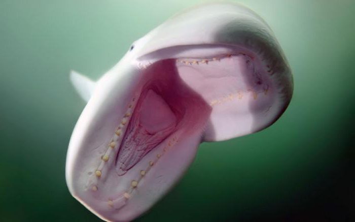
The Sea of Japan is characterized by the absence of true deep-sea fish. The fish that do live at great depths of the sea are completely different from the fish of the Pacific Ocean that live at the same depths on the eastern side of the Japanese islands. Fish of great depths are former inhabitants of the shallow coastal zone, which have descended and adapted to new living conditions. These are northern gobies and lipariids. The latter were discovered at a depth of more than 3,500 m. Interestingly, in the depths of the Sea of Japan, a fish was discovered with such a transparent skull that the brain was visible through it.


The absence in the Sea of Japan of real deep-sea fish, common in the Pacific Ocean, confirms that this sea is not a section of the Pacific Ocean that was detached from it as a result of the uplift of the Japanese Islands and Sakhalin, but was formed by the collapse of a section of the earth's crust. Otherwise, representatives of the deep-sea Pacific fauna would remain in the Sea of Japan.
For bottom and bottom fish, such as cod and flounder, the Sea of Japan is not entirely favorable, primarily due to the poor development of the continental shallows and the lack of shoals and banks - the favorite habitats of these commercial fish.
The Sea of Japan, characterized by temperature contrasts, is convenient for the life of schooling commercial fish that stay in the upper layer of the open sea and feed on plankton. Life is especially rich in areas where warm and cold waters meet. Fish such as mackerel and herring gather in numerous schools. Warm-loving commercial fish include mackerel and sardine.
The story of the disaster in the Far Eastern sardine fishery is instructive. Until 1941, it was the main commercial fish in the Sea of Japan. Millions of quintals of fish were caught along the eastern coasts of Korea, Japan and Soviet Primorye. In 1941, the catch decreased greatly everywhere, and in 1942 it stopped completely in most areas of the Sea of Japan, with the exception of its southernmost limits.
What is this fish, what is the history of its fishing and what are the reasons for its disappearance?
The sardine reaches a length of 30 cm. The taste is no different from its sister - the Atlantic sardine, very fatty and tasty, it sometimes contains up to 40% fat.
Unlike many other heat-loving forms, it reacts most sensitively and painfully to even minor changes in temperature. Soviet scientist P. Yu. Schmidt cites cases of mass death of sardines in summer off the coast of Sakhalin during a sudden and sharp drop in temperature.
Sardine is an alien from the subtropics. It spawns in the south, mainly off the southwestern coast of the Japanese island. Kyushu. Previously, there were spawning sites along the western and northeastern shores of the island. Honshu within the Tsushima Current. Spawning occurs in the south in January - February, in the northern regions in March - April at a temperature of 12-15°.
After spawning, the sardine rushes to feed in the northern regions of the Sea of Japan, where it finds an abundance of plankton. The rapid development of plankton is confined to the junction of warm and cold waters. Many commercial fish are concentrated here. These places represent the centers of world fishing. The junction of the Gulf Stream and the cold Labrador Current in the area of the Great Newfoundland Bank, the frontal zone of the meeting of the Kuro-Sivo and the cold Kuril Current in the northwestern part of the Pacific Ocean are the richest and long-known areas of world fishing.
Sardine migrations to the north took place in two ways - along the eastern coast of Korea and the western coasts of Honshu and Hokkaido. In numerous flocks, clearly visible from a ship and especially from an airplane, sardines approached the shores of Soviet Primorye, where they were caught with smooth nets, purse seines in the open sea, and most importantly, fixed seines close to the shore.
The sardine usually reached our shores in the Peter the Great Bay area in June, and in July - August it penetrated the Tatar Strait, reached De-Kastri Bay, and in October made a reverse migration, rolling back to the southern limits of the sea.
Iwashi fishing off the coast of Japan began in the middle of the last century, and off the coast of Soviet Primorye only in 1925, when 4,400 quintals of this fish were first caught. P. Yu. Schmidt wrote: “When I first came to the shores of the Pacific Ocean in 1900, I met iwashi in Nagasaki, but in Vladivostok, when collecting information about fishing, no one told me anything about this valuable fish. It was not available at the fish market, where one could then get a wide variety of representatives of the ichthyofauna.”
In the thirties, sardines were the main object of Soviet fishing in the Sea of Japan. In 1937, its catch reached a record figure - 1,400,000 cwt. In the thirties, more than 10 million quintals were caught off the coast of Korea, and 12-15 million quintals were caught off the coast of Japan.
In 1941, a disaster occurred in the sardine fishery in the Sea of Japan.
What happened to the sardine? There is no complete consensus on this issue among scientists. Japanese scientist Yasugawa considers the main reason for the disappearance of the sardine to be extremely unfavorable spawning conditions in 1936-1939, which resulted in a sharp decrease in the number of sardines.
Soviet scientist A.G. Kaganovsky explains the disappearance of the sardine not only by changes in temperature conditions, but also by qualitative changes in the sardine population - its grinding. And small sardines are even more sensitive to low temperatures than large ones.
Since 1941, summer temperature conditions in the Sea of Japan have been extremely unfavorable for sardines. In the northern and central parts of the sea, surface waters turned out to be 3-4° colder than in normal years, and from the Korean port of Wonsan to the Japanese port of Niigata, a cold layer of water (also poor in sardine food - plankton) formed, preventing sardines from penetrating into our water.
P. Yu. Schmidt also considers the cooling of the waters of the Sea of Japan to be the main reason for the disappearance of the Far Eastern sardine. In support of his view, P. Yu. Schmidt in his book “Fishes of the Pacific Ocean” cites maps of water temperatures in the Sea of Japan compiled by A. M. Batalin. These maps clearly show the significant difference in the physical conditions of the sardine in 1941 and 1942. Compared to a normal year, such as 1932

It was found that off the southwestern coast of Kyushu, in the main spawning areas of sardines, the water was 2-3° colder than normal only in the winter of 1936, and in subsequent winters (1937-1940) it turned out to be normal. Therefore, the unfavorable spawning conditions of 1936 could only affect this year’s generation. Thus, the theories of P. Yu. Schmidt and A. G. Kaganovsky are more correct than Yasugawa.
Let's now talk about the reasons for the cooling of the Sea of Japan in 1941-1944. A. M. Batalia believes that it is partly due to a decrease in the amount of heat delivered to the Sea of Japan by the Tsushima Current. He saw the main reason in the shift of warm currents to the southeast under the influence of the currents that intensified in 1941-1942. winter monsoon.

However, it seems to us that the cooling is associated with the very cold winters of the period 1940-1943. During these winters, powerful ice formed in the Tatar Strait, which persisted in the spring longer than usual, and therefore the Primorye Current intensified in these years. The cold waters of the Primorsky Current created the barrier that prevented the sardine from breaking through to the shores of Soviet Primorye.
The fact that the sardine came to our shores in the twenties, during the period of warming of the Sea of Japan, and disappeared in the forties, during the cooling period, allows us to make the assumption that over time the sardine will again enter the northern part of the sea. The temperature regime of the Sea of Japan has already reached its normal state several years ago, but it will probably take several more years for the sardine, which is now confined to the southernmost reaches of the sea, to gradually spread northward as its numbers increase. It is possible that this process has already begun, as evidenced by the first quintals of sardines caught in the north of the sea, off the coast of Sakhalin, in the summer of 1954 - 1955.
Another heat-loving fish - mackerel - after the disappearance of the sardine, became one of the main objects of Soviet fishing in the Sea of Japan. Adult mackerel is found in commercial quantities at water temperatures from 6 to 22°. Its temperature optimum is 12-16°. In January - March, mackerel lives in the southern part of the sea adjacent to the Korea Strait and stays mainly near the bottom. Here it is caught at depths of 100-150 m with bottom-mounted seines and trawls.
In March, the water temperature in this area is 13-14° and is almost the same from surface to bottom. In the spring, with the beginning of warming, mackerel migrates north for spawning, which lasts from April to July. Mackerel spawns in the coastal strip, in bays and bays or between islands, mainly along the northeastern coast of Korea and in Peter the Great Gulf.
The beginning of mackerel spawning depends on the maturation of its reproductive products, which in turn depends on the water temperature in the area of its wintering. If the temperature there is higher than normal, the reproductive products will ripen earlier, and mackerel will spawn in nearby bays on the eastern coast of Korea; Very few unspawned fish will reach Peter the Great Bay. When the water temperature in the wintering area is low, the maturation of reproductive products is delayed; a significant part of the mackerel, without spawning, reaches the Peter the Great Bay, where the main spawning occurs.
After spawning, the mackerel moves further and further north in search of food until it reaches the northern limits of its habitat: Sovetskaya Gavan - Shirokaya Pad. In September - October, it leaves the northern regions and migrates south to wintering areas.
Cold-loving fish of the Sea of Japan include cod, flounder, and herring. However, extremely low temperatures are “contraindicated” for them, just as very high temperatures are “contraindicated” for heat-loving fish. They tolerate negative temperatures especially poorly. In winter, when cold waters appear off the coast of Primorye, cod moves to depths and approaches the shore in summer when the weather warms. Off the coast of Hokkaido in the summer, when the temperature in the coastal strip rises, cod, on the contrary, migrates from the coast to deeper and colder horizons, and in winter it stays near the coast, since the water temperature here is favorable for it.

Unlike Atlantic cod, which has free-floating eggs, Pacific cod, like gobies and skates, have bottom-dwelling eggs. This biological adaptation has been developed by Far Eastern cod due to the fact that it spawns in areas with strong currents and where ice appears in winter. If it did not have bottom eggs, it would freeze into the ice or be carried away by currents and die.
Herring, which lives in the Sea of Japan, like cod, avoids excessively cooled waters, but is even more intolerant of high temperatures. Herring is suitable for spawning on the southwestern shores of Sakhalin in April at a water temperature of 0-4°. The behavior of fattening herring in the Tatar Strait also greatly depends on temperature. At the end of May - beginning of June, the development of plankton in the southern part of the Tatar Strait reaches its maximum. It is during this period that schools of herring flock here to feed.
The choice of places for abundant fishing, as well as the most catchy fishing gear, largely depends on thermal conditions. In relatively cold years, such as 1946 and 1947, shoals of herring stayed close to the shore all summer and were caught with drift nets (Drift (smooth) nets are usually “swept out” at night, they are kept “afloat” and slowly drift with the current ) and fixed seines, first in the surface and then in the bottom layers. In relatively warm years (1948 and 1949), the length of time the herring stays off the coast is greatly reduced, and the fish move faster to the open sea. Driftnet fishing off the coast in such years ceases by mid-July, and with fixed seines even earlier. The second time the herring approaches the shores is in the fall, in September - October, when the waters become colder.

As V.G. Bogaevsky showed, the length of stay of herring in the coastal zone also depends on the thickness of the surface layer of water heated above 10°. Herring avoid this heated layer and stay lower in the underlying waters with a lower temperature. Most of it accumulates off the coast during strong northeast winds, when heated water is driven away from the shore, and cold deep waters rise to the surface.
With changes in temperature conditions in the Sea of Japan, rare fish that are not the target of fishing may disappear and appear. According to A.I. Rumyantsev, in the summer of 1949, after a 7-8-year break caused by a sharp cold snap in 1941-1944, cases of catching subtropical and tropical fish in the Peter the Great Bay area were again recorded. Thus, on September 30, 1949, a sea eel living off the coast of the southern Japanese islands was caught in the Ussuri Bay. On the same day, the so-called caragoid fish, common in the tropical latitudes of the Indian and Pacific oceans, was caught in the Zarubino area. In August of the same year, three specimens of eastern tuna weighing 245, 261 and 336 kg were caught in Peter the Great Bay, and a triggerfish, a representative of the subtropics, was caught near Cape Peschany in the Amur Bay. In the same year, a huge inhabitant of tropical waters - a moon fish - was found in the waters of Primorye. Her weight reached 300 kg.
These findings indicate a general warming of the waters of the Sea of Japan. The first quintals of sardines caught in our waters in 1954-1955 indicate the same thing.
Fishing industry. Three countries fish in the Sea of Japan: the Soviet Union, Japan and Korea.
The production of fish, sea animals and other seafood in the Far East has always been extremely important for our country. The share of fishing in the Far Eastern seas in the post-war years ranged from 20 to 36% of the total production of the Soviet Union.
The raw materials resources of the Far Eastern seas make it possible to increase production. This primarily applies to saury, pollock, cod and other fish.
Among the Far Eastern seas, the Sea of Japan until 1941 ranked first in terms of the amount of fish caught due to high sardine catches. After the war, the Sea of Japan gave way to first place to the Sea of Okhotsk and the Kamchatka waters of the Pacific Ocean, where salmon, herring and flounder are mainly caught.
Before the war, a small number of fish species were commercialized in the Sea of Japan. These included sardines, salmon (chum salmon, pink salmon, masu salmon), herring, cod, flounder and navaga (sama). In the post-war years, fishing for mackerel, pollock, greenling, smelt, etc. was organized.

Massive fishing for mackerel in the waters of Primorye began only in 1947, and by 1953 its catch reached 183 thousand cwt.
The flounder fishery in Primorye has existed for a long time. Of the 25 species found in Far Eastern waters, 19 are caught in Peter the Great Bay (according to P. A. Moiseev). The catches are dominated by yellowfin, sharphead and smallmouth flounder.
This fishery is based on catching them during their spring migration from wintering areas to the shore and their return migration in the fall. Flounder overwinter at significant depths - from 170 to 250 m and even deeper, avoiding coastal negative temperatures. Most of it accumulates on a bank located southeast of the island. Askold.
Flounders are characterized by relatively low mobility. To determine its migrations, in some places individual fish were tagged and released back into the sea. Further than 17 miles from the release site, none of the tagged flounder were recaptured.

The fishery has developed aggregations of flounder in the northern part of the Tatar Strait, the catches of which began to increase after the Second World War and reached 100 thousand cwt.
Such important commercial bottom fish as cod and another representative of the cod family, pollock, are not sufficiently used in the Sea of Japan.
Until 1941, cod was caught in the Sea of Japan in negligible quantities. After the war, its catch increased due to fishing off the southwestern coast of Sakhalin. Like cod fishing, pollock fishing began in the post-war years. Pollock, which lives in the bottom and intermediate horizons at depths of up to 150-200 m, is distributed throughout the Sea of Japan, but especially large accumulations form off the eastern coast of Korea, in the Korean Gulf. There in 1946-1948. fishing vessels were sent for expeditionary fishing. Catches reached 5 thousand quintals per vessel. The total catch of pollock in 1948 was 180 thousand cwt. Its reserves in the Sea of Japan are very large and make it possible to significantly increase production.
Herring lives mainly in the northern part of the Sea of Japan and is caught off the coast of Primorye, Hokkaido and South Sakhalin.
Until very recently, mainly spring spawning herring with a low fat content (up to 5-6%) was caught. Until 1945, spawning herring was caught by the Japanese in huge quantities off southwestern Sakhalin. In 1931, the catch reached 5.5 million centners, then it decreased to 1.5-3 million centners per year. Herring spawning off Sakhalin occurs in April. It approaches the shore quickly and in huge numbers. The catches of Sakhalin herring were: in 1946 - 506 thousand centners, in 1947 - 609, in 1948 - 667, in 1949 - 1135 thousand centners, and since 1950 they began to decline sharply in connection with the depletion of the Sakhalin-Hokkaido herring stock. In addition to spawning, there is a fishery for feeding herring, which is of excellent quality, with a fat content of up to 20%. Salmon (chum salmon, pink salmon, masu salmon) are caught in the rivers of Primorye and the western coast of Sakhalin during their spawning run.
One of the undeveloped but very promising fisheries is saury. Until 1934, it appeared in the Sea of Japan irregularly, and in subsequent years it began to approach spawning more regularly and abundantly even to our shores. Saira is sensitive to electric light and gathers in the lighting zone, where it is successfully caught with lifting nets.
In the Sea of Japan, fishing for crabs, shellfish (mainly scallops), and marine plants (kelp, seaweed, ahnfeltia, zoster) is developed. Medicinal preparations are prepared from kelp, and agar is extracted from ahnfeltia (red algae). Most marine invertebrates and algae are underexploited by fisheries and could be greatly expanded.
And the Japanese islands are the boundaries separating the waters of the Sea of Japan from the Pacific basin. The Sea of Japan predominantly has natural boundaries, only some areas are separated by conventional lines. The Sea of Japan, although it is the smallest of the Far Eastern seas, belongs to the largest. The water surface area is 1062 thousand km2, with a water volume of about 1630 thousand km3. The average depth of the Sea of Japan is 1535 m, the maximum depth is 3699 m. This sea belongs to the marginal oceanic seas.
A small number of rivers carry their waters into the Sea of Japan. The largest rivers are: Rudnaya, Samarga, Partizanskaya and Tumnin. Mostly all of this. During the year it is about 210 km 3 . Throughout the year, fresh water flows evenly into the sea. In July, river flow reaches its maximum. Water exchange between and the Pacific Ocean occurs only in the upper layers.
The northern and western parts of the Sea of Japan/East Sea are much colder than the eastern and southern parts. The temperature difference ranges from −20 °C to +27 °C.
Therefore, in autumn there are typhoons and hurricanes in these latitudes. Of course, the flora and fauna of these areas are very different. Moreover, some animals migrate from north to south at unfavorable times of the year.
The Sea of Japan/East Sea is recognized as the richest sea in our country in terms of the number of animal and plant species. There are 225 species of algae alone.
The most famous is, of course, kelp. It is so actively used in cooking and the cosmetics industry that it is collected not only in the natural environment, but also grown on plantations.
Kamchatka crab is also well known to Russians. Its distribution area stretches from the Bering Sea to the Korean Sea and the American coast, at a depth of up to three hundred meters. The crab grows to enormous sizes, with a claw span of up to one and a half meters. The main fishery is located off the coast of Kamchatka, where its population is especially numerous.

There are quite a few species of shellfish in the Sea of Japan/East Sea. They are natural water filters, live about a hundred years and grow up to twenty centimeters in length. And giant ones - up to seventy. Their colonies live at depths of up to seven meters and easily survive the winter under the ice.

Mussels contain many useful substances and are very nutritious. Therefore, they are the subject of fishing and food not only for humans, but also for many species of starfish and fish. Since they lead a sedentary lifestyle, their fertility saves them from complete extinction; at the end of summer they release more than a million eggs each. However, mollusks have the unpleasant feature of accumulating substances that they pass through with water. In environmentally unfavorable areas, their use can be hazardous to health.
 Steller sea lion is a mammal of the Sea of Japan/East Sea.
 Whaling, due to its past intensity, is prohibited in the Sea of Japan/East Sea. Therefore, the mammal population gradually began to recover and is currently home to about thirty species of seals, dolphins and whales. All species of minke whales and many varieties of odontocetes are common in the Sea of Japan. For example, beluga whale and killer whale.

Six species of seals live in this region. The most famous is the northern fur seal.
Almost two hundred species of fish out of nine hundred existing are caught in Primorye. These are mackerel, flounder and many other species known to the general consumer.

There are twelve sharks in the Sea of Japan/East Sea that are not dangerous to humans. Rather, on the contrary, the Japanese love for shark fin soup has greatly reduced the number of katran fish. Rhopilema jellyfish is also considered an expensive and sophisticated delicacy. In addition to its culinary value, in China it is used to prepare medicines. For example, for the treatment of tracheitis.
Japan and the Russian Federation.
Although the reservoir belongs to the ocean basin, it is well isolated from it. This affects both the salinity of the Sea of Japan and its fauna. The overall balance of water is regulated by outflows and inflows through straits. It practically does not participate in water exchange (small contribution: 1%).
It is connected to other bodies of water and the Pacific Ocean by 4 straits (Tsushima, Soyu, Mamaia, Tsugaru). is about 1062 km 2. The average depth of the Sea of Japan is 1753 m, the greatest is 3742 m. It is difficult to freeze, only its northern part is covered with ice in winter.
The hydronym is generally accepted, but is disputed by the Korean powers. They claim that the name was literally imposed by the Japanese side on the whole world. In South Korea it is called the East Sea, while North Korea uses the name Korean East Sea.
The problems of the Sea of Japan are directly related to ecology. They could be called typical, if not for the fact that the reservoir washes several states at once. They have different policies on the sea, so the influence from people also varies. Among the main problems are the following:
- industrial mining;
- release of radioactive substances and petroleum products;
- oil spills.
Climatic conditions
According to glaciation, the Sea of Japan is divided into three parts:
- Tatarsky is against;
- Peter the Great Bay;
- area from Povorotny Cape to Belkin.
As already described above, ice is always localized in part of a given strait and bay. In other places it practically does not form (if you do not take into account the bays and northwestern waters).
An interesting fact is that ice initially appears in places where fresh water is present in the Sea of Japan, and only then does it spread to other parts of the reservoir.
Glaciation lasts in the south for about 80 days, in the north - 170 days; in Peter the Great Bay - 120 days.
If winter is not characterized by severe frosts, then areas are covered with ice in early to late November; If the temperature drops to critical levels, then freezing occurs earlier.
By February, the formation of the cover stops. At this moment, the Tartary Strait is covered by about 50%, and the Peter the Great Gulf by 55%.
Thawing often begins in March. The depth of the Sea of Japan facilitates the rapid process of getting rid of ice. It could start at the end of April. If temperatures remain low, thawing begins in early June. First, parts of the Peter the Great Bay are “opened,” in particular, its open waters, and the coast of the Golden Cape. While the ice in the Tatar Strait begins to retreat, in its eastern part it thaws.
Resources of the Sea of Japan
Biological resources are used by humans to the maximum extent. Fishing is developed near the shelf. Herring, tuna and sardines are considered valuable fish species. In the central regions, squid are caught, in the north and southwest - salmon. Algae from the Sea of Japan also play an important role.
Flora and fauna
The biological resources of the Sea of Japan in different parts have their own characteristic features. Due to the climatic conditions in the north and northwest, nature has moderate characteristics; in the south, the faunal complex predominates. Near the Far East there are plants and animals inhabiting warm-water and temperate climates. Here you can see squid and octopus. In addition to them, there are brown algae, sea urchins, stars, shrimp and crabs. Still, the resources of the Sea of Japan are bursting with diversity. There are few places where you can find red sea squirts. Scallops, ruffs and dogs are common.

Sea problems
The main problem is the consumption of sea resources due to the constant fishing of fish and crabs, algae, scallops, and sea urchins. Along with state fleets, poaching is flourishing. The overuse of fish and shellfish production leads to the constant extinction of some species of marine animals.
In addition, careless fishing can lead to death. Due to fuel and lubricant waste, wastewater and petroleum products, fish die, mutate or become contaminated, which poses a great danger to consumers.
Several years ago, this problem was overcome thanks to coherent actions and agreements between the Russian Federation and Japan.
Ports of companies, enterprises and populated areas are the main source of water pollution containing chlorine, oil, mercury, nitrogen and other hazardous substances. Due to the high concentration of these substances, blue-green algae develop. Because of them, there is a danger of hydrogen sulfide contamination.

Tides
Complex tides are characteristic of the Sea of Japan. Their cyclicity differs significantly in different regions. The semi-diurnal one is found near the Korea Strait and near the Tatar Strait. Daytime tides are typical for areas adjacent to the coasts of the Russian Federation, the Republic of Korea and the DPRK, as well as near Hokkaido and Honshu (Japan). Near Peter the Great Bay, the tides are mixed.
Tidal levels are low: from 1 to 3 meters. In some areas the amplitude varies from 2.2 to 2.7 m.
Seasonal variations are also not uncommon. They are observed most often in summer; in winter there are fewer of them. The water level is also affected by the nature of the wind and its strength. Why do the resources of the Sea of Japan depend so much?

Transparency
Throughout the entire length of the sea, the water is of different colors: from blue to blue with a green tint. As a rule, transparency remains at a depth of up to 10 m. The waters of the Sea of Japan have a lot of oxygen, which contributes to the development of resources. Phytoplankton is more common in the north and west of the reservoir. On the surface of the water, the oxygen concentration reaches almost 95%, but this figure gradually decreases with depth, and by 3 thousand meters it is equal to 70%.

